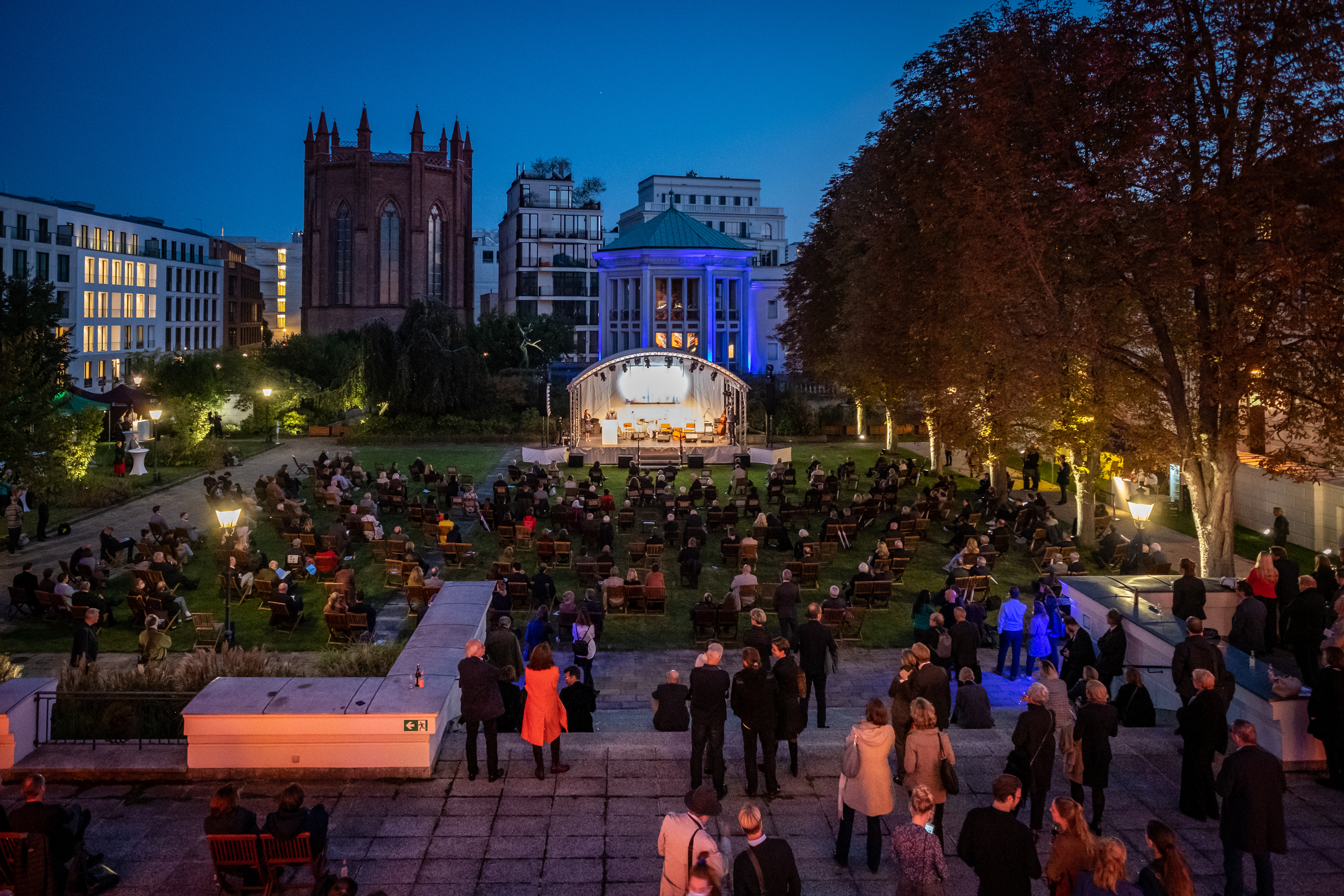
The images and photos in the press area are intended exclusively for journalistic purposes from 30 September 2020, 12 noon, and may only be used in connection with reporting on the exhibition “Unfinished Metropolis”, stating the title of the image and copyrights as stated, until six weeks after the end of the exhibition.
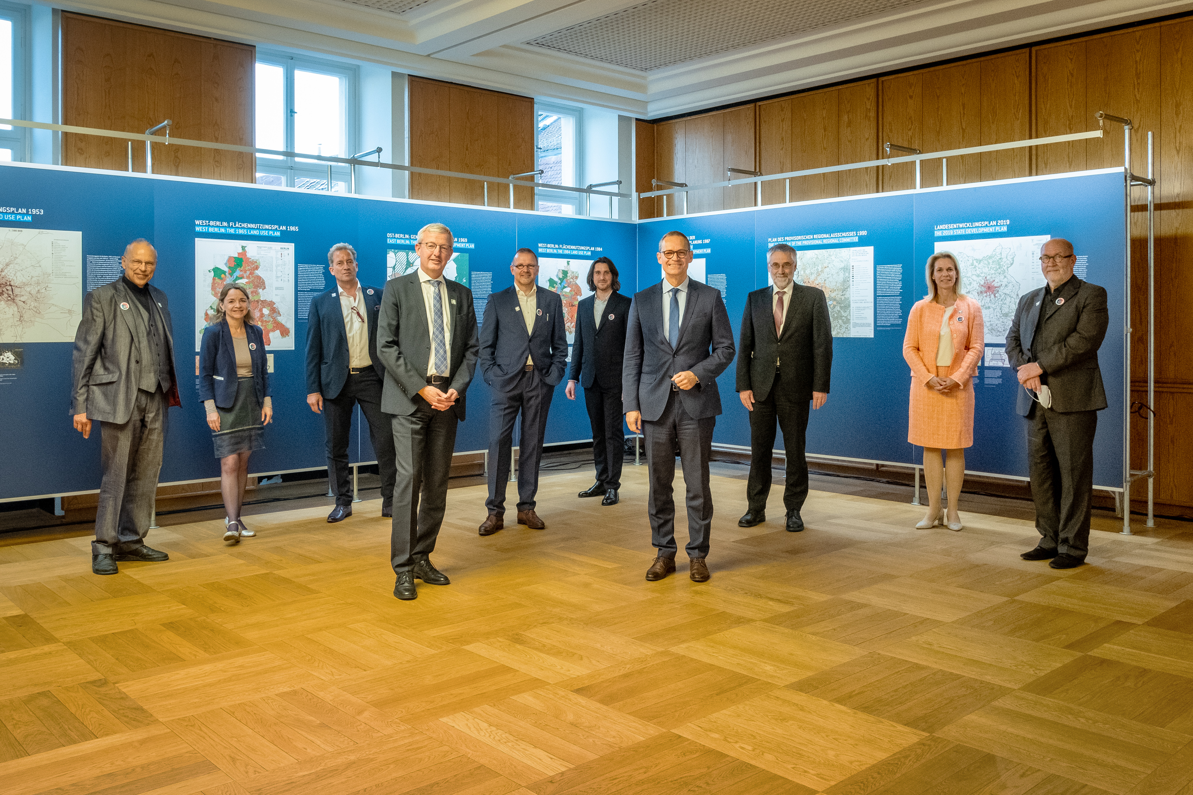
From left to right: Prof. Dr. Harald Bodenschatz (Curator), Christina Gräwe (Co-Curator), Dr. Benedikt Goebel (Co-Curator), Guido Beermann (Minister for Infrastructure and Regional Planning of Brandenburg), Tobias Nöfer (Chairman AIV), Patrick Zamojski (Berlin 2020 gGmbH), Michael Müller (The Governing Mayor of Berlin), Dr. Christoph Krupp (BIMA board), Dr. Melanie Semmer (2nd Chairwoman AIV), Prof. Dr. h.c. Wolfgang Schuster (Competition Curator)
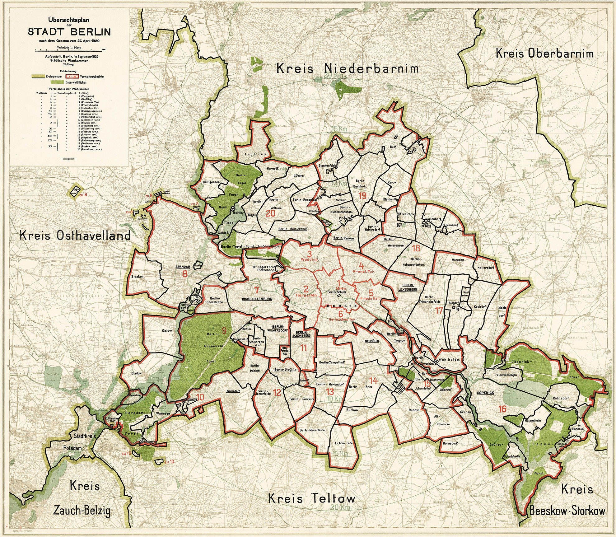
1920: A Crisis Year: The Creation of Greater Berlin
The general plan according to the Greater Berlin Act passed on 27 April 1920 shows the 20 boroughs and the permanent forest areas. Source: Berlin State Archive, F Rep. 270, A 9054
Bahnhof Potsdam Pirschheide, 2020. The former Potsdam main station was one of the most important stations on the outer ring of railways in the GDR era. After reunification it lost its weight. Photo: Harald Bodenschatz
“Square” in the south of the Steglitz roundabout, 2020, where an area for the distribution of car traffic extends. Other Berlin “non-places”: Innsbrucker Platz, Molkenmarkt. Photo: Thomas Spier, apollovision
The Centre of Everywhere: The Issue of the City’s Many Centres
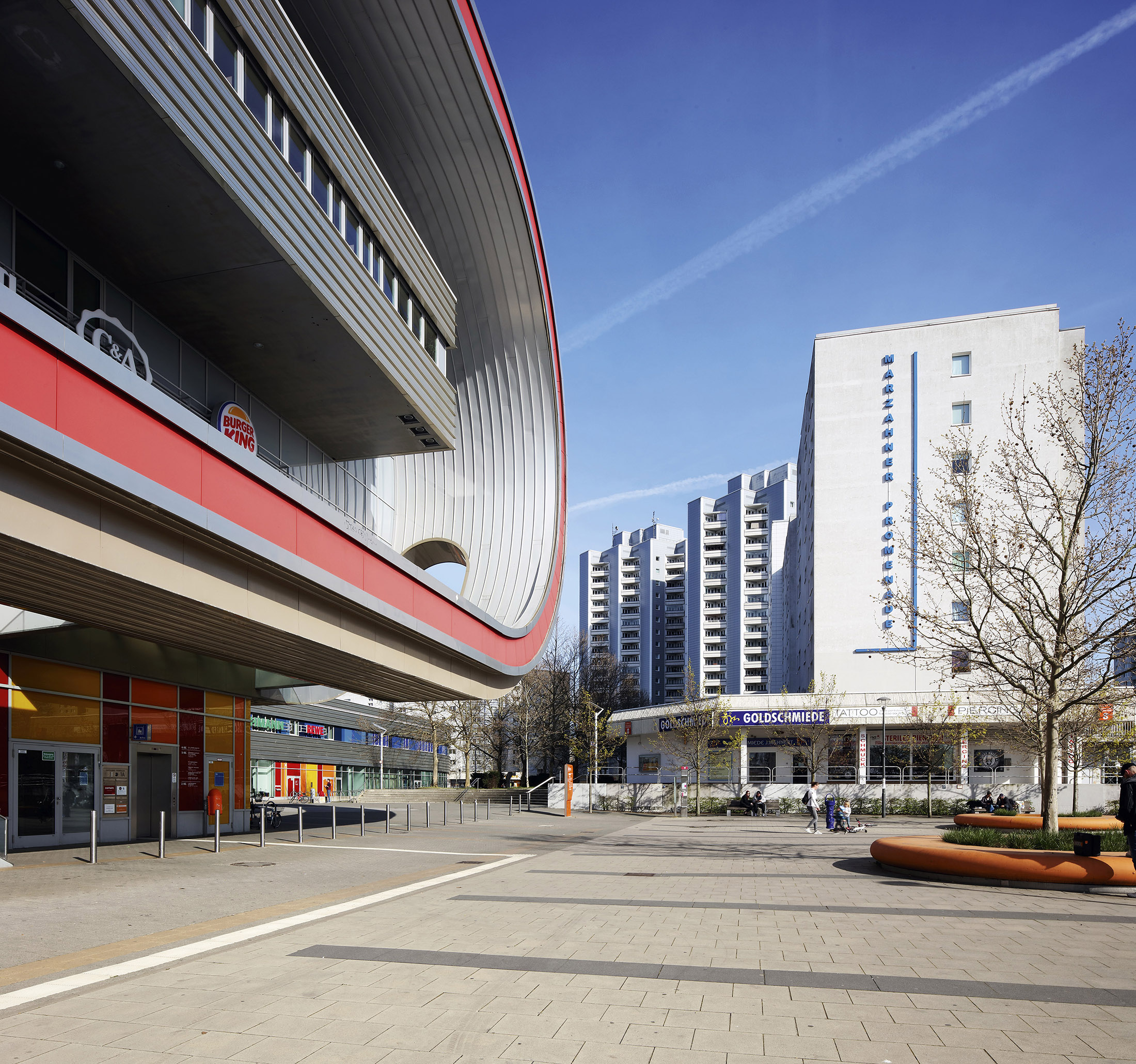
Centre of Marzahn, 2020. The Eastgate shopping centre opened in 2005 at the western beginning of the Marzahn Promenade in contrast to GDR residential buildings and supply facilities. Photo: Thomas Spier, apollovision
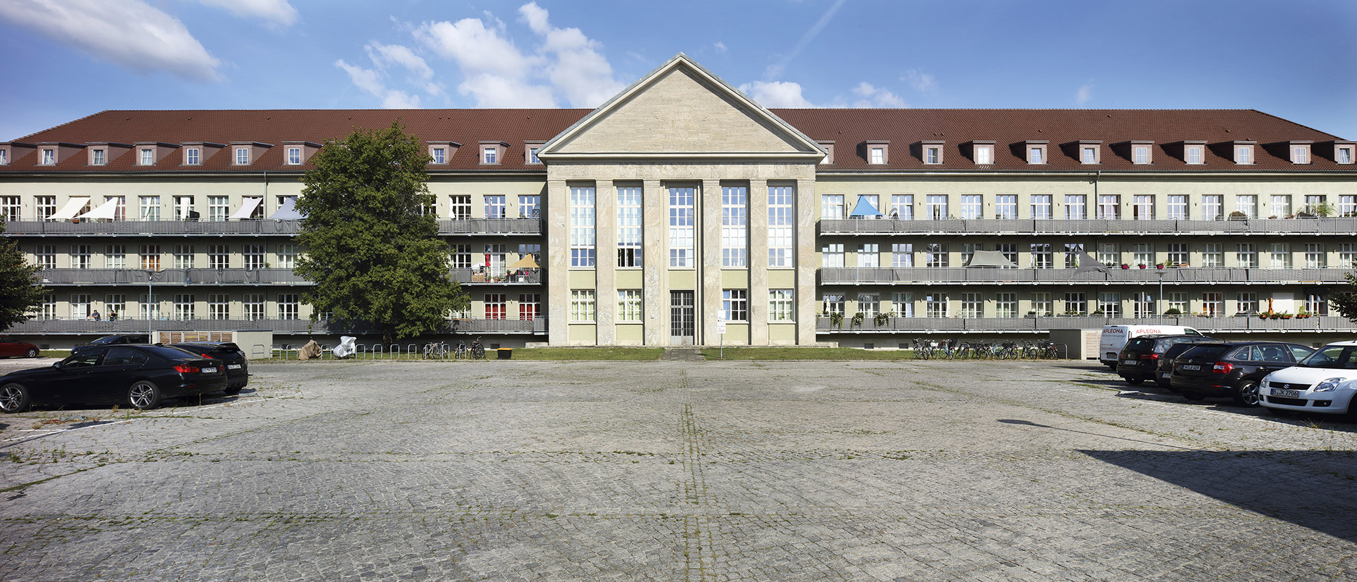
Former Pioneer School Karlshorst, 2020. The military area created during the National Socialist era was turned into a residential area after the withdrawal of the Russian military; the Pioneer School alone now houses around 370 flats. Photo: Thomas Spier, apollovision
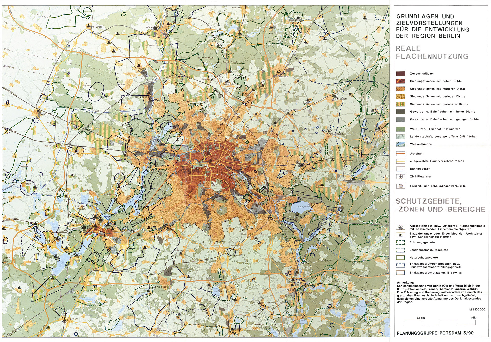
Plan of the Provisional Regional Committee 1990. Before the reunification of Berlin, a group of experts from East and West met. Their recommendations were to prevent urban sprawl in the surrounding area, secure open spaces, strengthen existing centres, preserve the urban cultural values of the region, strive for equal living conditions and improve public transport – all in an ecologically and socially acceptable manner. Provisional Regional Committee, Potsdam Planning Group, Basic Principles and Objectives for the Development of the Berlin Region, Report 1 – 5/90 – map section
Infrastructure, Industry and the Military: A Selection of Major Projects
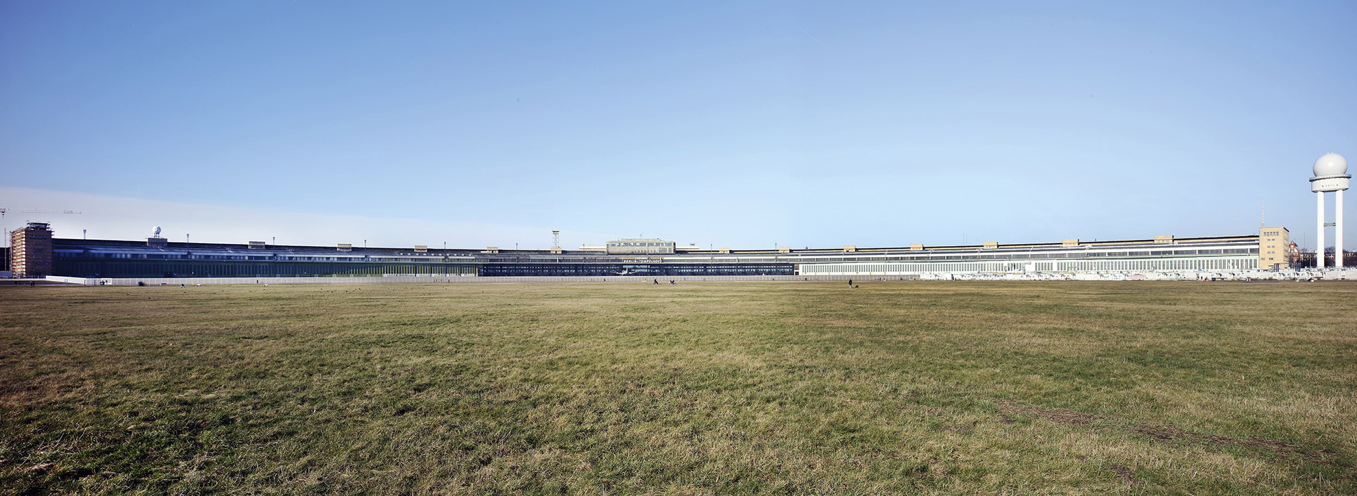
Tempelhof Airport, 2020. Opened in 1923 and located close to the city centre, it became the air hub of Europe. In 1936, the largest building in the world at the time was constructed. During the Second World War, the site was a forced labour camp, and in 1948/49 it was the site of the Airlift. Civil air traffic, which resumed in 1951, was suspended in 2008. Photo: Thomas Spier, apollovision
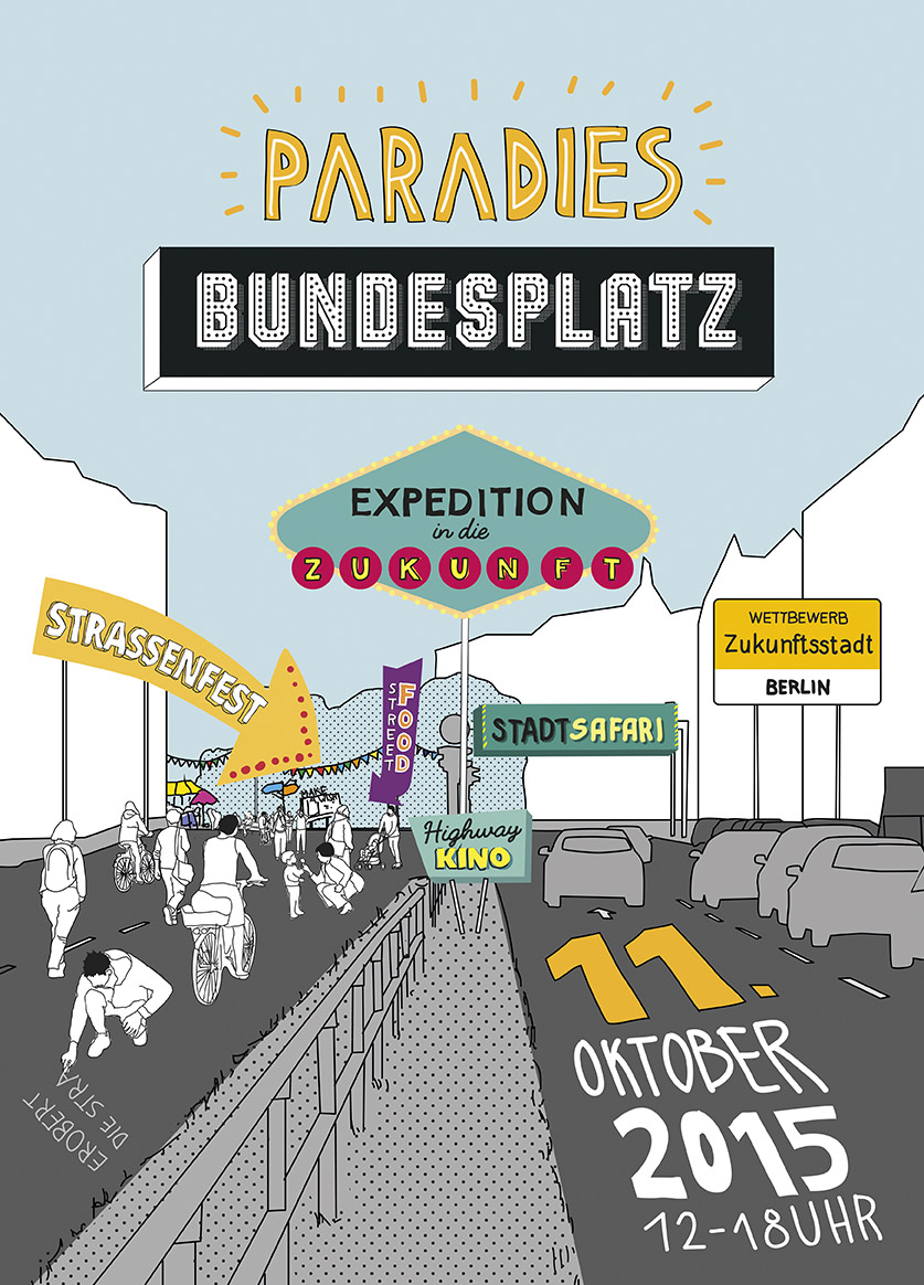
Advertising for a party on Bundesplatz, the centrepiece of Bundesallee, from October 2015. The celebration was initiated by the Initiative Bundesplatz and supported by the Council for European Urbanism Deutschland. Bundesallee is not just any street and Bundesplatz is not just any square. In addition to their distinctive names, they comprise one of the most striking urban-developmental features in Berlin’s layout. These two locations – along with the city motorway – are the most emphatic witnesses to the conversion of West Berlin into a car-oriented city. Since 2010 the Initiative Bundesplatz, one of the largest citizens’ initiatives in the German capital, has campaigned for the revival of the square as a place to spend time, the limiting of traffic and, in the medium term, the shutdown of the tunnel that slices the square in half. Despite verbal assurances, the campaign has achieved only limited success. Postcard, Polinna Hauck Landscape + Urbanism /Studio Amore Burke Harmel Jank GbR
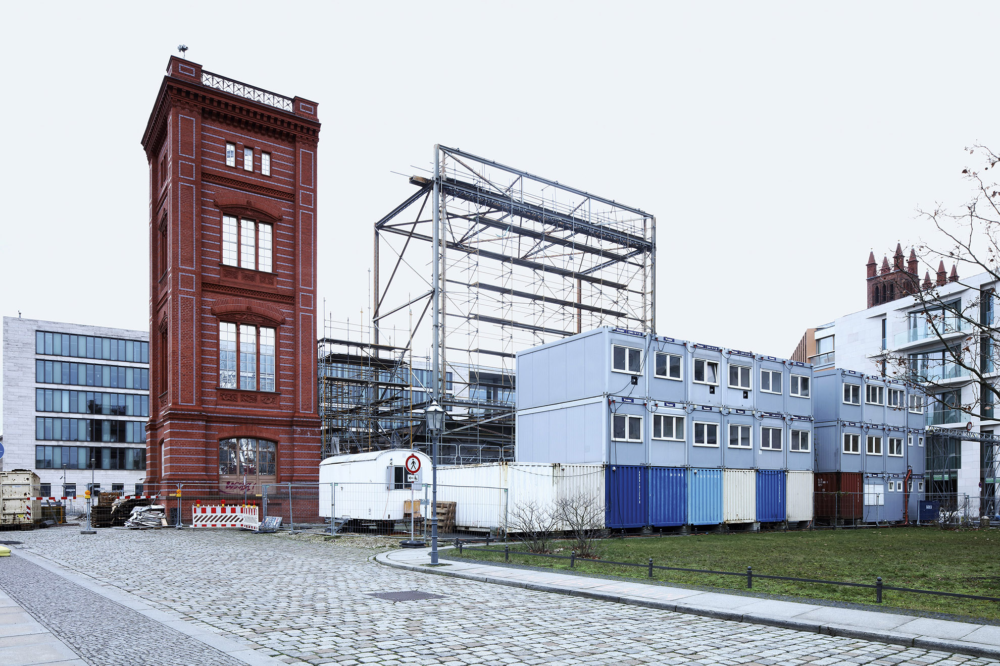
Gift of the Federal Government to the capital: a new Bauakademie. Here the reconstructed corner of the Bauakademie, which was only slightly destroyed in the Second World War but demolished in 1961/62 in favour of the GDR Foreign Ministry, 2020. The original building was erected between 1832 and 1836 according to plans by Karl Friedrich Schinkel. Photo: Thomas Spier, apollovision
A Kindred Place: The Cities and Countryside of Brandenburg
Hohen Neuendorf town hall, right old building, left new building, 2019. The town, first mentioned in 1349, fell into the maelstrom of the big city at the end of the 19th century after the construction of the northern railway. During the Nazi era it was extended, and in the GDR era it was given an additional station on the outer railway ring. After reunification, the population grew rapidly. The centre includes the town hall, pagoda, hotel and shopping centre. The extension of the town hall and the open spaces were completed in 2020. Photo: Harald Bodenschatz
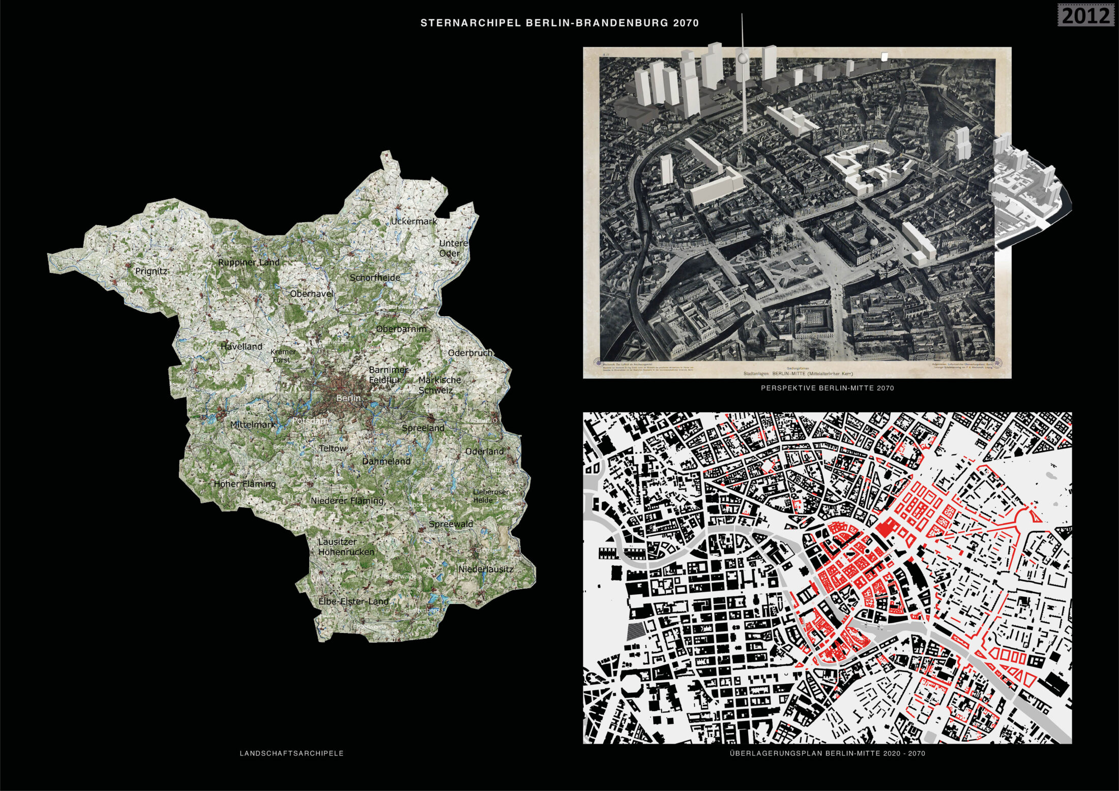
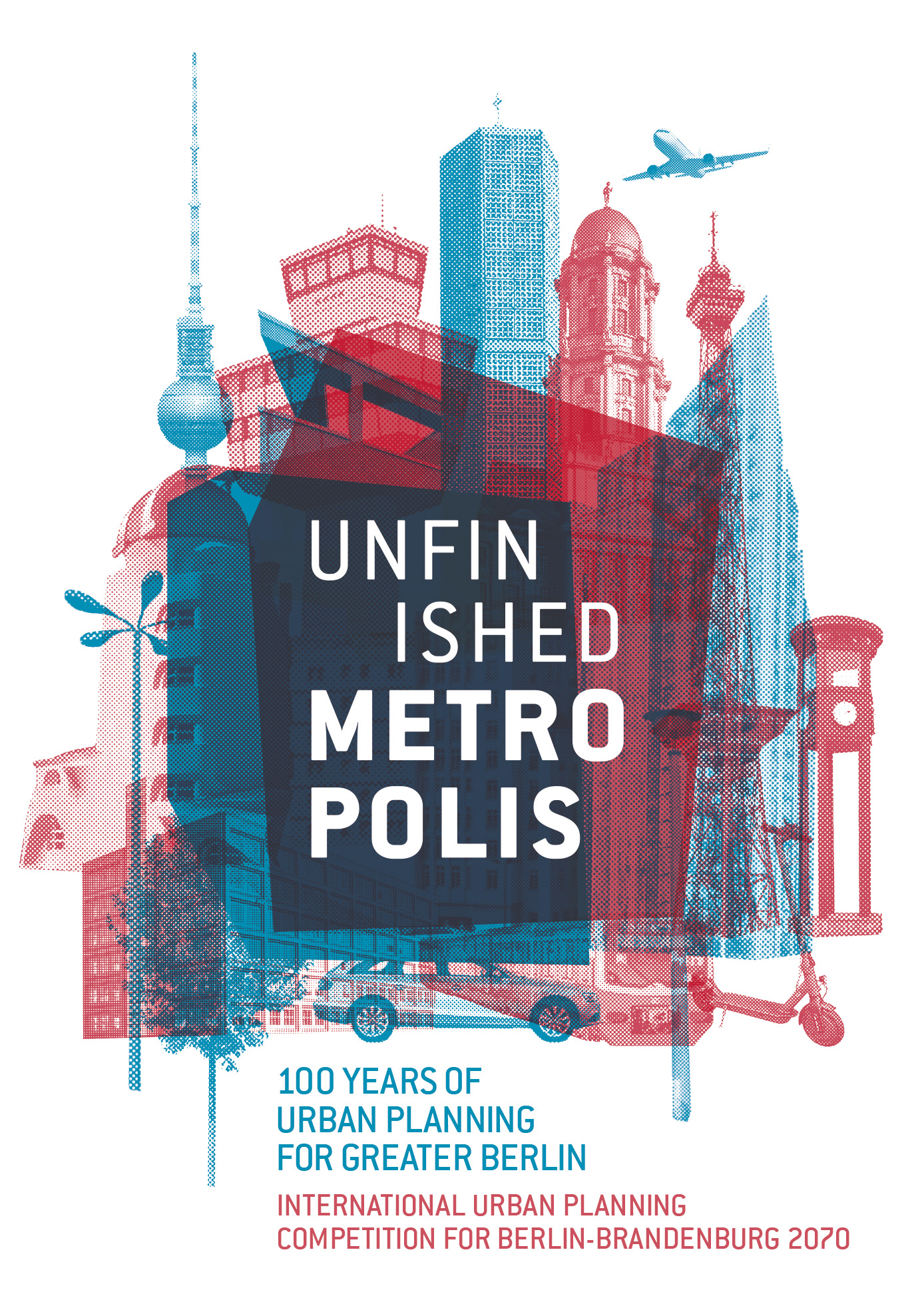
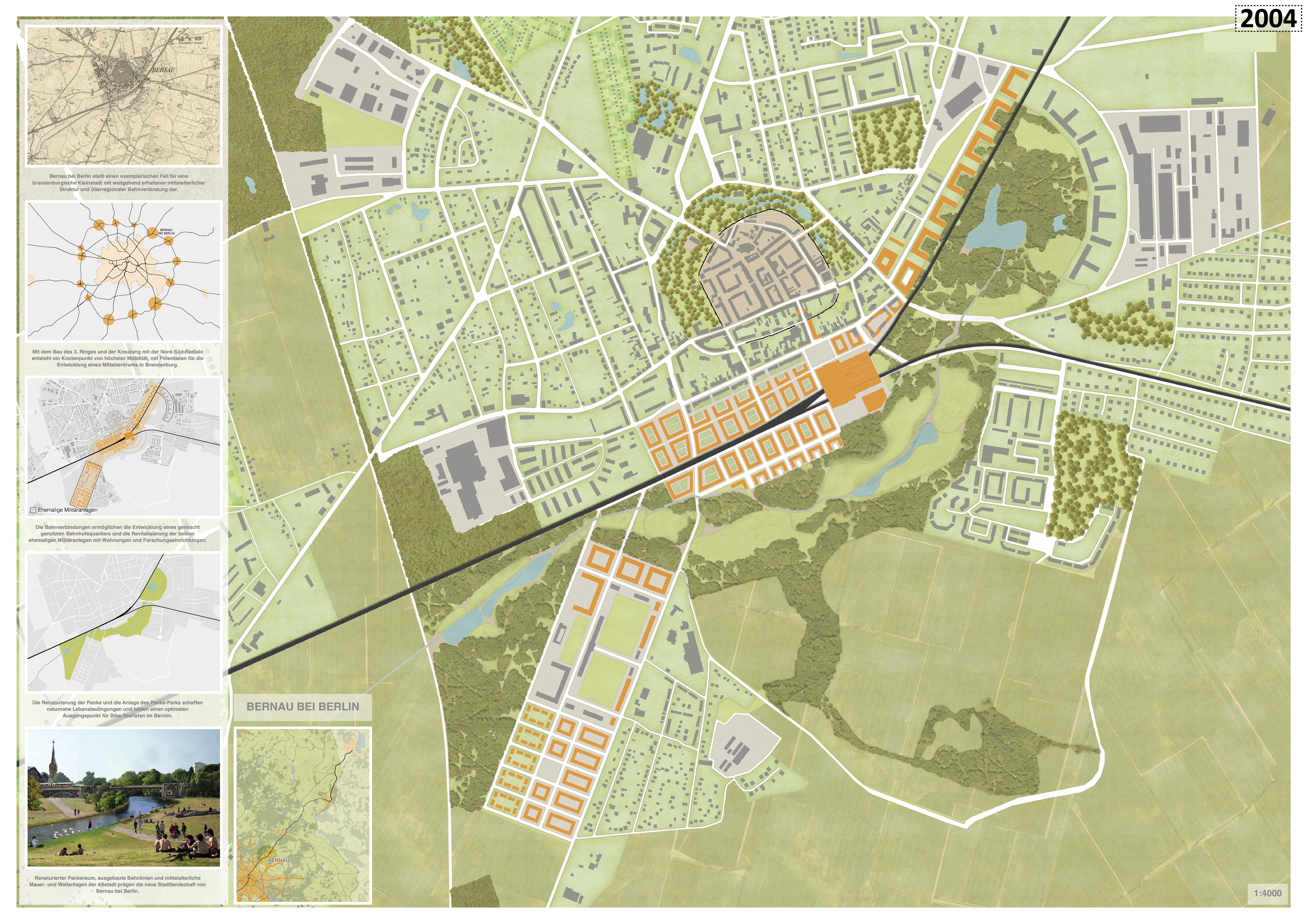
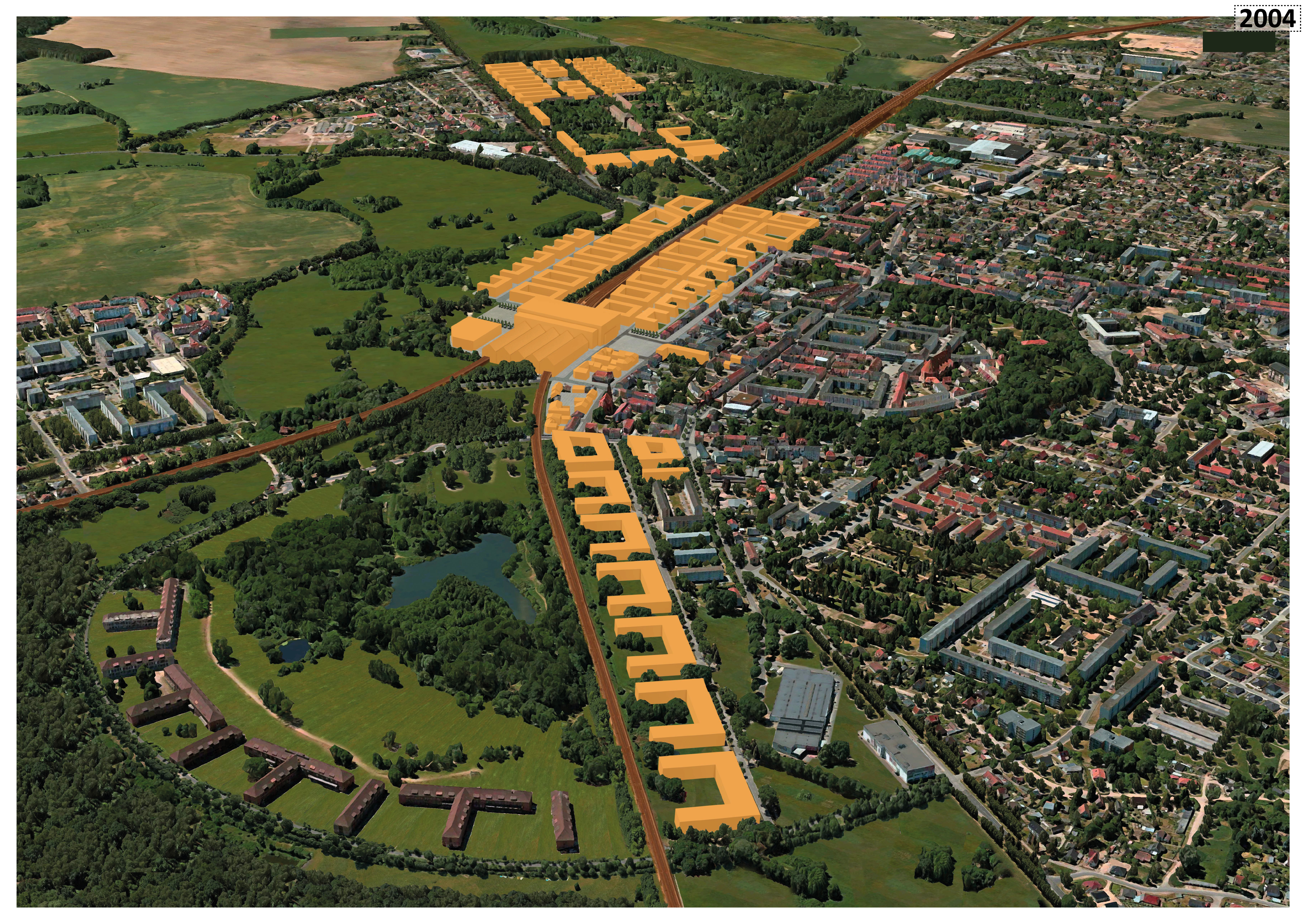
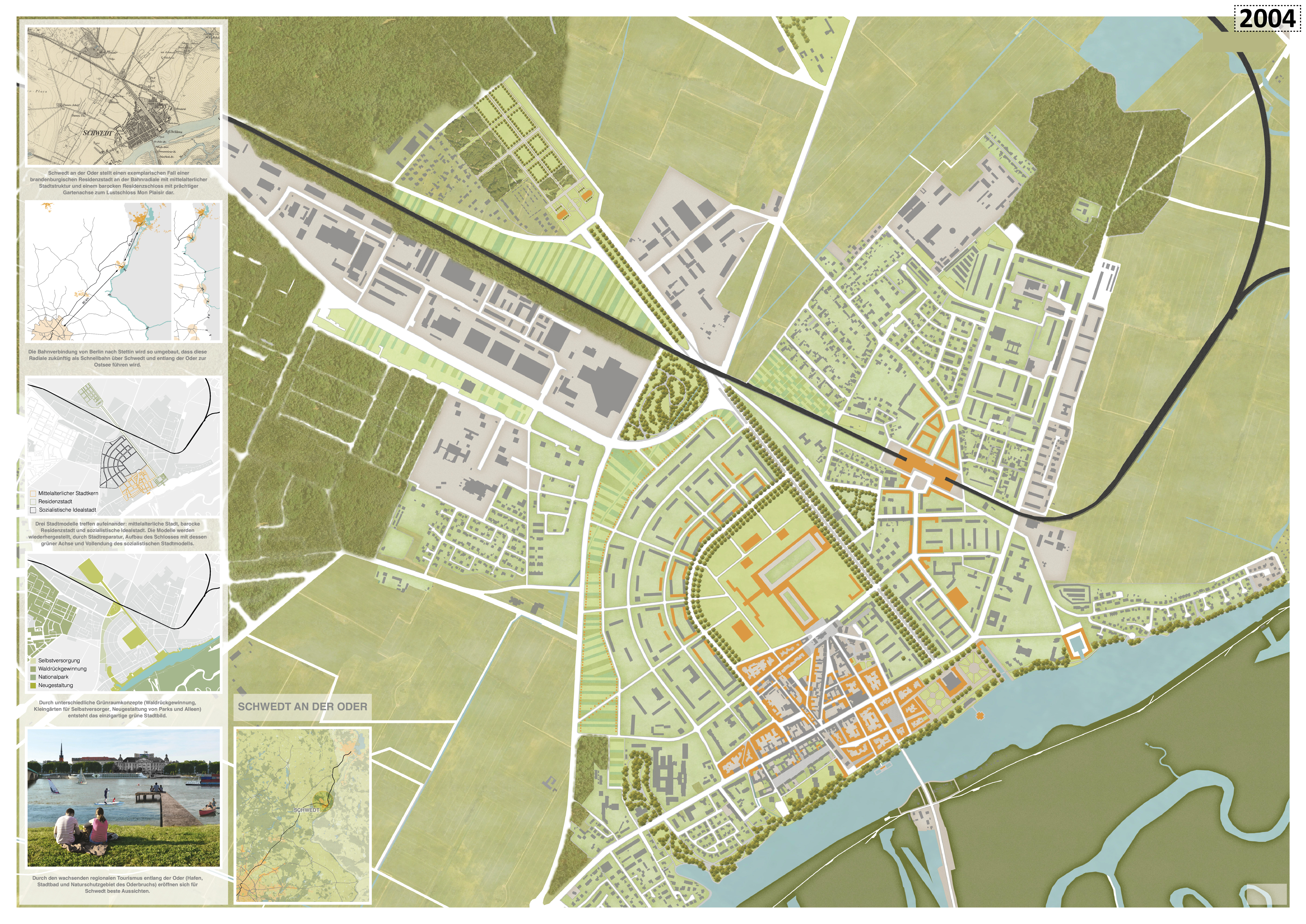
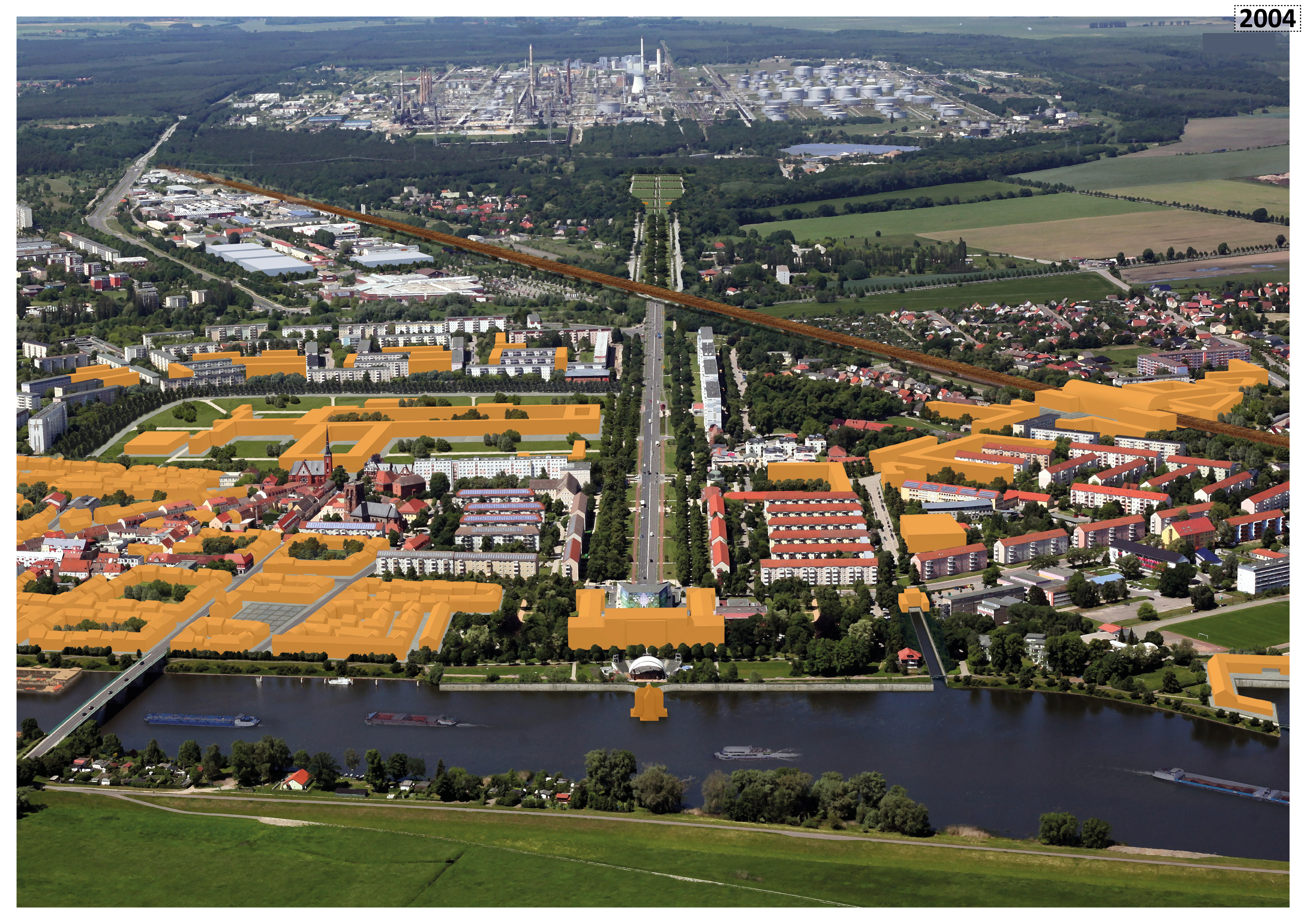
International Urban Planning Competition for Berlin-Brandenburg 2070
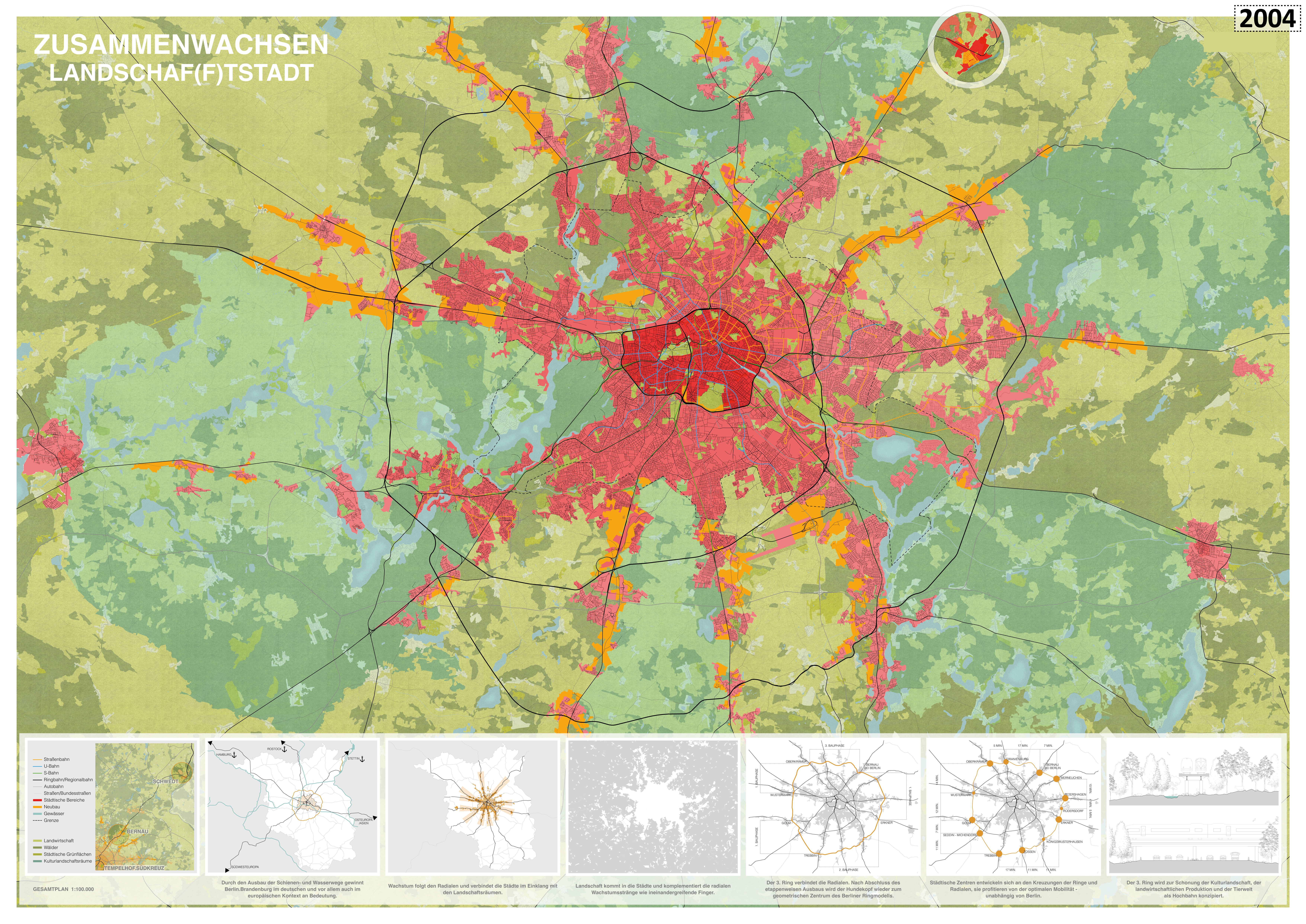
A confirmation of the “settlement star”: 1st prize “Growing together – Landschaf(f)tStadt”. Bernd Albers Society of Architects mbH, Vogt Landschaft GmbH, Arup Deutschland GmbH
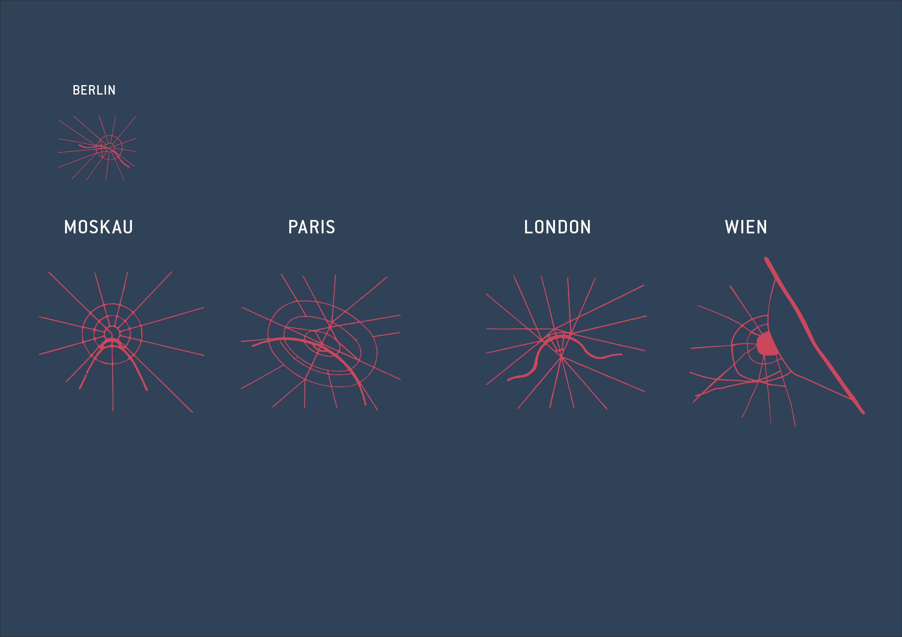
Wir sind nicht allein: Blick nach Europa – Paris, Moskau, Wien, London
Schemes of the urban areas of Berlin, Moscow, Paris, London and Vienna with concentration on main streets and rivers. They correspond to representations that were probably created by the designers Aleksandr M. Rodčenko and Varvara F. Stepanova and published in Moscow in 1938. They go back to sketches by Eugène Hénard, which he published in his writings Études sur les transformations de Paris (1903-1906). The scheme of Vienna was redesigned according to the historical sketches of Lilja Schick. Source: bwag/wikipedia
Thomas Stellmach Planning and Architecture / fabulism GbR (Berlin), Lysann Schmidt Landschaftsarchitektur, Melissa Gómez (Beraterin für nachhaltige Mobilität und urbane Innovation), Marcus Andreas (Berater für Nachhaltigkeit), Florian Strange (Berater für Urbanismus & Design Prozesse)


