The Issue of the City’s Many Centres
The history of Greater Berlin will be on show in all its glory behind the reconstructed palace façade of the Humboldt Forum. The former palace was the centre of old Berlin until it lost this function in the November Revolution. It operated as a museum during the Weimar Republic and did not play a prominent role during the Nazi era. It was partially destroyed in the war and the new ruling powers in East Berlin ordered it to be demolished in 1950. Two decades later, the Palace of the Republic was built in its place. It was the most important government building in the German Democratic Republic and served as an open house, insofar as that was possible in a dictatorship. After reunification and many years of debate, the German Bundestag decided to build the Humboldt Forum and the Palace of the Republic was subsequently demolished. The Humboldt Forum is scheduled to open in stages beginning in autumn 2020, one hundred years after the creation of Greater Berlin. Like in the 1920s, it will operate as a cultural venue, but with higher standards. This opening of the Humboldt Forum fundamentally changes the historic centre: it consolidates the city’s cultural centre from its site close to the dominating TV Tower and Museum Island.
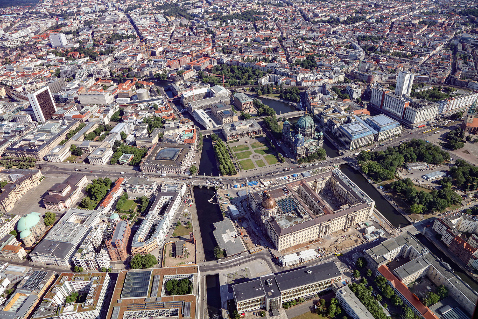
Museum Island and the Humboldt Forum pictured from the south in 2020.
Photo Philipp Meuser
The city’s system of centres altered fundamentally after the creation of Greater Berlin. The emerging centre of the New West around the Kaiser Wilhelm Memorial Church became more important, along with the undisputed main city centre between Alexanderplatz and the Reichstag. In the years after 1933, the Nazis planned a brand new main centre to the west of the historic city centre. When Berlin was divided, the city’s two rival main centres were expanded: one around Alexanderplatz and the other around Breitscheidplatz. The greater Berlin area has also had an extraordinarily high number of medium-sized, small and tiny centres since the end of the nineteenth century, some of which are high-quality urban developments, such as those in Lichterfelde West, Frohnau and Weißensee. Other prominent centres such as Hermannplatz, Fehrbelliner Platz and Marzahn emerged later. It is hard to imagine another city in Europe with such a diverse range of centres.
The trend of development in the city centre is from east to west. The city’s main business areas were originally only in the historic centre to the right of the River Spree, but have now grown to include Friedrichstrasse, Leipziger Strasse and Wilhelmstrasse as well as Potsdamer Platz and its surrounding area. This development will continue. The area around the Zoological Garden will become a part of the city, albeit a special one.
Two major traffic intersections in particular stand out in Berlin’s city centre: Alexanderplatz, the centre of the East, and Auguste-Viktoria-Platz, the centre of the West.
Tower buildings should only be approved in exceptional cases to serve as viewpoints and landmarks at particularly important locations in the city.
Gustav Böß,
mayor of Greater Berlin from 1921 to 1929
Berlin Today, Berlin 1929
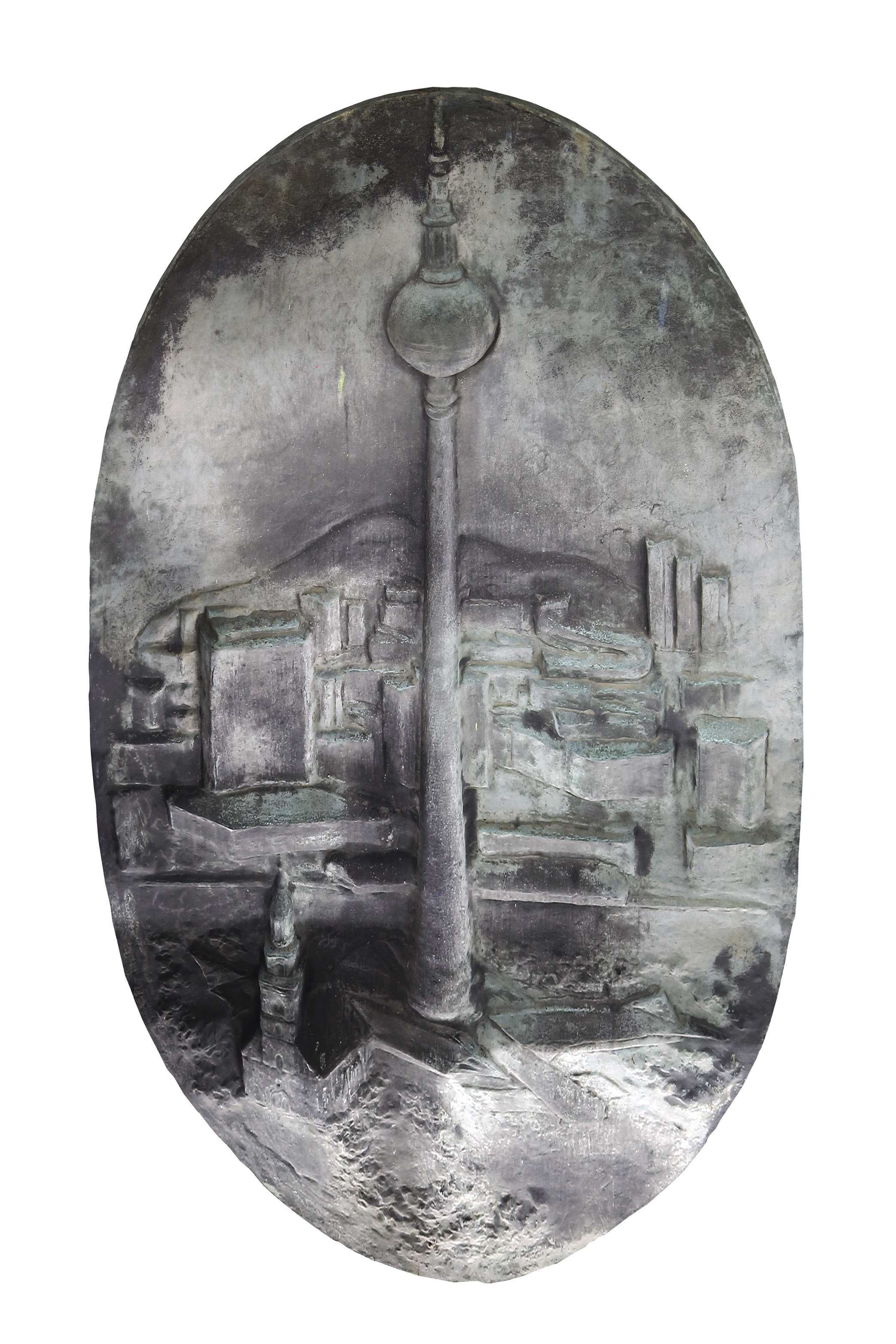
Old and New Berlin
The middle part of the large Old and New Berlin bronze relief designed by Evelyn Hartnick-Geismeier in 1978. It shows the Marienkirche, TV Tower and Alexanderplatz. It was previously on display at Berolina Haus but is now in storage.
The Decline of the Historical Centre and Rise of the New West
Berlin’s historic centre changed very little during the Weimar Republic. New buildings were rare and the area to the west of the palace remained unchanged. However, those responsible saw the historic centre to the east of the palace as a problem. The narrow streets, small houses and poor residents were not considered worthy of a global city. In contrast, a new area rose to prominence among the other centres of the new Berlin. Although it had not undergone
any significant structural change either, it became the centre of the New West. Business owners, politicians and city planners were alarmed. Wholesale redevelopment projects were planned to open up wide streets and slow the decline of the historic centre. Reorganising the historic centre was Greater Berlin’s most important city centre project – yet it failed, at least during the Weimar Republic.
The Shiny New West
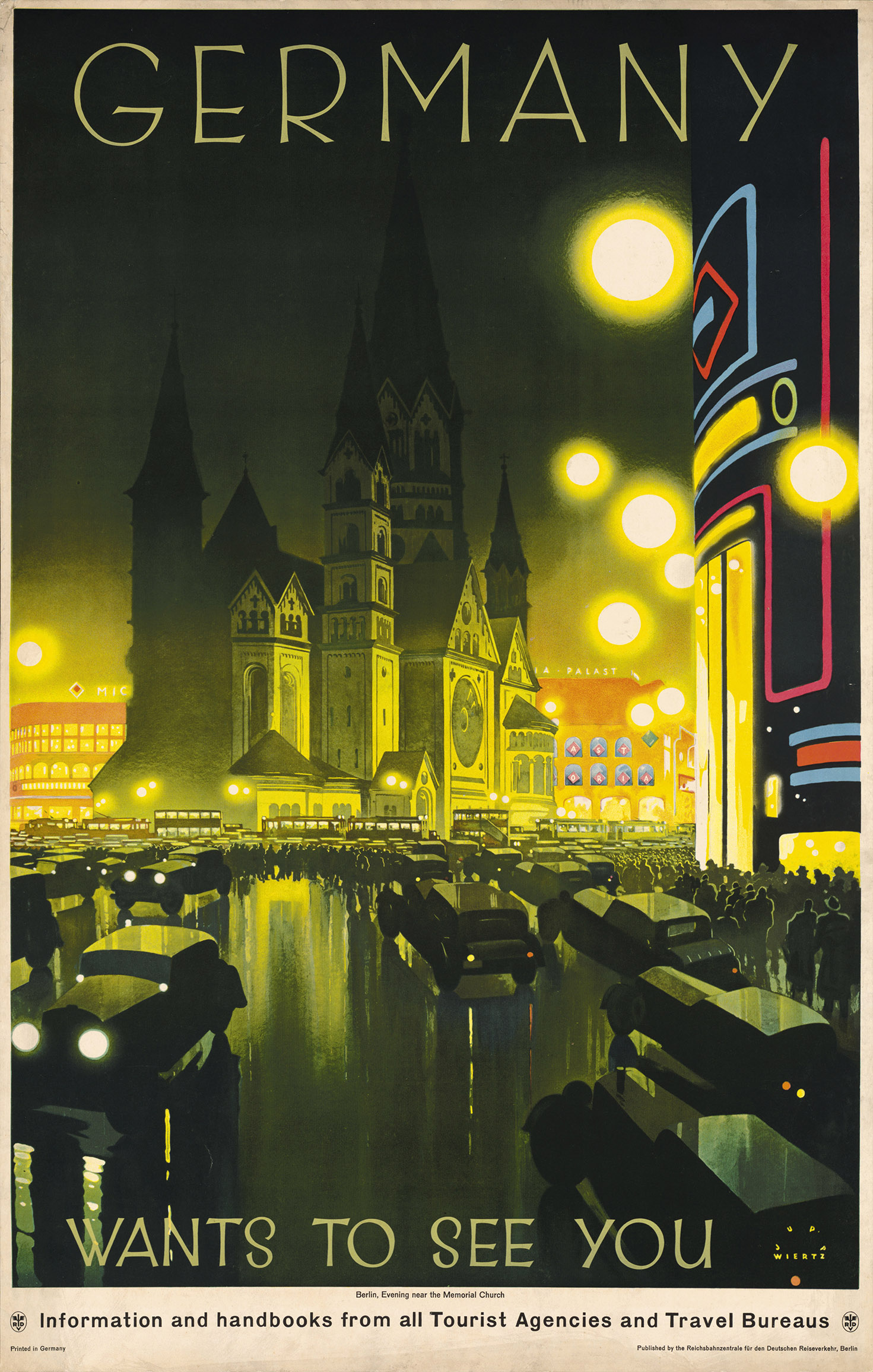
Jupp Wiertz, HAT TUB, Sig. ZSF-009
The New West was a winning location in Greater Berlin. An elegant shopping and recreational area surrounded the neo-Romanesque Kaiser Wilhelm Memorial Church, and it remained an expensive residential area.
A Stagnating Historic Centre
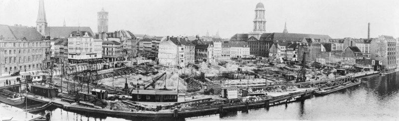
Photo illus / Zentralbild; German Federal Archives, no. 183-R97900
The historic centre was seen as being in decline. The answer to this was the largest centre-building project in Greater Berlin and involved the radical reorganisation of the southern historic centre. It included renovating Alexanderplatz, which proved to be a highlight of the project.
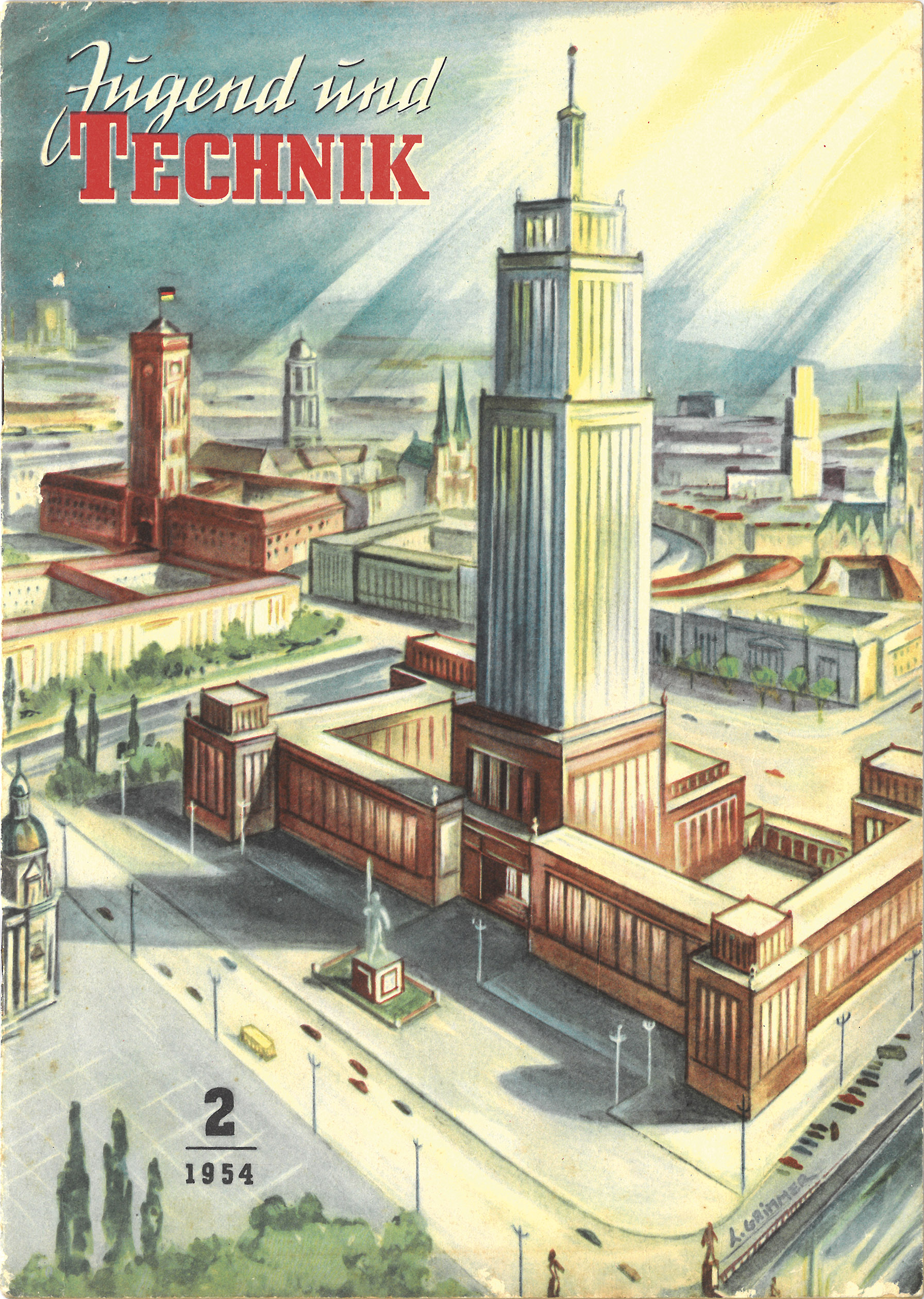
New Centres for Hitler and Stalin
The National Socialist government regarded the historic centre as too poor and therefore planned a new centre outside the old historic centre. It was a remarkable decision. In contrast, in the 1930s, Mussolini and Stalin designed their new centres for Rome and Moscow within the old centres. However, all three dictatorships planned dominant buildings for their new centres to produce a triumph of urban development for the capital and indeed the entire country. In the end, none of these buildings were ever built. After the war, a new plan to build a socialist centre in East Berlin was developed based on Moscow’s 1930s planning concepts. It proposed to extensively reconstruct the absolutist buildings on the eastern side of Unter den Linden boulevard, but it did not include a palace. Above all, it was to include a dominating multi-storey building in the historic centre for party and state authorities. This project was also never carried out.
A New Centre in the West of the Historic Centre
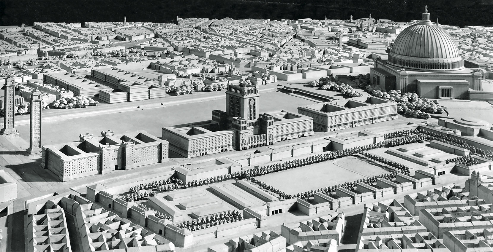
Schusev State Museum of Architecture, Moscow
The future centre of the capital of the Reich had to be monumental and completely new. It was planned as the centrepiece of the north–south axis, which was to extend between a north and south train station to the west of the historic centre.
A New Centre in the Historic Centre
Drawing by L. Grimmer; Harald Bodenschatz collection
After the division of Berlin, the historic centre moved to the outskirts of the Soviet sector. Nevertheless, it was confirmed as the centre of the socialist city. This was emphasised by a central multi-storey building, similar to one planned in Moscow and built in Warsaw.
Rebuilding the Centre during the Cold War
The division of Berlin after the end of the war was further cemented when the Berlin Wall was built. It led to the formation of two large city centres located in two central areas: Alexanderplatz in the east and Breitscheidplatz in the west. Both offered insights into their sides of the city and their systems. Initially it was not clear how either of the squares would be designed. Only one thing was for sure: they should look radically different to how they did before the war. Both squares are important examples of car-oriented city planning. It’s as if both were working off the same plans.
Alexanderplatz:
The Centre of Berlin and Capital of the German Democratic Republic

IRS (Erkner) / Scientific Collection, no. D1_1_1_18-F008
Alexanderplatz had changed significantly as a result of the renovation works carried out during the years of the Weimar Republic. It was redesigned following the destruction of the Second World War and incorporated the Alexander House and Berlonia House buildings designed by Peter Behrens in 1929.
Breitscheidplatz: The Centre of West Berlin

Photo Horst Siegmann; Berlin State Archive, F. Rep. 290, no. 115194
The centre of the New West, which has now risen to become the centre of West Berlin, was also completely redesigned. The Kaisereck building and the ruins of the Kaiser Wilhelm Memorial Church are the only remaining reminders of the old Roman Forum.
Two Central Squares in a Period of Change
Alexanderplatz was drawn into the spotlight immediately after the reunification of East and West Berlin. Breitscheidplatz, on the other hand, disappeared in the shadows. Groups of multi-storey buildings that would tower over the existing buildings were planned for both squares, but the process of building them was slow. Both squares continue to remain relevant thanks to their important train stations, which are surrounded by wide open spaces. Debate over how these spaces are designed has raged since the 1990s.
Alexanderplatz: The Centre of the East

Office of Hans Kollhoff
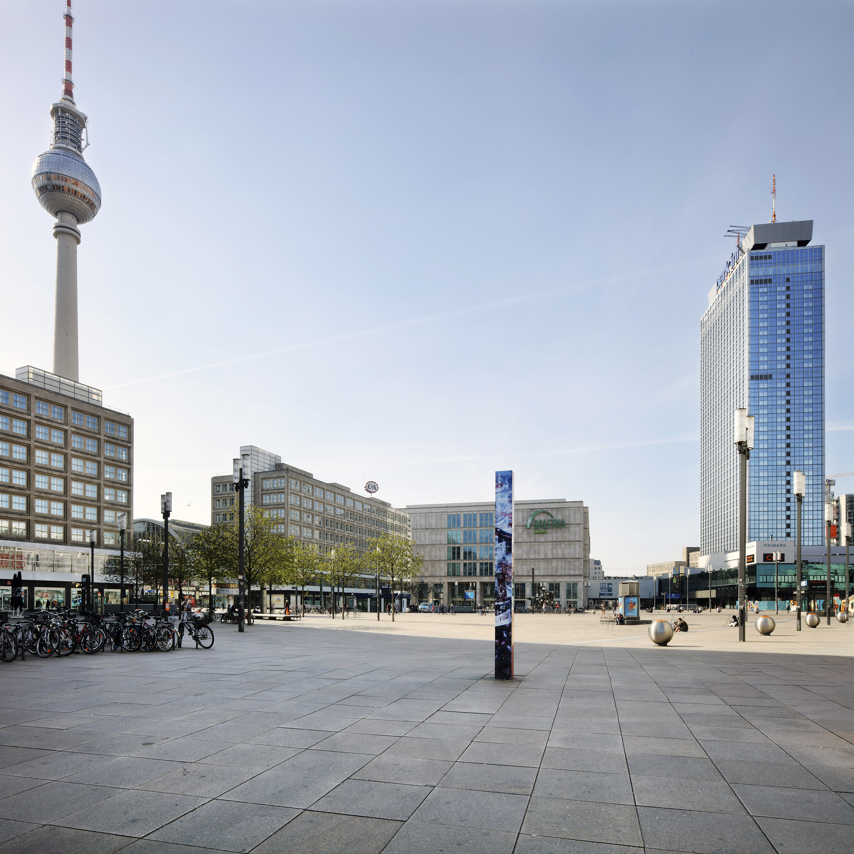
Photo Thomas Spier, apollovision
After the reconstruction of Alexanderplatz towards the end of the Weimar Republic and the new construction undertaken in the GDR period, a third, brand-new architectural vision of Alexanderplatz was decided after reunification.
Breitscheidplatz: Centre of the West

Photo Thomas Spier, apollovision
Following on from the construction of the Roman Forum in the imperial period and its redevelopment as the centre of West Berlin in the 1950s, City West, as it is now known, is currently taking on a third urban form. Skyscrapers are now being built at Breitscheidplatz, while Alexanderplatz is still waiting for its high-rise buildings.
A Number of Centres Since the Imperial Era
Until 1920, Greater Berlin was not a single city, but rather a collection of many cities and municipalities. Each municipality had its own centre, and some even had several centres. This legacy is invaluable, as it provides for a degree of decentralisation and, as a result, sustainable development. The number of centres continued to grow in the years after 1920, but not all were successful in the long term. Some of these centres have attracted international attention, but have not received the attention they deserve in Berlin.
Lichterfelde West Centre: Archetype of a Suburban Centre
The square in front of Lichterfelde West station is quite possibly the first planned local suburban shopping centre of its kind. It’s older than the much more famous centre in Lake Forest, north of Chicago in the US. The centre in Lichterfelde West is still open and serving the community today. It has proven to be forward thinking, particularly given the current transition away from car-oriented cities.

Postcard; Udo Christoffel (ed.), Berlin in Postcards (Berlin, 1987), p. 398

Photo Thomas Spier, apollovision
Frohnau Centre:
A Model Centre in the Garden City
Greater Berlin has some suburban centres at suburban train stations that are of great significance. In addition to the Lichterfelde West station forecourt and Mexikoplatz, this also includes the double square in Frohnau, which is one of the most important suburban centres in terms of urban quality.

The Garden City of Frohnau in Old Photographs (Berlin, 1981)
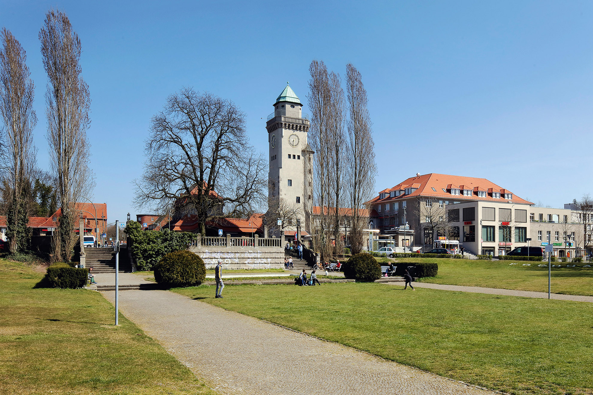
Photo Thomas Spier, apollovision
The Weißensee Communal
Forum:
A Small Lake as the Town Centre
The Weißensee Communal Forum was built in around 1910 around the small Kreuzpfuhl pond and is another, lesser-known highlight in the construction of suburban centres in the greater Berlin area. It intended, although ultimately failed, to underline the claim that the suburb would become a town.

Photo Harald Bodenschatz
Hermannplatz:
Centre of the South (Karstadt)
Striking new district centres were also created in the densely built-up city built according to the Hobrecht city. Hermannplatz is a perfect example. Its huge Karstadt department store was designed by Philipp Schaefer and built between 1927 and 1929. It attracted international attention at the time.
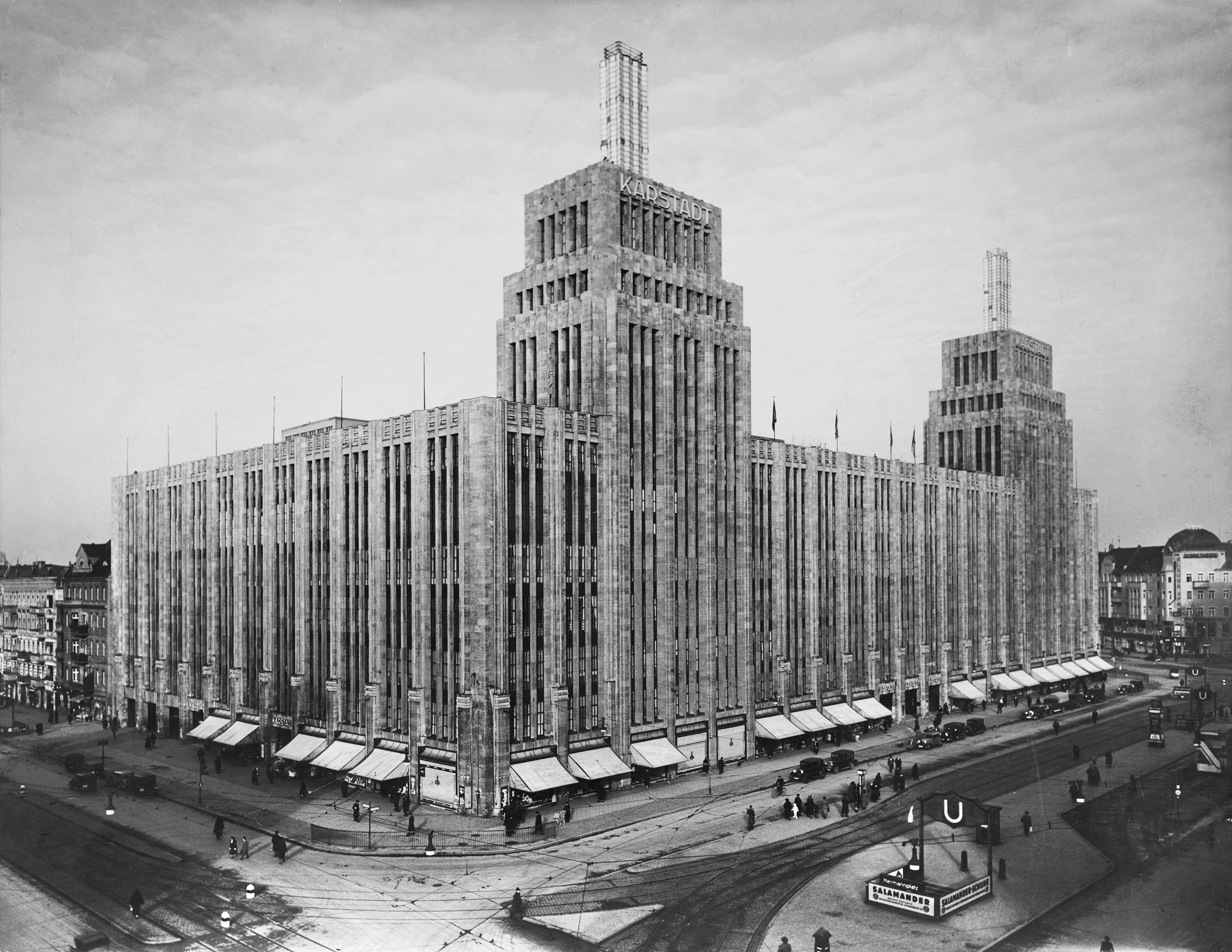
SIGNA Prime Selection AG
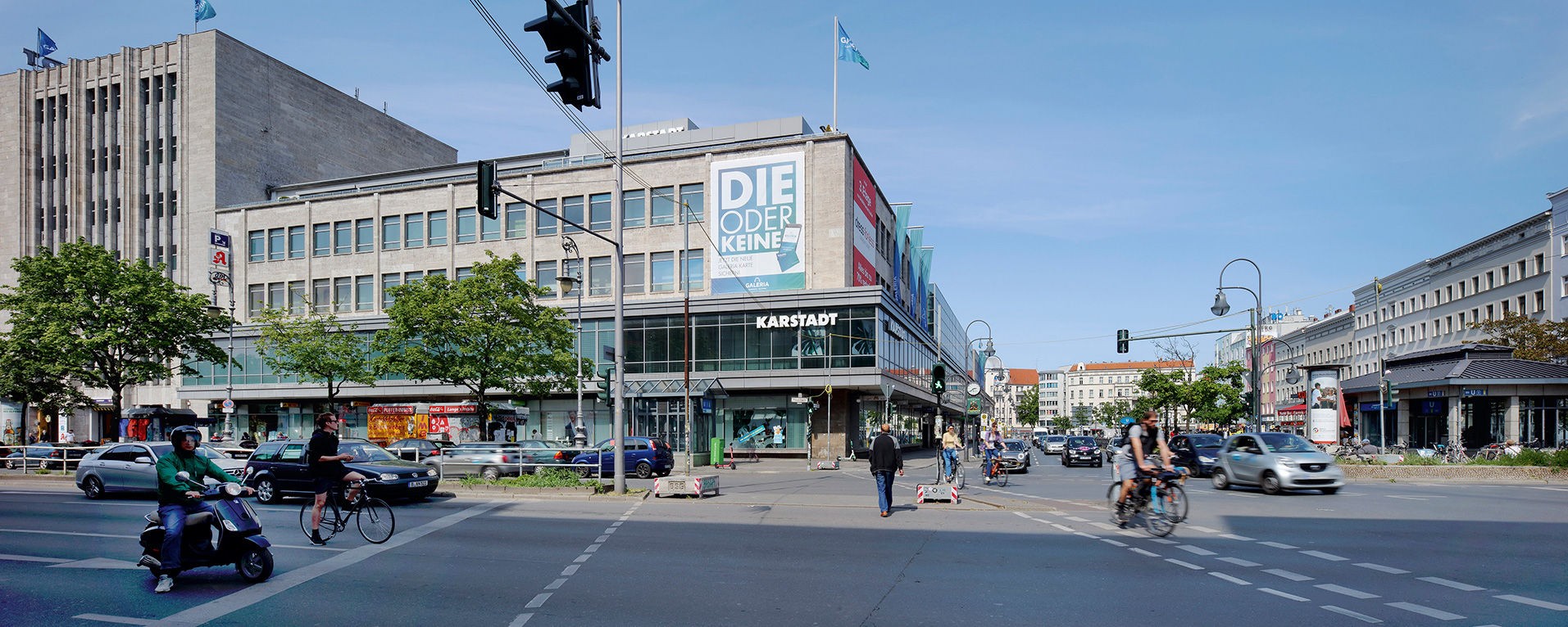
Photo Thomas Spier, apollovision
Fehrbelliner Platz: Administrative Centre of the Southwest
Due to the one-sided attention given to the new plans conceived for the centre of the Reich capital, real building activity carried out during the National Socialist dictatorship often took place out of sight – for example, the strictly designed Fehrbelliner Platz, the most important new city centre built during the Nazi era.

Photo Thomas Spier, apollovision
Marzahner Promenade:
Pride of the Far East
Marzahner Promenade is situated in the far east of Berlin and runs parallel to Landsberger Allee, formerly Leninallee. It’s still not well known to many residents of the western part of the city, but it is perhaps the most ambitious centre of a large-scale housing development from the GDR era.

pictured in May 1989. It uses an imaginative
design approach and is enhanced by works
of art. It offered local amenities and served
as a meeting place for people living in the
Marzahn housing development.
Photo Carin Martin, IRS (Erkner) / Scientific
Collection, no. D1_1_5_3-002
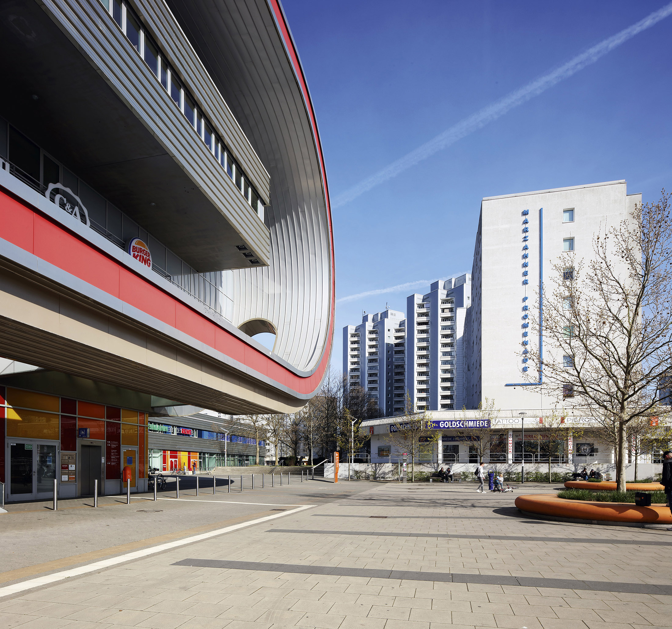
Photo Thomas Spier, apollovision