The Greater Berlin Act was passed by the Prussian Parliament on 27 April 1920 and came into effect on 1 October 1920. The passing of the act came just a month after the Kapp Putsch at a time when both Berlin’s and Germany’s future was uncertain. It coincided with the severe crisis that followed the First World War and the end of the Spanish Flu pandemic. It was one of the most important events in Berlin’s 800-plus years of history and came as a result of decades of disputes between the individual municipalities in the greater Berlin area as well as between Berlin and Prussia.
Although Greater Berlin wasn’t created until 1920, it already existed socially, economically and structurally for some time before then. Industry, the military and the neighbourhoods favoured by the wealthy had all increasingly been moving to the edges of the old city of Berlin since the 1880s. Siemens set up a base in Spandau, Borsig set up in Tegel, while AEG moved to Hennigsdorf and Oberschöneweide.
The military also began to occupy more of the city’s surrounding areas, including Döberitz, Jüterbog, Kummersdorf and Wünsdorf. New, grand residential areas emerged in the west (Westend), north (Frohnau), east (Karlshorst) and particularly in the southwest (from Grunewald to Wannsee). Large numbers of unskilled workers remained in the city centre, especially in Moabit, Wedding, Friedrichshain, Kreuzberg and Neukölln. The old town became the city centre. Commuter railway lines, natural and artificial waterways and large arterial roads held the new city together.
Gustav Böß, mayor of Greater Berlin from 1921 to 1929 Berlin Today, Berlin 1929
On the Eve of the Creation of Greater Berlin:
The Spanish Flu Pandemic of 1918 – 1920
A chart showing mortality rates related to Spanish Flu in New York, London, Paris and Berlin between June 1918 and March 1919. The Spanish Flu killed more people worldwide than the First World War, but had been largely forgotten until the coronavirus pandemic restored it to public attention. Somewhere between 27 and 50 million people lost their lives over three waves of infections between spring 1918 and 1920. More than 40,000 people in the Greater Berlin area died from the disease. At that time, municipalities like the Prussian state were unable to implement measures to contain the pandemic. The chart shows the peak of the pandemic in the autumn of 1918. Note that it is missing continuous data from Berlin.
The Kapp Putsch in March 1920
The Kapp Putsch by Else Hertzer. Germany’s young democracy appeared to be faltering in mid-March 1920, just over a month before the passing of the Greater Berlin Act. The Ehrhardt Brigade marched from Döberitz to Berlin via the Heerstrasse (now Bundesstrasse 5 federal highway). The soldiers wore a white swastika emblem on their helmets. The imperial government managed to flee to Dresden and later moved on to Stuttgart. Wolfgang Kapp, an East Prussian civil servant, declared himself the new Chancellor. The subsequent general strike was the largest in German history and ultimately forced the putschists to surrender. Hertzer’s painting shows soldiers on a Berlin street at night. The diffuse light shining aggressively from the vehicle headlights spreads fear.
Greater-Berlin Hardly worth reporting
The birth of Greater Berlin was not a brilliant event that dominated the front pages of the newspapers. Neither on April 27, when the Prussian State Assembly approved the merger by a wafer-thin majority, nor on October 1, when Greater Berlin became a reality. On the contrary: the decision in favor of Greater Berlin was worth only a scrawny piece of news, which hardly differed from newspaper to newspaper. The headlines were delivered by other events, such as the consequences of the Kapp Putsch and the international situation.
Champions for Greater Berlin
The creation of Greater Berlin did not come out of nowhere. Great efforts – and great personalities – were needed in order to overcome tough resistance. It is astonishing that some of the key figures have been forgotten. Mayor Martin Kirschner was a huge proponent of Greater Berlin and served as chairman of the jury for the Greater Berlin Urban Planning Competition of 1910, and Greater Berlin would not exist with the strategic skills of Mayor Adolf Wermuth. Finally, it was Mayor Gustav Böß who determined the fate of the city during the turbulent 1920s.
Largely Forgotten: Mayor Martin Kirschner
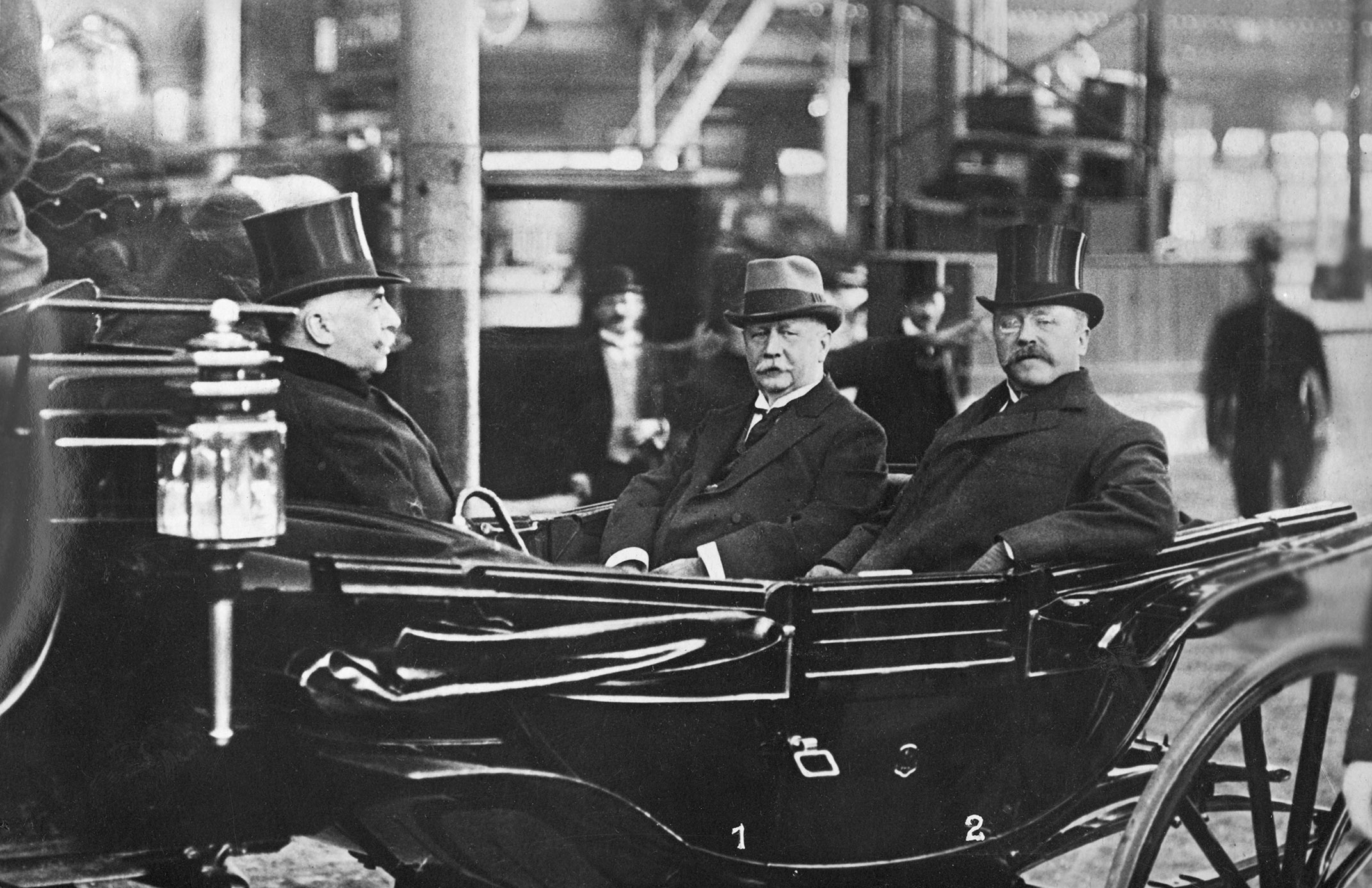
Martin Kirschner served as mayor of Berlin between 1899 and 1912 during a period of turbulent growth and campaigned for the creation of Greater Berlin. He influenced the results of the Greater Berlin Competition (1908–1910) through his role as chairman of the jury. During Kirschner’s time in office, the idea of Greater Berlin as a single municipality did not catch on and it was only possible to set up a Joint Authority in 1912.
Largely Forgotten: Mayor Adolf Wermuth
As mayor of Berlin from 1912 to 1920, Adolf Wermuth fought vehemently for the creation of Greater Berlin as a single municipality. It is thanks to Wermuth’s strategic skills that Berlin has the scope and the two-tier administrative organisation that we still know today.
Largely Forgotten: Mayor Gustav Böß
Gustav Böß, a local politician with the German Democratic Party (DDP) and city treasurer, was elected mayor in 1921, just one year after Greater Berlin was created. He was the key decision maker in the municipal urban development process for the single municipality during the Weimar Republic until the end of his term in 1929.
Renée Sintenis: A Little Bear for Greater Berlin
The new, bigger Berlin needed a new heraldic animal that would differ from the bears of the old Berlin. It needed an animal of the Weimar Republic to distance it from the empire. Renée Sintenis created Berlin’s most famous bear in 1932. Her bear is a clumsy, dishevelled little creature, hardly awe-inspiring, but lovable nonetheless. A slightly modified 1956 version of the bear standing on its hind legs with its front paws raised has served as the Golden Bear award at the Berlinale film festival since 1960.
Town halls aplenty
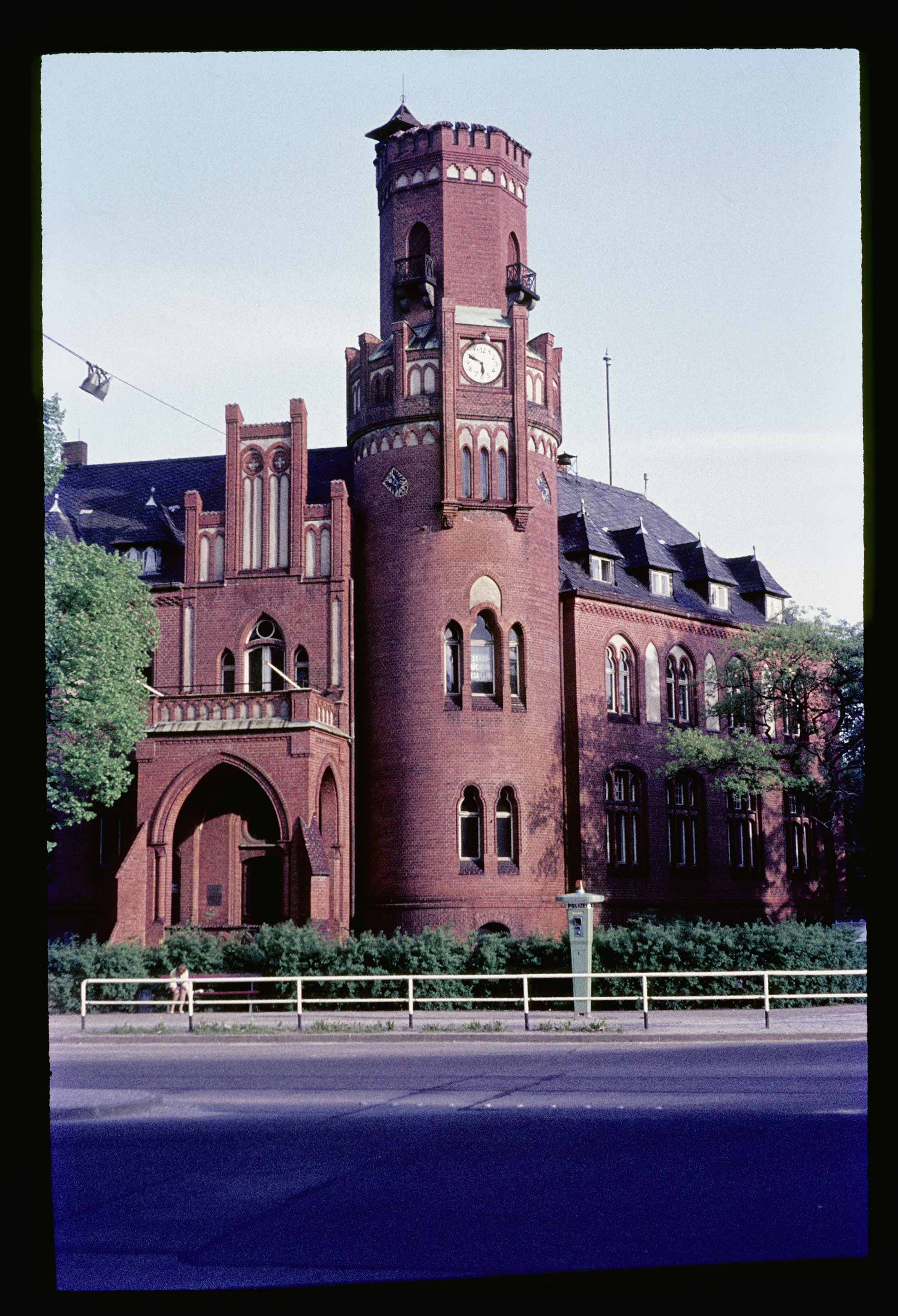
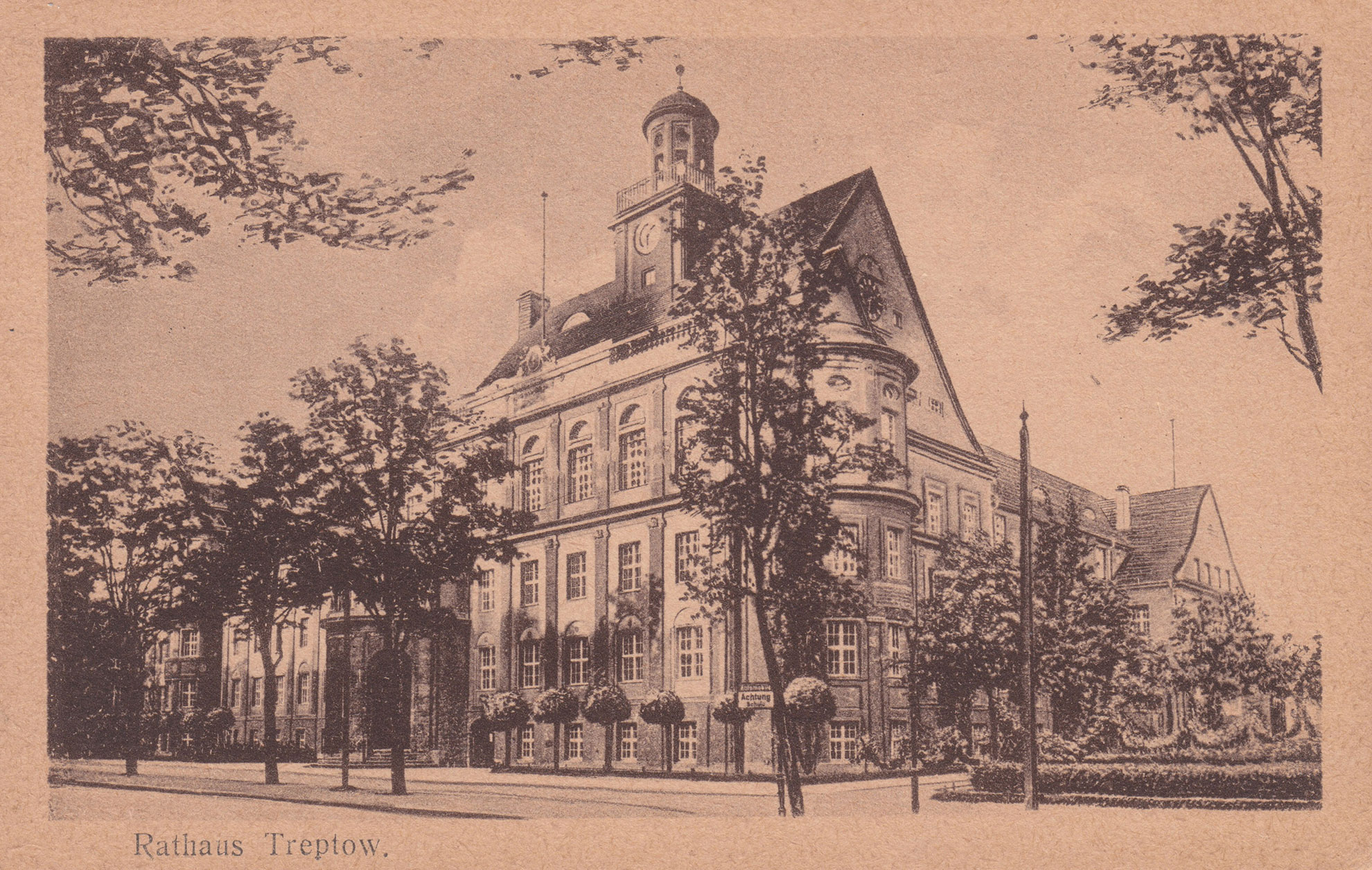
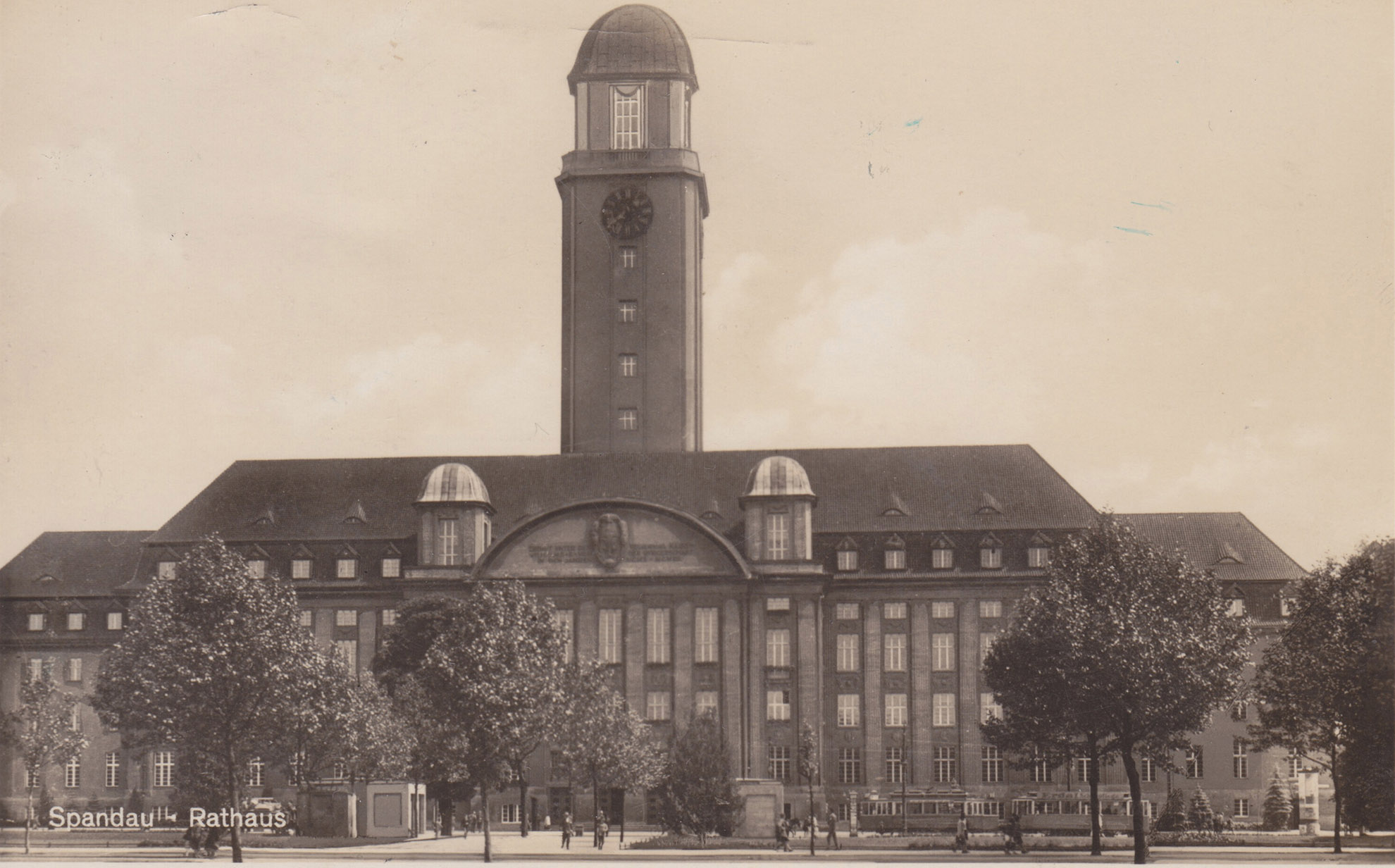
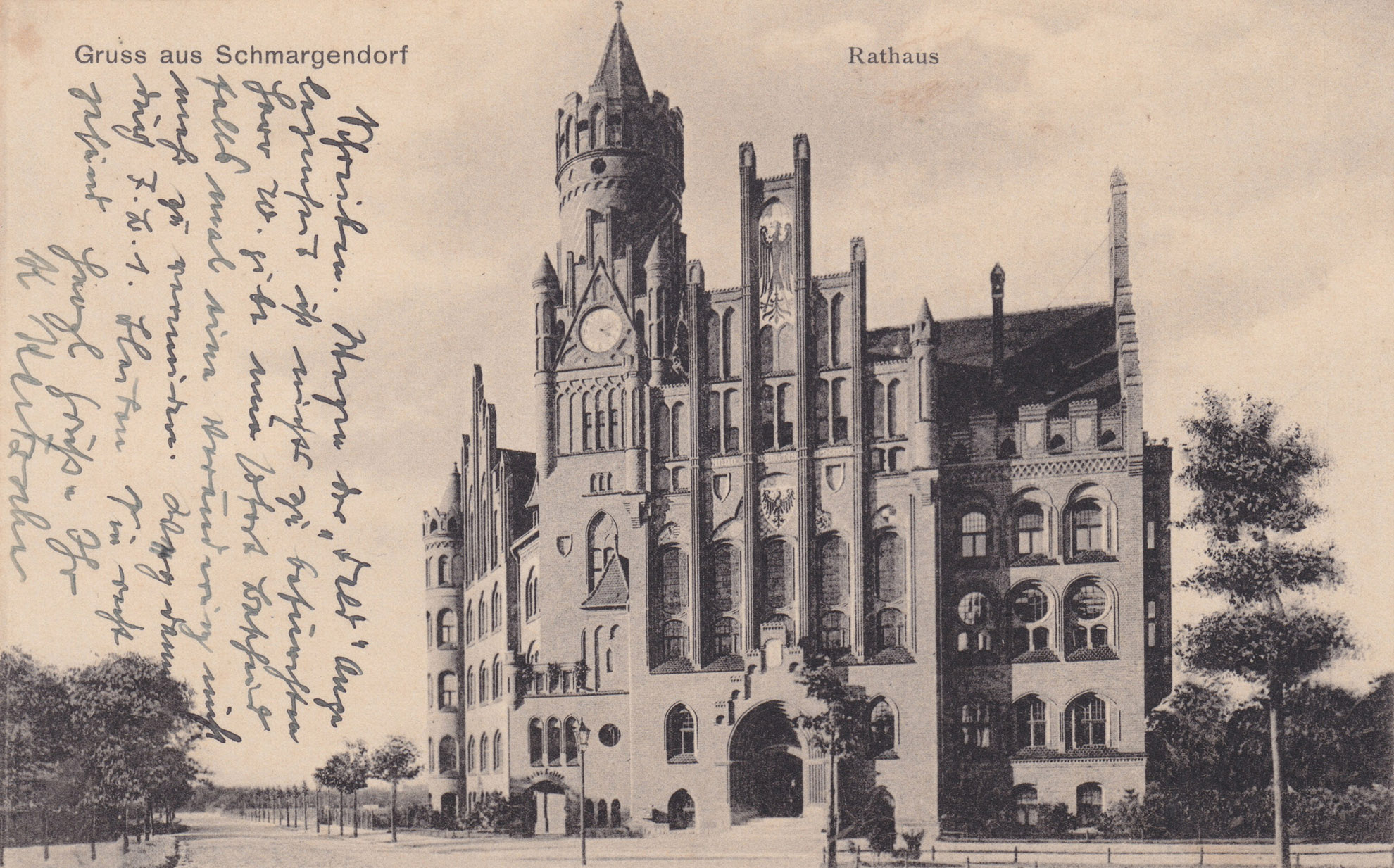
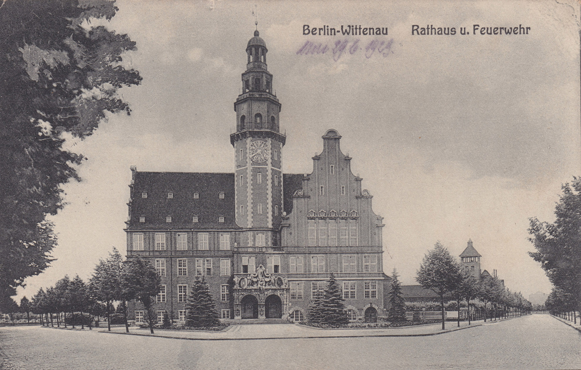
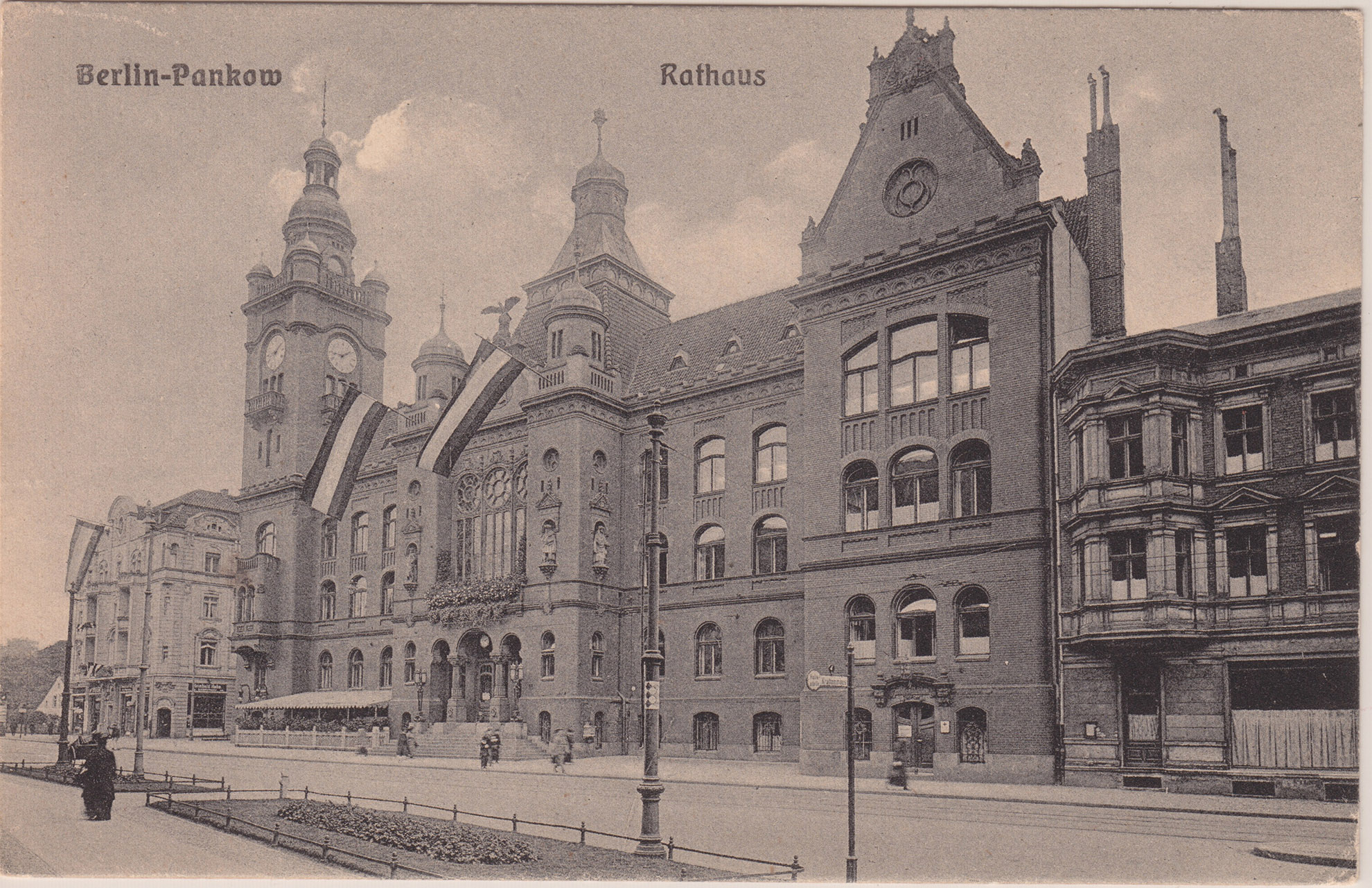
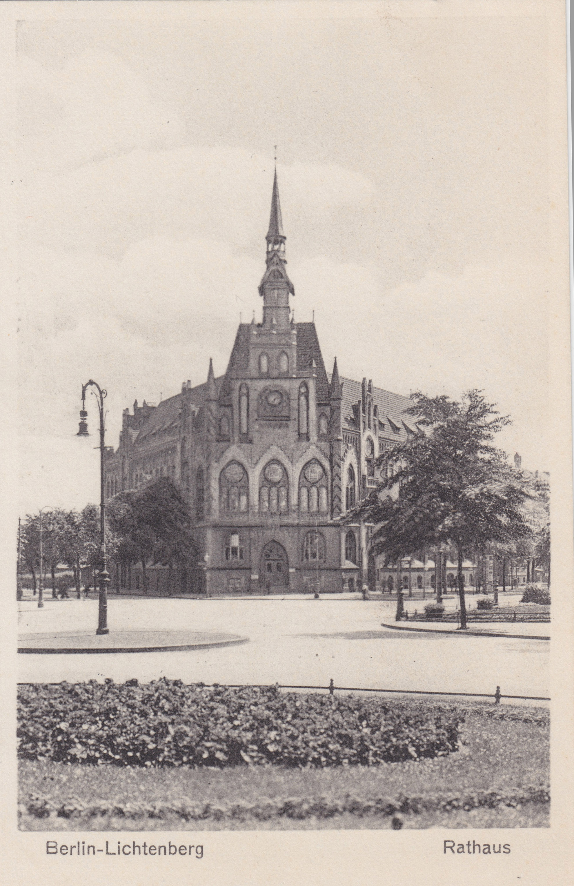
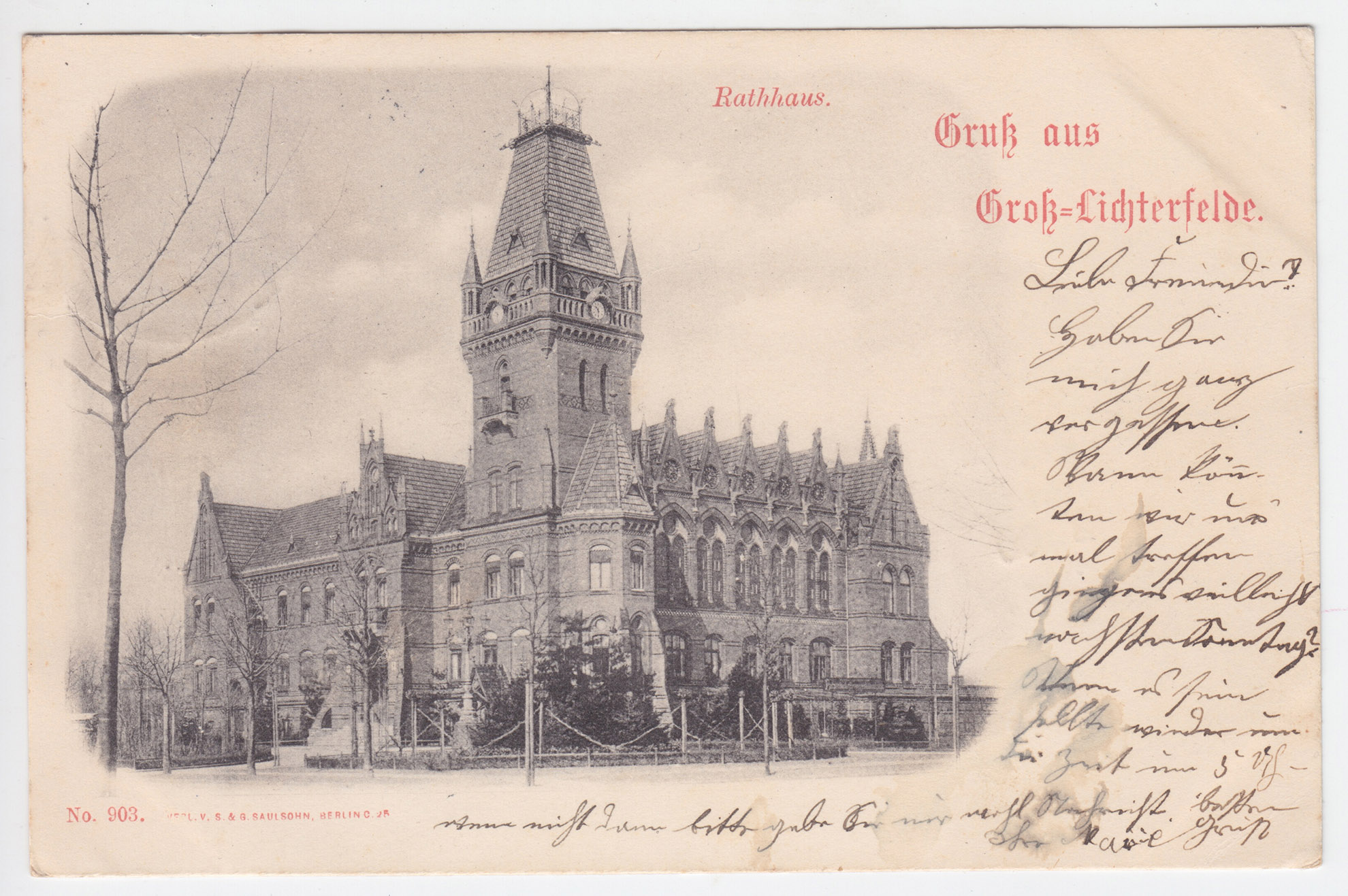
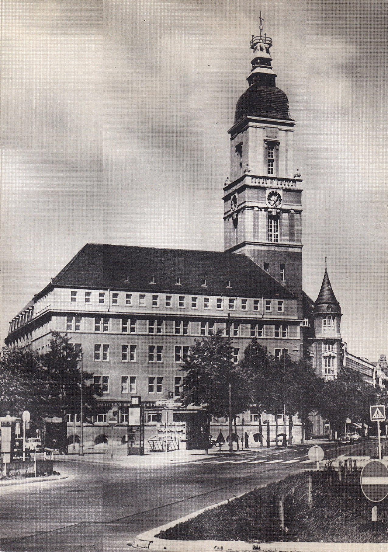
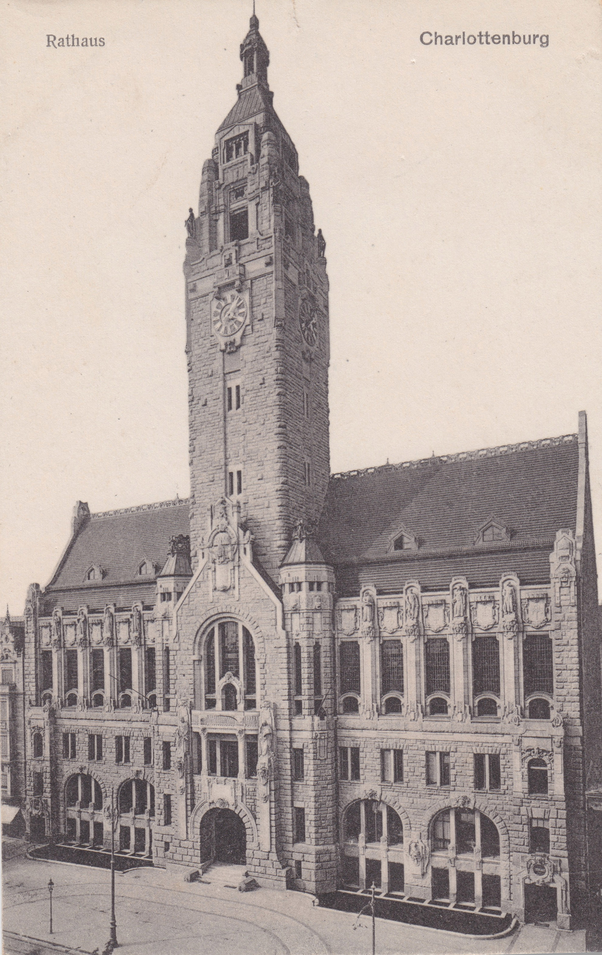
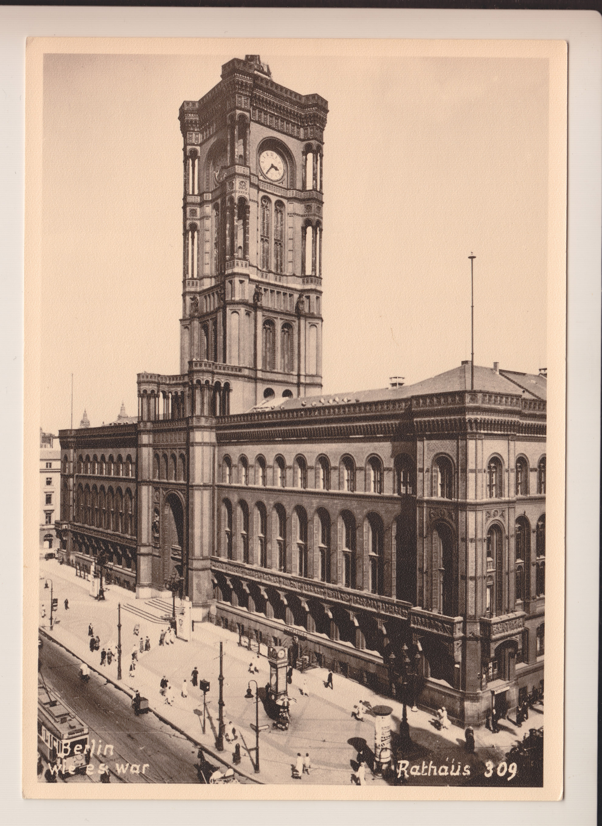
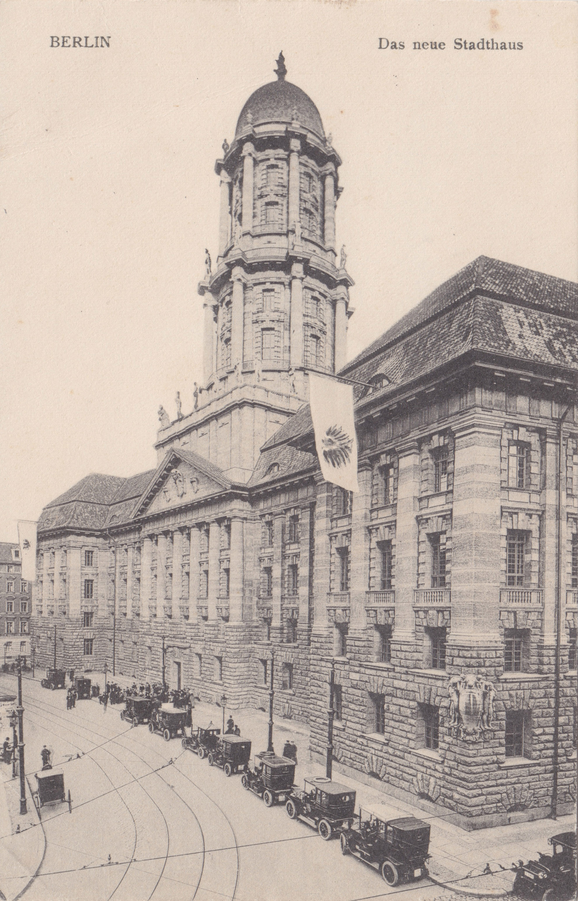
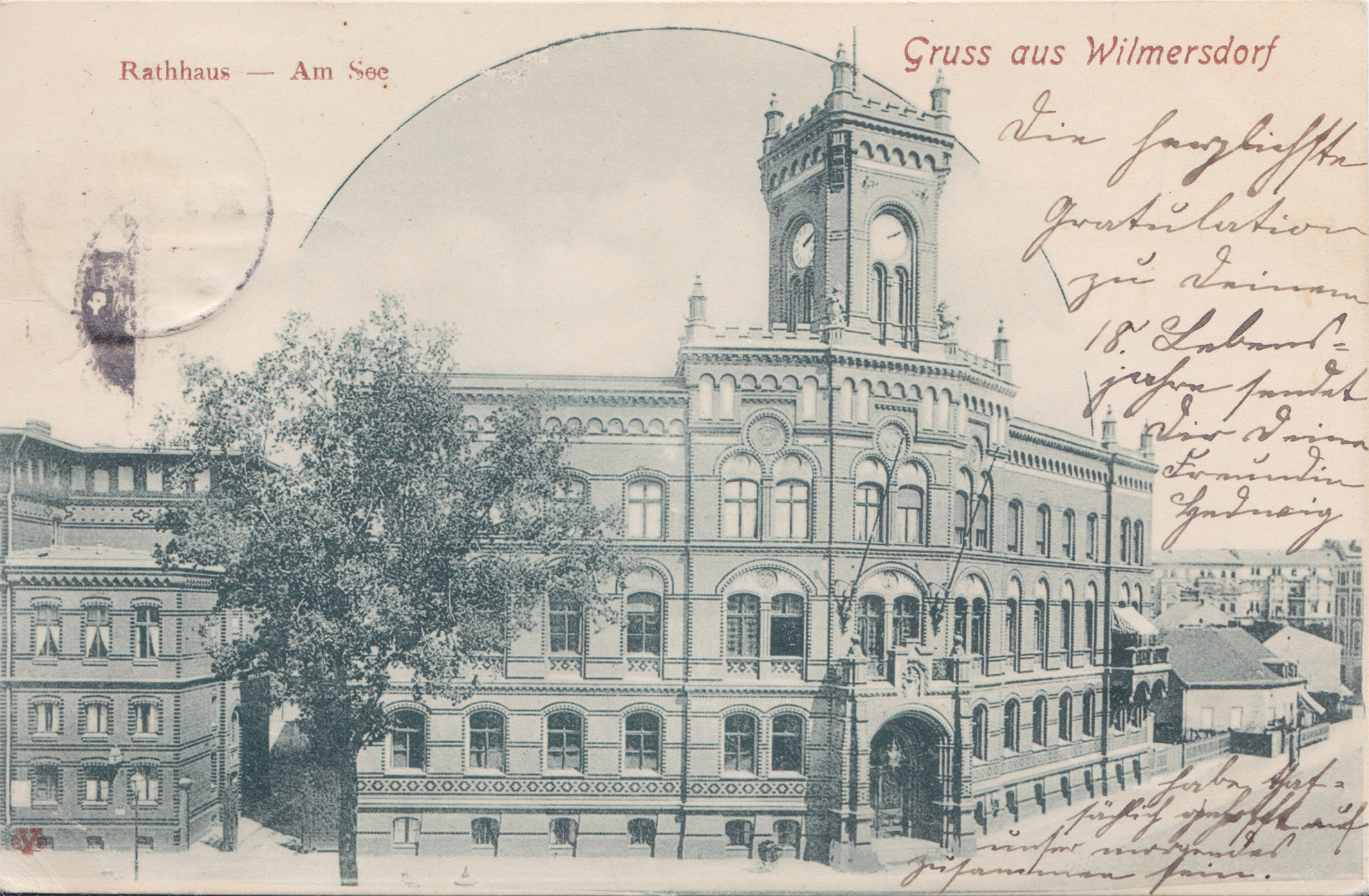
The countless more or less grand town halls dotted throughout the city and its metropolitan area show that Greater Berlin came as a result of consolidating many towns and municipalities. Back in 1920, most of the town halls were still relatively young, dating from the imperial era. No other major European city has as many town halls as Berlin. They are evidence of the fact that the city has overcome municipal fragmentation, but also that the municipalities have lost their independence.
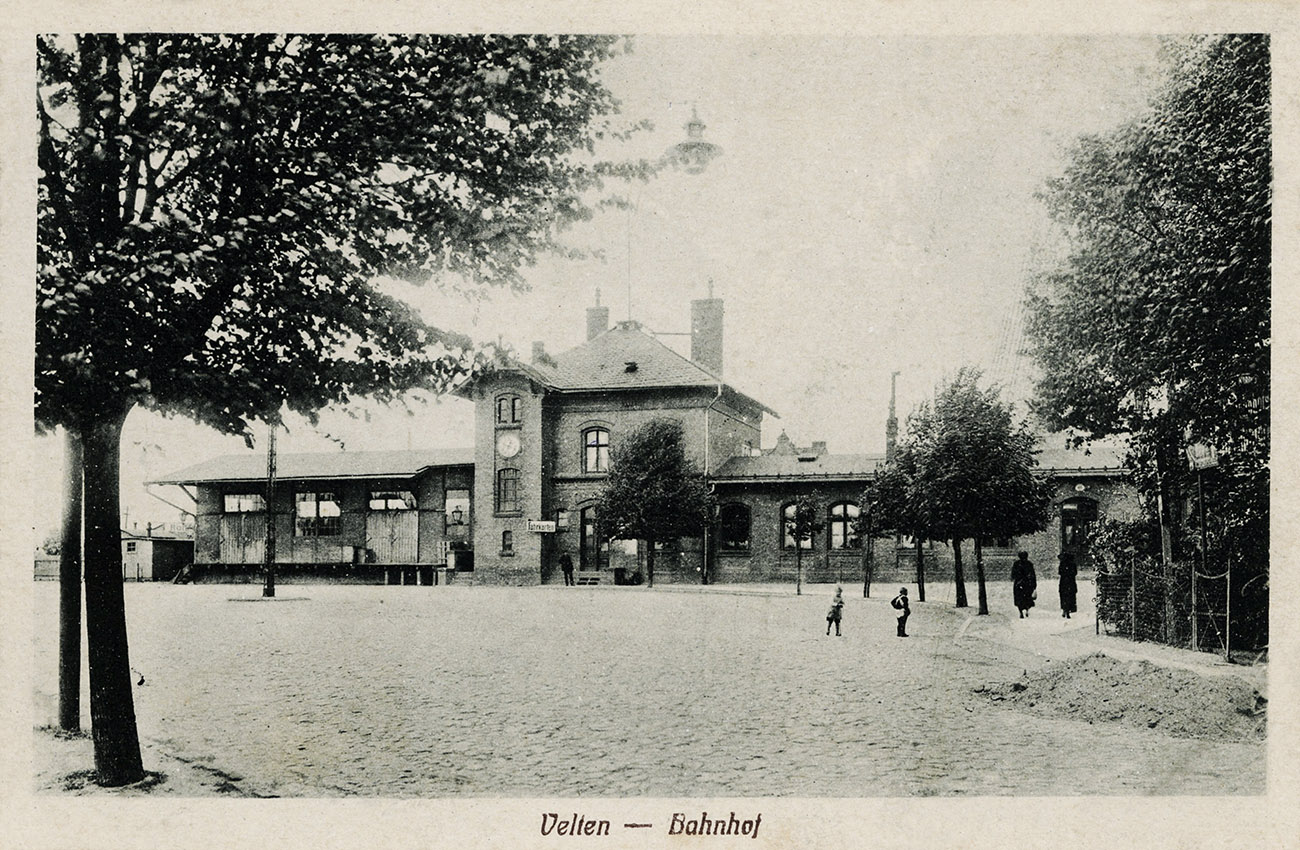
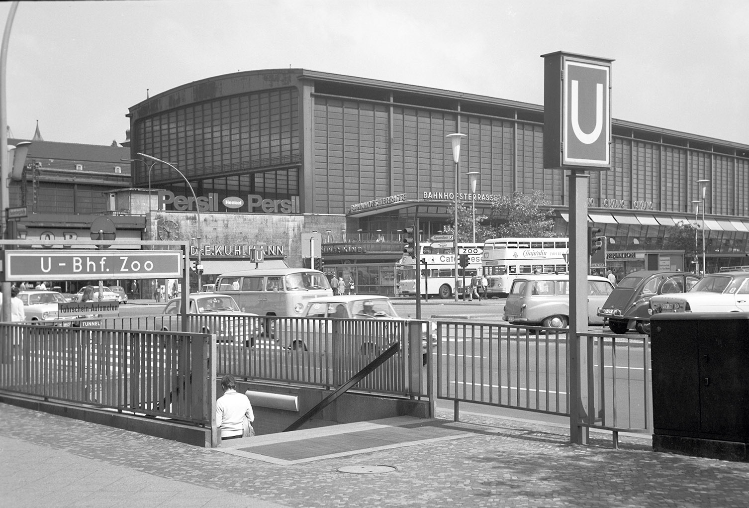
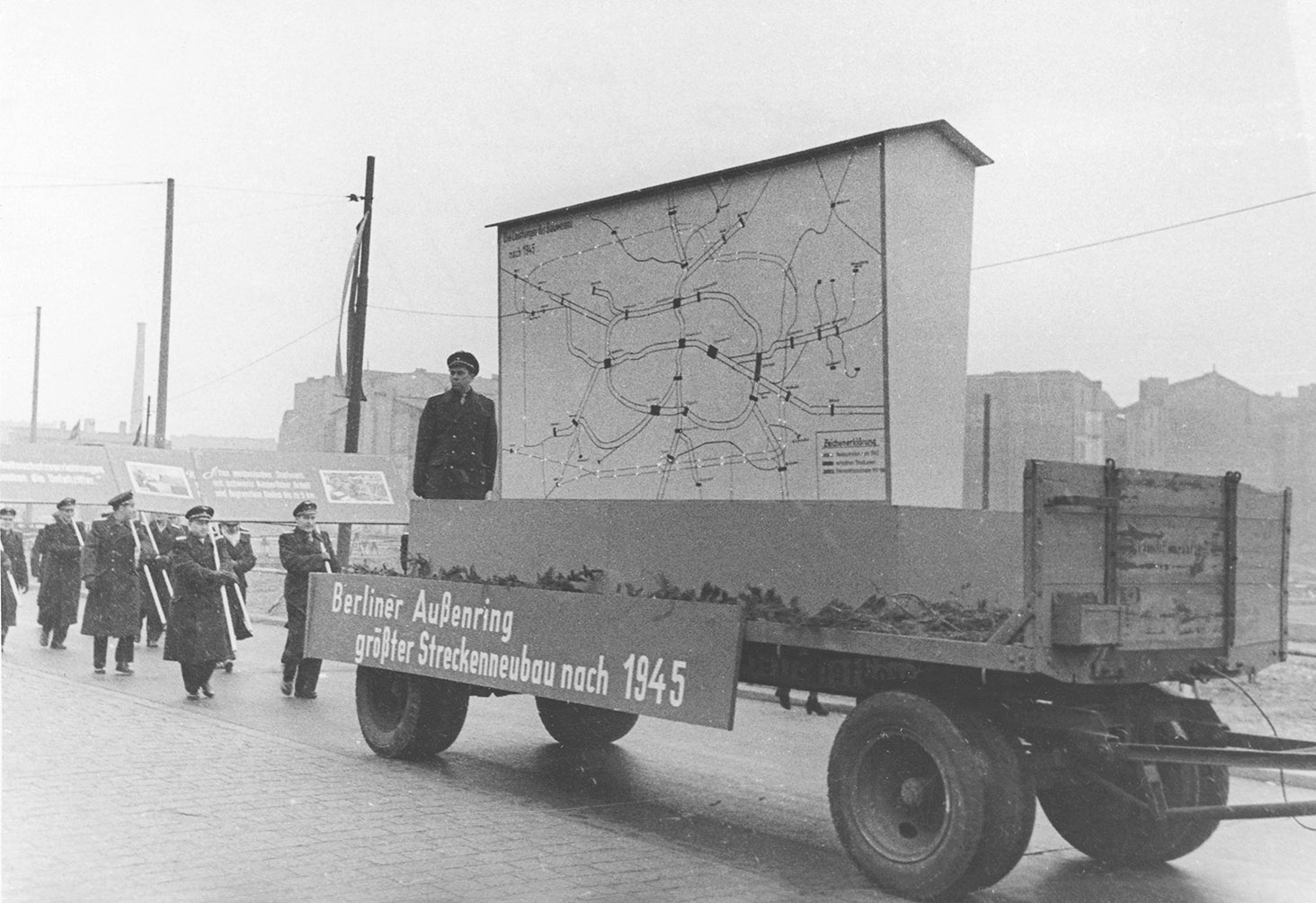
The greater Berlin area came about as a result of the railway. High-speed rail transport made it possible to build the suburbs. The formation of Greater Berlin led to fundamental reform of the public transport system. A single, unified municipal transport company was created in 1928: Berliner Verkehrs-AG (BVG). The reforms affected buses and the U-Bahn, but they were primarily focused on trams, which were the most important means of transport in the city at that time. Following the Second World War, the local public transport network was largely separated. Trams in West Berlin closed, but the underground U-Bahn network was expanded on both sides of the wall. An outer railway ring was built in order to bypass West Berlin. After reunification, a new system of train stations was created, thereby reducing the importance of the divided city’s two central train stations: Zoologischer Garten and Ost-Bahnhof. At the same time, the project of the century was finally carried out: the north–south main rail line.
Gustav Böß, mayor of Greater Berlin from 1921 to 1929 Berlin Today, Berlin 1929
Pedestal from the Elevated Railway
Three-roller load-bearing pedestal from the elevated railway line at Schlesisches Tor, 2020. The double decoupling of guideways and the supporting construction continues to protect the elevated line from material fatigue.
Greater Berlin: A Child of the Rails
Even in the years before the First World War, Berlin needed an extensive high-speed rail system in order to transform the city centre and ensure the swift growth of the greater Berlin area. The two ‘station streets’ (Leipziger Strasse and Friedrichstrasse), which carried passengers from key train stations to the city centre, became the most important main streets in the city centre. The high-speed rail system also enabled the rapid rise of the centre of the New West area at the Zoologischer Garten station as well as the expansion of the villa colonies in southwest Berlin and elsewhere. It also promoted further migration of industry to the outskirts of the city. The Prussian Railway Division orchestrated the rail-guided expansion of Berlin, in particular from the 1880s onwards. The radial rail network led to a star-shaped settlement pattern, and this relatively sustainable basic city pattern is still tangible today.
The Network of the Circular Railway, Light Railway System and Commuter Lines
A map of commuter lines in 1920. All of the lines end outside the boundary of Greater Berlin. Around half of the lines were single-track, and some were also long-distance lines.
Commuter Line Stations
Diagram of the Expansion into the Suburban Area
A dynamic model of radial urban expansion developed in 1911. Richard Petersen’s star-shaped settlement pattern shows the desired form of modern urban development: Growth takes place along the lines radiating out from the centre, with commuter train lines providing the supporting framework. The growth corridor condenses at the train stations. Building density reduces as you move outwards from the central core. Open spaces stretch between the lines radiating out from the centre, reaching all the way into the central core. Petersen was a transport planner and, together with Rudolf Eberstadt and Bruno Möhring, won third prize in the Greater Berlin Competition (1908–1910) with the radial urban expansion model.
The Long Search for a Central Train Station
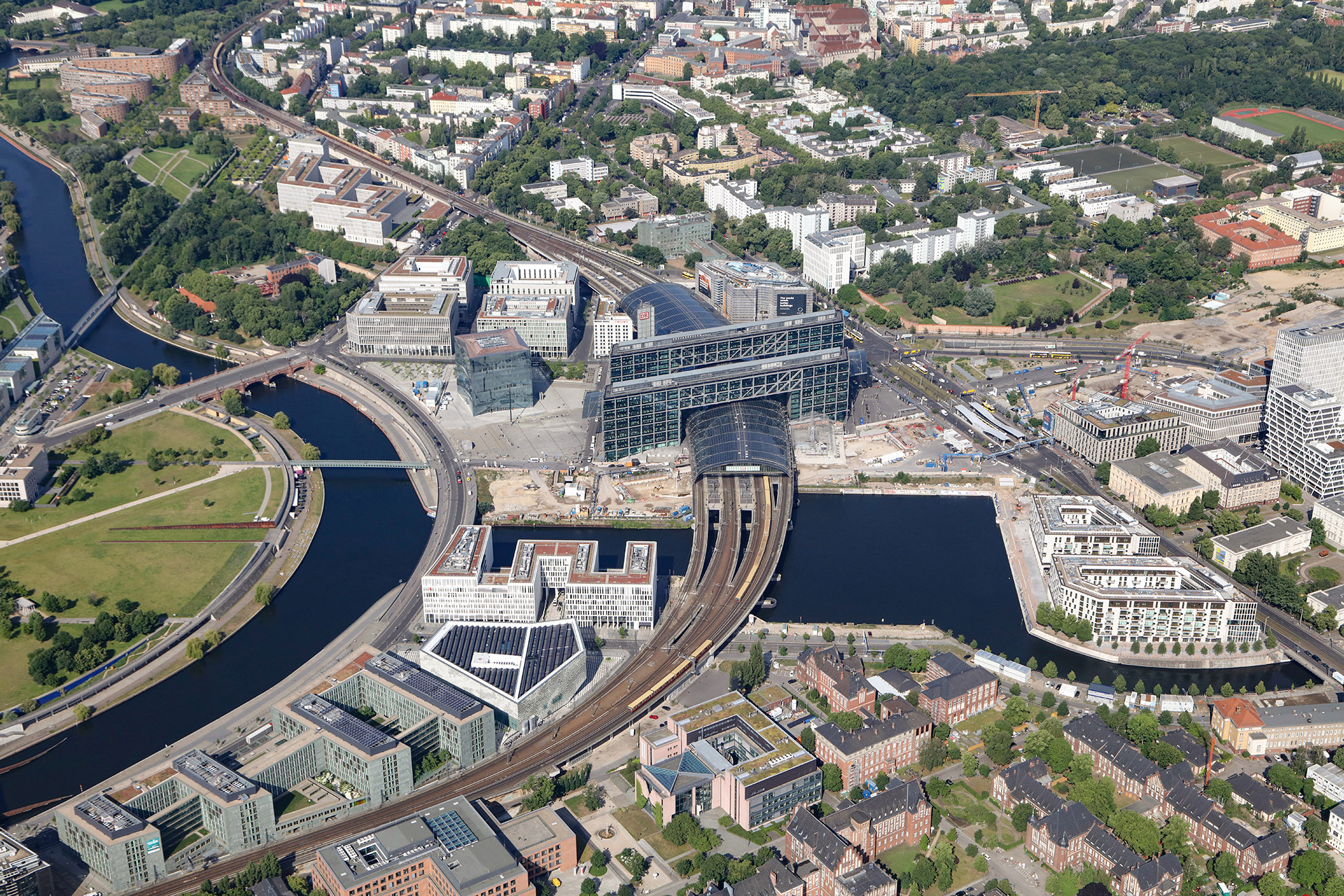
Berlin’s lack of a central train station was seen as a serious failure even during the Greater Berlin Competition (1908–1910). Numerous competition entries proposed having two central train stations, which would be connected by an underground line running from north to south. Lehrter train station was selected as a suitable location for the north station, while the Deutsches Technikmuseum (German Museum of Technology) would be the site for the south station. The plans for a proper central train station at the site of the former Lehrter station were set out in considerable detail during the Weimar Republic. Nazi-era planners then moved the site of the northern central station further north towards Gesundbrunnen. When the city was divided, Lehrter station lost its significance due to its position on the periphery of both East and West Berlin. The new central station opened here in 2006 – after around 100 years of planning.
Proposals Submitted for the Greater Berlin Competition
Proposals During the Weimar Republik
The Plan for Two New Large Train Stations during the Nazi Era
Central Train Stations in the Divided City: East Berlin
Central Train Stations in the Divided City: West Berlin
A New Central Train Station
BVG: A Child of Greater Berlin
A city having a single, central transport company that uses a standardised fare system is not something that should be taken for granted, as it’s not always a given. It wasn’t until after Greater Berlin was established that it was possible to get past the situation of having several competing private and public transport companies. The crowning achievement of all of this was the introduction of a fixed fare of 20 pfennigs in 1927. This fare also allowed for passengers to change to another line. Berlin’s public transport company, Berliner Verkehrs-Aktiengesellschaft (BVG), was founded in 1928 and was the largest transport company in the world at the time. City Councillor for Transport Ernst Reuter spearheaded the foundation of the company.
The Tram and U-Bahn Network
The rail network was further expanded after Greater Berlin was established. Trams made up 50 per cent of the total public transport system in 1928, while elevated and underground lines made up 15 per cent. In the years after 1945, trams were considered old-fashioned in West Berlin and the system was closed down.
BVG Company Housing Complexes
Combining tram depots with housing for tram employees was an approach unique to Greater Berlin. The residential buildings were built by a company-owned housing association: the non-profit Heimstättenbau. Jean Krämer was the outstanding architect of these complexes. He has largely been forgotten today.
After 1990: A Rail Renaissance
Berlin’s rail system was reorganised following German reunification. A new structure was developed, discussed and agreed on and ultimately implemented within a very short space of time. The Federal Ministry of Transport opted for the mushroom model, and this has provided structure to Berlin since its adoption in 1992. It would now fulfil two dreams: determining a central train station on the exact site that was proposed one hundred years ago and developing the underground, long-distance North–South main line, which brought with it another key new major train station: Südkreuz. Work is also underway to expand the tram system and in particular, to reintroduce trams to the western part of the city. That’s not all. The city is growing and local and regional transport must be rapidly expanded, yet the necessary shift towards sustainable transport must be considered. The first plans are in place as part of the i2030 transport project.
Breathtakingly Fast: The Railway Mushroom Model
After reunification, it was by no means clear how the unified rail system should be reorganised. Discussions focused around two models: the mushroom model and the ring model.
Initially Almost Overlooked: The New Südkreuz Station
Südkreuz station went almost unnoticed as it quietly developed in a hidden location. The urban development opportunities that a key train station like this presents were also overlooked for a long time.
The Outer Railway Ring: A Forgotten Treasure?
It was well known to East Berliners, but not so much to West Berliners: The outer railway ring connects the radial routes of the suburban transport system. It was initially scaled back after reunification. Its potential was yet to be discovered.
Expansion of the Tram Network
The revival of the tram is an unmistakable reality. Not only are we seeing a push to bring back trams to the western part of the city, plans are also in place to massively expand the tram network. However, it is not yet clear how trams will be integrated into the public space in a way that’s compatible with the city.
Big Plans: i2030
The i2030 project involves the states of Berlin and Brandenburg working with Deutsche Bahn and the Berlin-Brandenburg Transport Association to plan multiple sub-projects focused on adapting infrastructure to increased requirements in the coming years. In future, it will be necessary to consider whether the outer railway ring – constructed by the German Democratic Republic to detour around West Berlin – can still play a key role.
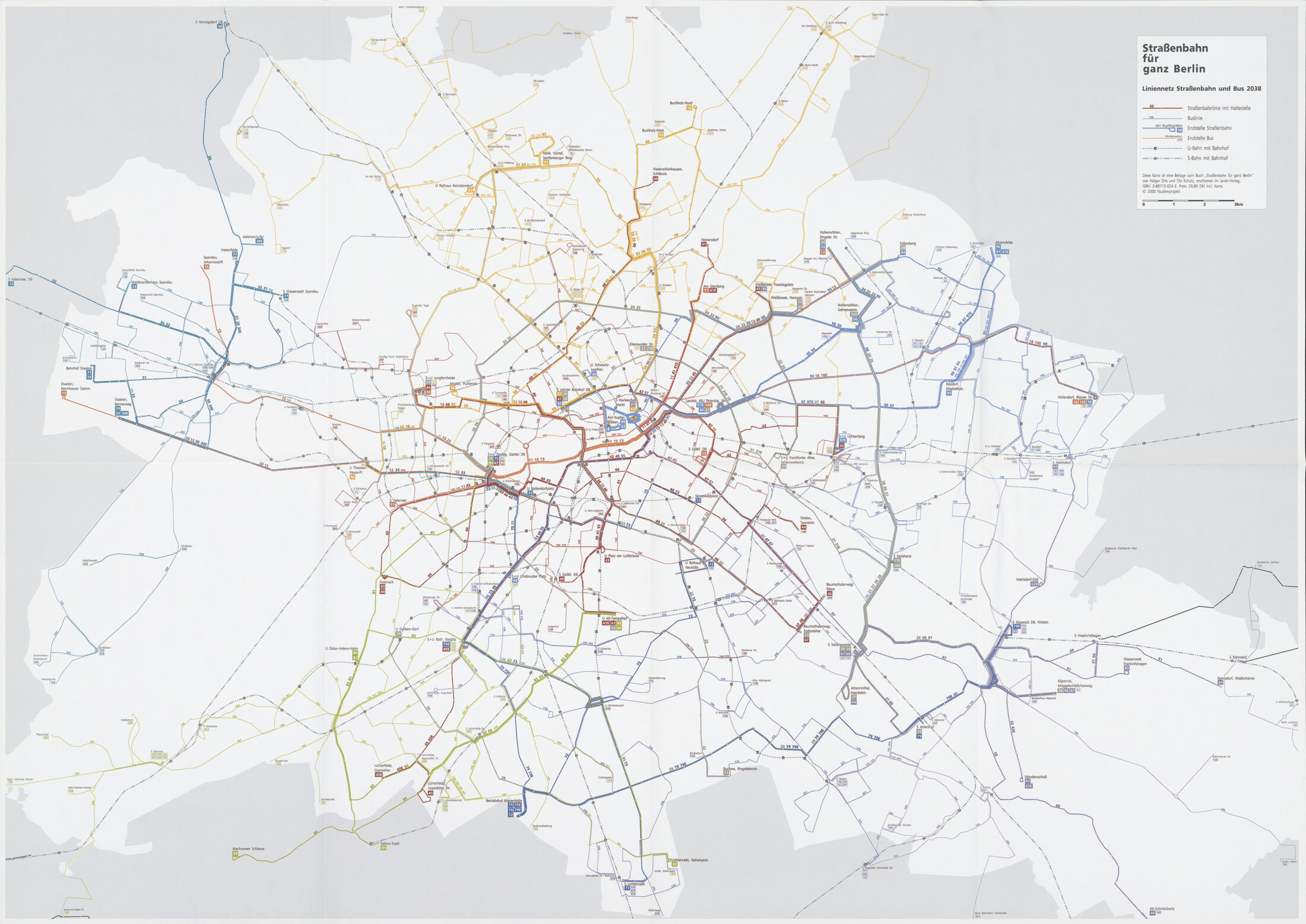
Greater Berlin started out as a rail-oriented city, but it became more and more car-centric over time. The first car-focused plans were considered during the Greater Berlin Competition in 1910 and began taking shape during the Weimar Republic. Plans were further developed during the Nazi era and reached their peak with the planning and partial construction of the outer Berliner Ring orbital motorway. After the Second World War, the car-oriented expansion of East and West Berlin was dramatically accelerated. This resulted in the construction of a partial inner ring road in West Berlin as well as the transformation of major arterial roads. These costly urban redevelopment projects have been to the detriment of the city’s green spaces, footpaths and pedestrians as well as trams and cyclists. City streets and town squares became areas dominated by cars and traffic.
Gustav Böß, mayor of Greater Berlin from 1921 to 1929 Berlin Today, Berlin 1929
Right of Way for Cars!
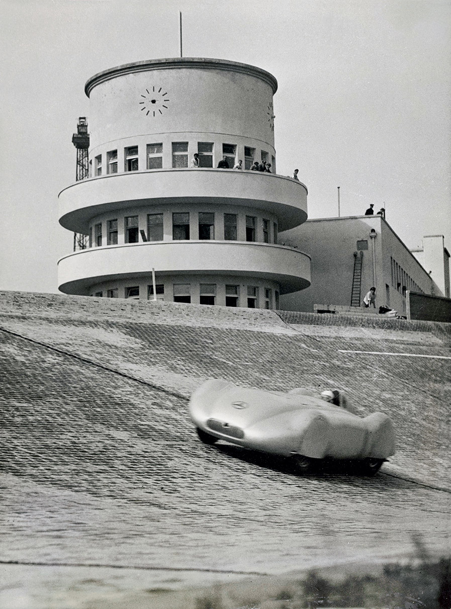
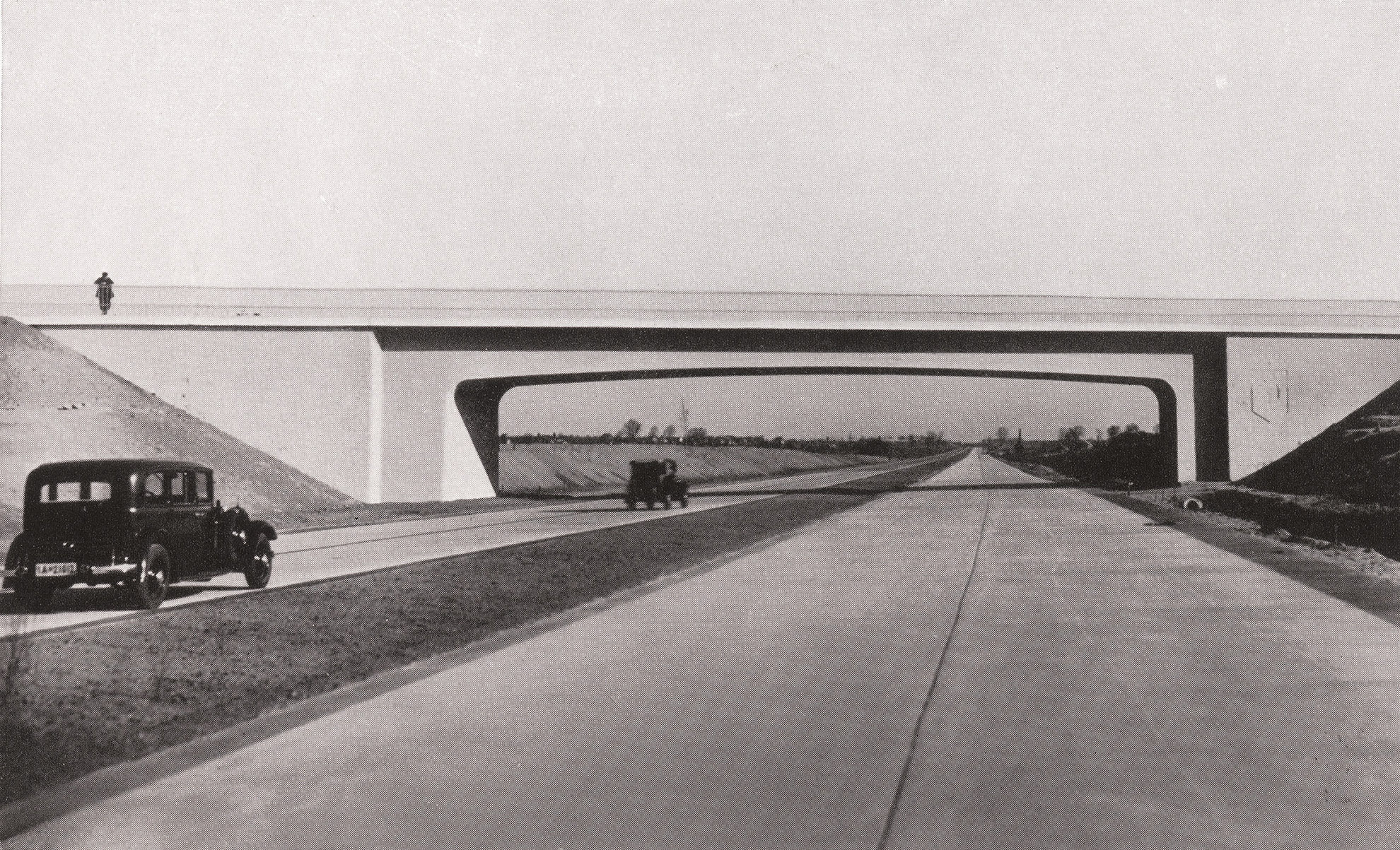
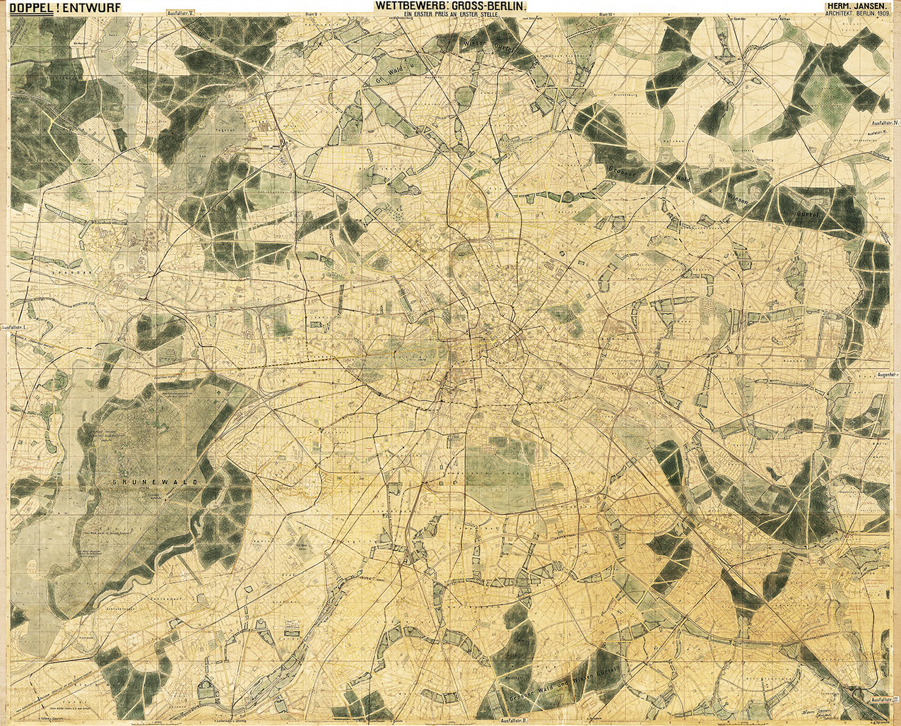
Berlin’s fascination with cars began very early on. Hermann Jansen was awarded first place in the Greater Berlin Competition for his entry proposing radial roads for cars so that they could ‘put the pedal to the metal’, as he put it. In 1913, preparations began for the construction of the world’s first motorway to be used exclusively by cars. Known as AVUS, the 19-kilometre, controlled-access racing circuit opened almost exactly one year after the formation of Greater Berlin. Berlin was already being planned as a car-oriented city in the later years of the Weimar Republic, but it really began to take shape during the Nazi era with the partial construction of the Berliner Ring orbital motorway. After the Second World War, both East and West Berlin opted to develop car-centric infrastructure. Initially, however, there was very little traffic in both parts of the city.
Around 1910: Cars in the Greater Berlin Competition
One of the first examples of car-oriented planning for Greater Berlin: Hermann Jansen’s winning entry to the 1910 Greater Berlin Competition envisaged five main intersection-free radial roads.
AVUS (Automobile Traffic and Training Road)
The Automobile Traffic and Training Road, better known as AVUS, was famous the world over for motor racing and speed records, but also because of the fatal accidents that happened there. It became a public access road to the Berliner Ring orbital motorway in 1940.
Construction of the Outer Berliner Ring Orbital Motorway during the Nazi Era
The outer Berliner Ring orbital motorway is one of the most far-reaching legacies of Nazi-era urban development. Its construction marked the beginning of the era of the car-oriented city.
Construction of the Inner (Partial) Orbital Motorway since the 1950s
In the 1950s, both East and West Berlin worked intensively on planning a motorway network for the city centre. A partial orbital motorway was built in the West Berlin section of the city.
The Loss of Town Squares along Bundesstrasse 1 Federal Highway
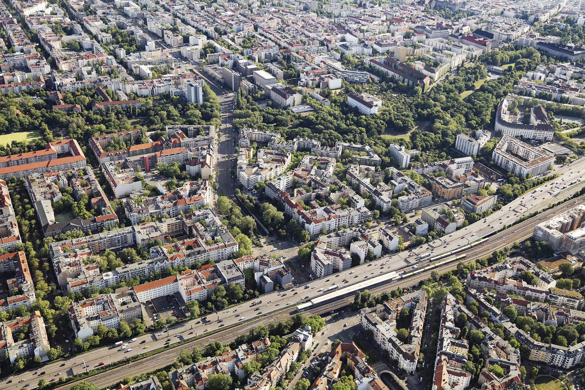
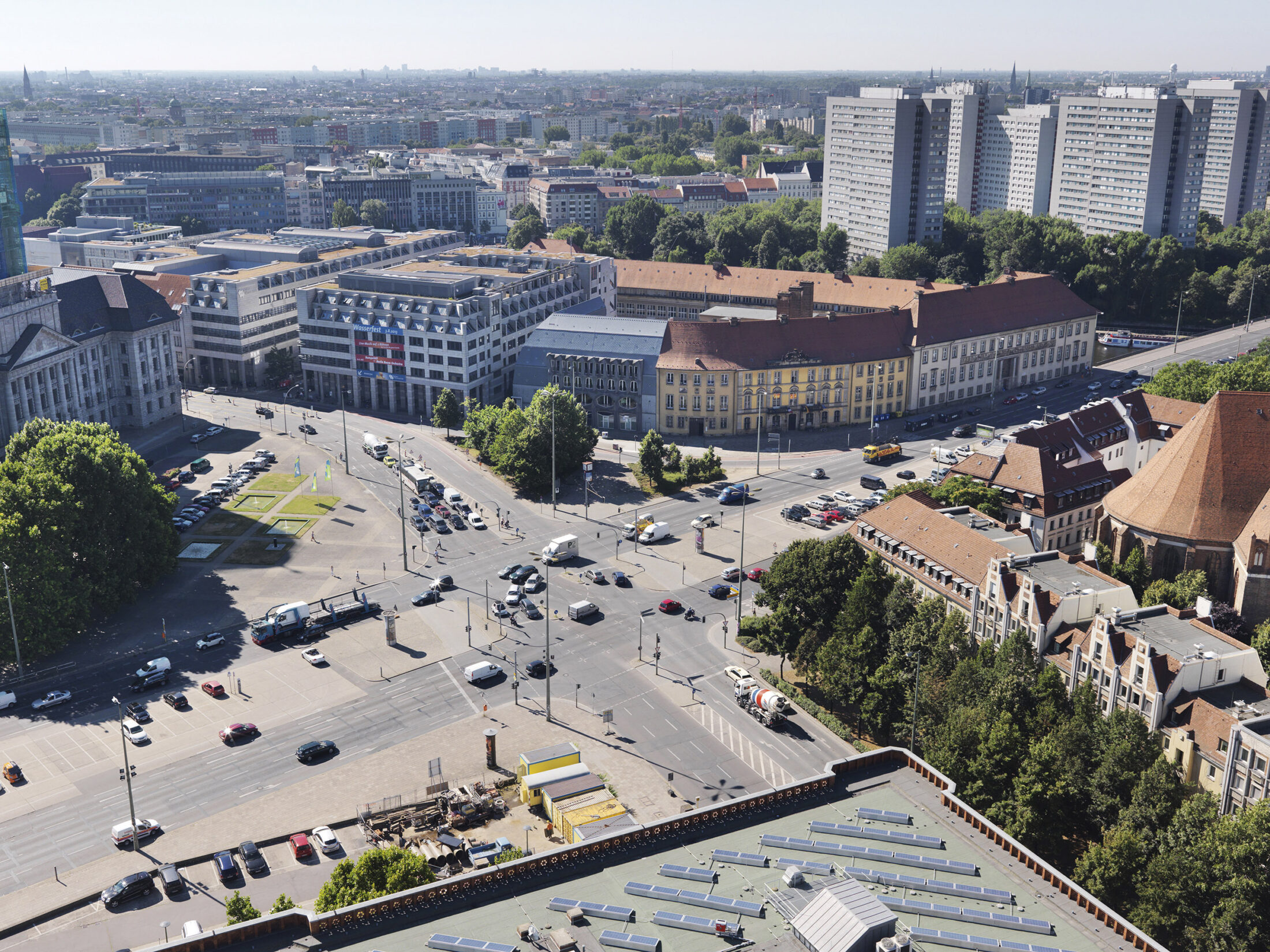
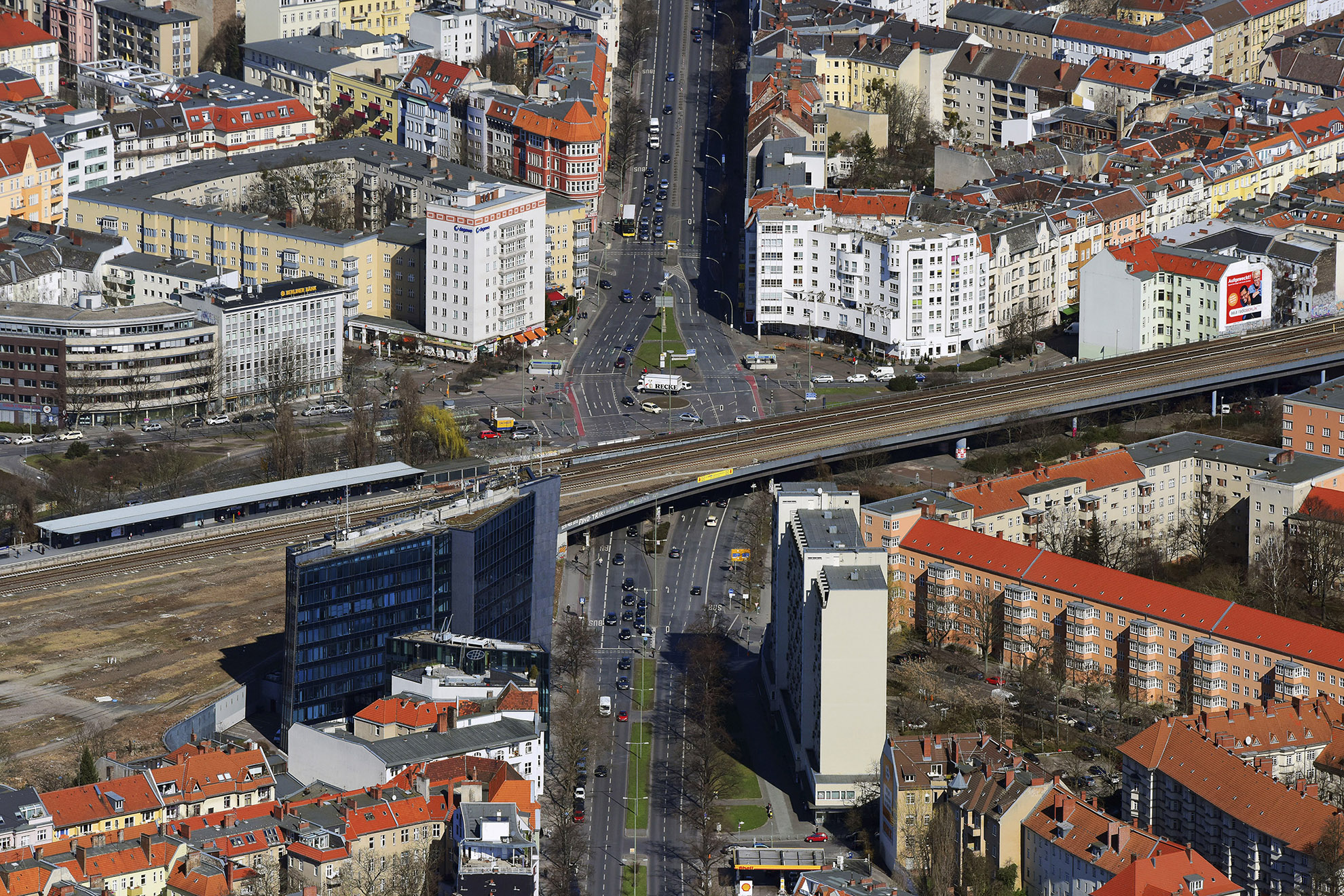
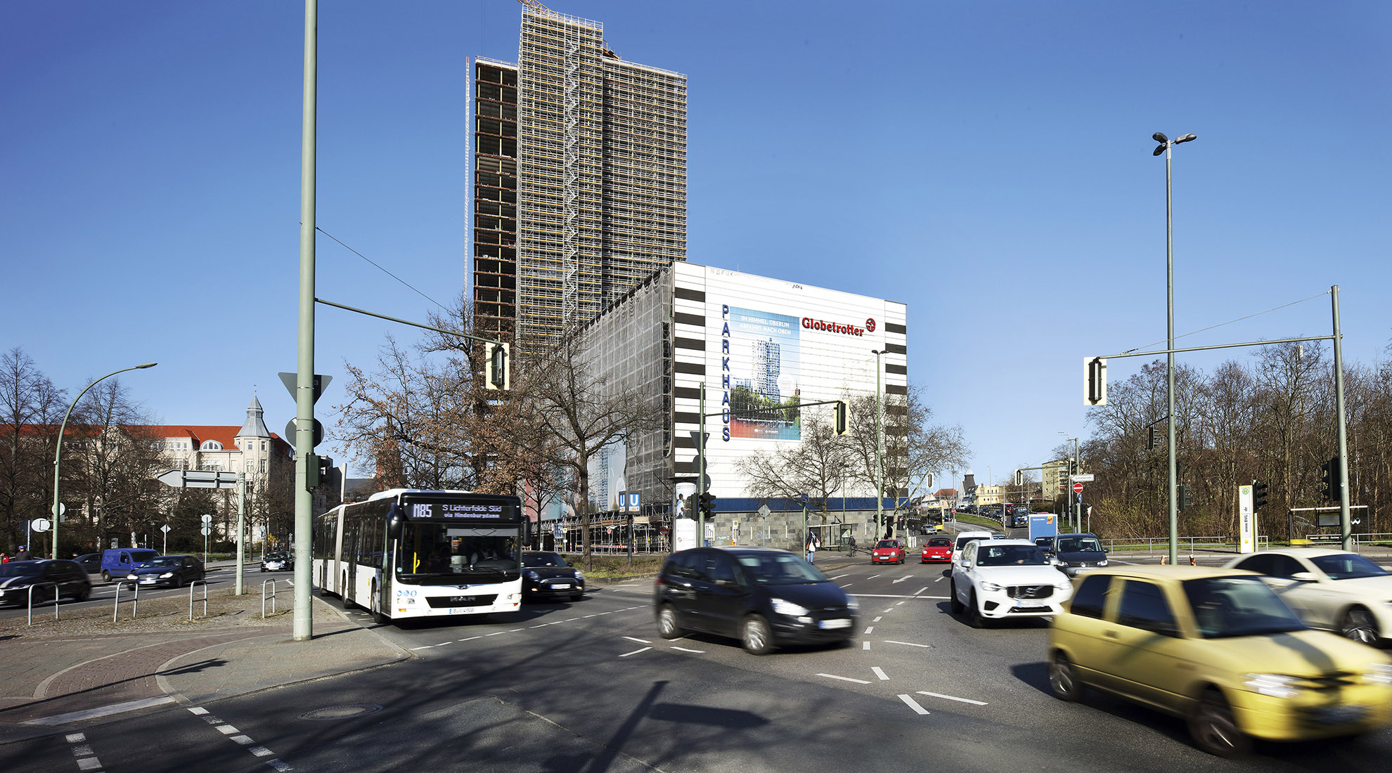
Bundesstrasse 1 federal highway, formerly Reichsstrasse 1, is one of Germany’s most important national roads, previously linking Königsberg with Aachen. It became the city’s most important road after the formation of Greater Berlin: It connected the two former residences of the Hohenzollern royal family in Berlin Mitte and Potsdam, ran into the city centre along the main shopping streets and crossed an extensive residential area in the southwest of the city. The car-oriented expansion of the city has largely preserved this famous road as a radial urban street, but there has been considerable damage caused in some places, including the empty expanse at Molkenmarkt, the no less daunting expanse at Innsbrucker Platz and the nameless space in front of the car park at the Steglitzer Kreisel building.
Molkenmarkt
How many Berliners know that Molkenmarkt is the centre of the oldest part of the city? Today it is an empty expanse solely dedicated to the car, home only to multi-lane streets and parking spaces. This is one of the negative sides of Greater Berlin.
Innsbrucker Platz
Innsbrucker Platz, which was originally a town square, has been a sprawling, car-dominated intersection since the 1970s. The city’s Ringbahn circular line, U-Bahn and motorway all intersect here. There are also some roads, including Bundesstrasse 1 federal highway, that lose ground here.
A Nameless Area to the South of the Steglitzer Kreisel Building
It’s a little-known fact that the Steglitzer Kreisel building was built on what was until the 1960s the village of Steglitz. Since then, the area south of the building in front of the multi-storey car park has become a vast, nameless space that serves only traffic, most of which comes from the Western Tangent motorway.
The Tedious Search for the Streets and Squares of the Future
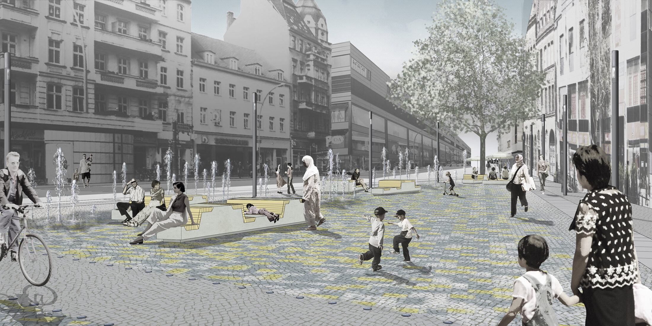
Dismantling car-oriented city structures is an inevitable step in the process of developing a sustainable city. It is widely agreed that it is necessary to further expand Berlin’s public transport network. It is also undoubtedly the case that measures must be taken to restrict the number of private cars on the city’s streets. The new Berlin Mobility Act enhances the status of bicycle and pedestrian traffic, at least in principle. However, the scope of Berlin politics is limited and Brandenburg must always be taken into account. The question is, what should the streets and squares of the future look like? And how can we balance the needs of all road users? The shift to more sustainable modes of transport requires a lot of new ideas, a great deal of persuasion and a driving force behind the implementation – we must go beyond laws and proclamations. The crowning achievement of these efforts will be new, sustainable main streets that we cannot yet imagine.
The city’s system of centres altered fundamentally after the creation of Greater Berlin. The emerging centre of the New West around the Kaiser Wilhelm Memorial Church became more important, along with the undisputed main city centre between Alexanderplatz and the Reichstag. In the years after 1933, the Nazis planned a brand new main centre to the west of the historic city centre. When Berlin was divided, the city’s two rival main centres were expanded: one around Alexanderplatz and the other around Breitscheidplatz. The greater Berlin area has also had an extraordinarily high number of medium-sized, small and tiny centres since the end of the nineteenth century, some of which are high-quality urban developments, such as those in Lichterfelde West, Frohnau and Weißensee. Other prominent centres such as Hermannplatz, Fehrbelliner Platz and Marzahn emerged later. It is hard to imagine another city in Europe with such a diverse range of centres.
Gustav Böß, mayor of Greater Berlin from 1921 to 1929 Berlin Today, Berlin 1929
Old and New Berlin
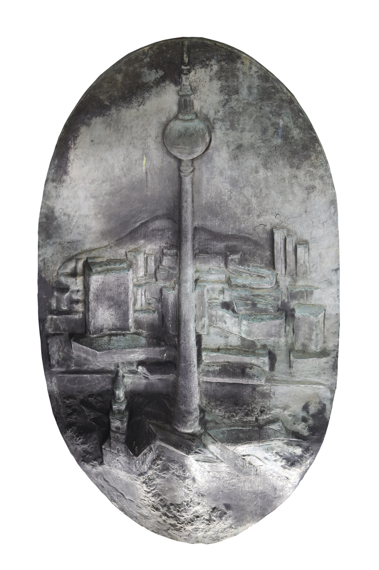
The middle part of the large Old and New Berlin bronze relief designed by Evelyn Hartnick-Geismeier in 1978. It shows the Marienkirche, TV Tower and Alexanderplatz. It was previously on display at Berolina Haus but is now in storage.
The Decline of the Historical Centre and Rise of the New West
Berlin’s historic centre changed very little during the Weimar Republic. New buildings were rare and the area to the west of the palace remained unchanged. However, those responsible saw the historic centre to the east of the palace as a problem. The narrow streets, small houses and poor residents were not considered worthy of a global city. In contrast, a new area rose to prominence among the other centres of the new Berlin. Although it had not undergone any significant structural change either, it became the centre of the New West. Business owners, politicians and city planners were alarmed. Wholesale redevelopment projects were planned to open up wide streets and slow the decline of the historic centre. Reorganising the historic centre was Greater Berlin’s most important city centre project – yet it failed, at least during the Weimar Republic.
The Shiny New West
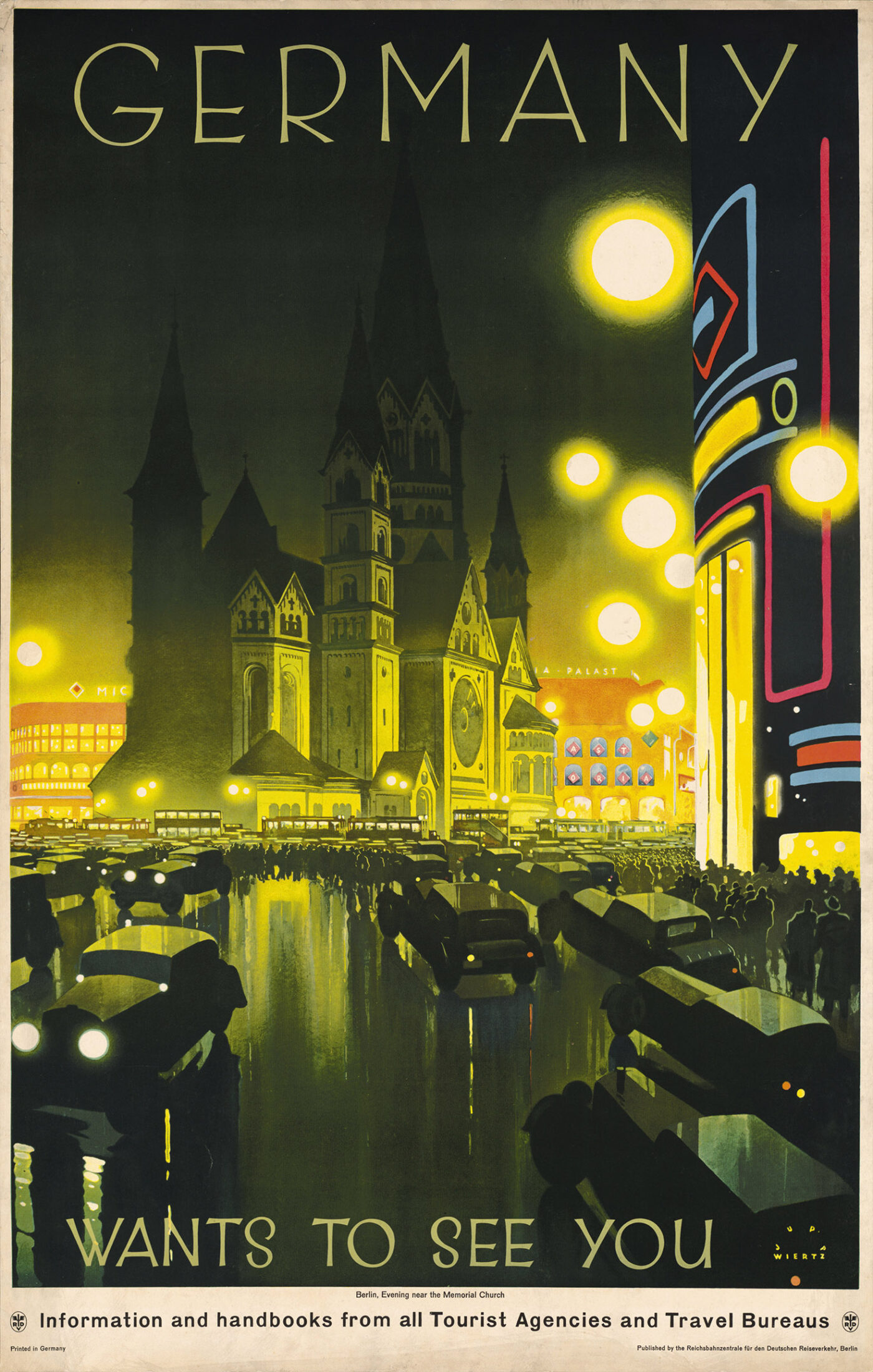
The New West was a winning location in Greater Berlin. An elegant shopping and recreational area surrounded the neo-Romanesque Kaiser Wilhelm Memorial Church, and it remained an expensive residential area.
A Stagnating Historic Centre
The historic centre was seen as being in decline. The answer to this was the largest centre-building project in Greater Berlin and involved the radical reorganisation of the southern historic centre. It included renovating Alexanderplatz, which proved to be a highlight of the project.
New Centres for Hitler and Stalin
The National Socialist government regarded the historic centre as too poor and therefore planned a new centre outside the old historic centre. It was a remarkable decision. In contrast, in the 1930s, Mussolini and Stalin designed their new centres for Rome and Moscow within the old centres. However, all three dictatorships planned dominant buildings for their new centres to produce a triumph of urban development for the capital and indeed the entire country. In the end, none of these buildings were ever built. After the war, a new plan to build a socialist centre in East Berlin was developed based on Moscow’s 1930s planning concepts. It proposed to extensively reconstruct the absolutist buildings on the eastern side of Unter den Linden boulevard, but it did not include a palace. Above all, it was to include a dominating multi-storey building in the historic centre for party and state authorities. This project was also never carried out.
A New Centre in the West of the Historic Centre
The future centre of the capital of the Reich had to be monumental and completely new. It was planned as the centrepiece of the north–south axis, which was to extend between a north and south train station to the west of the historic centre.
A New Centre in the Historic Centre
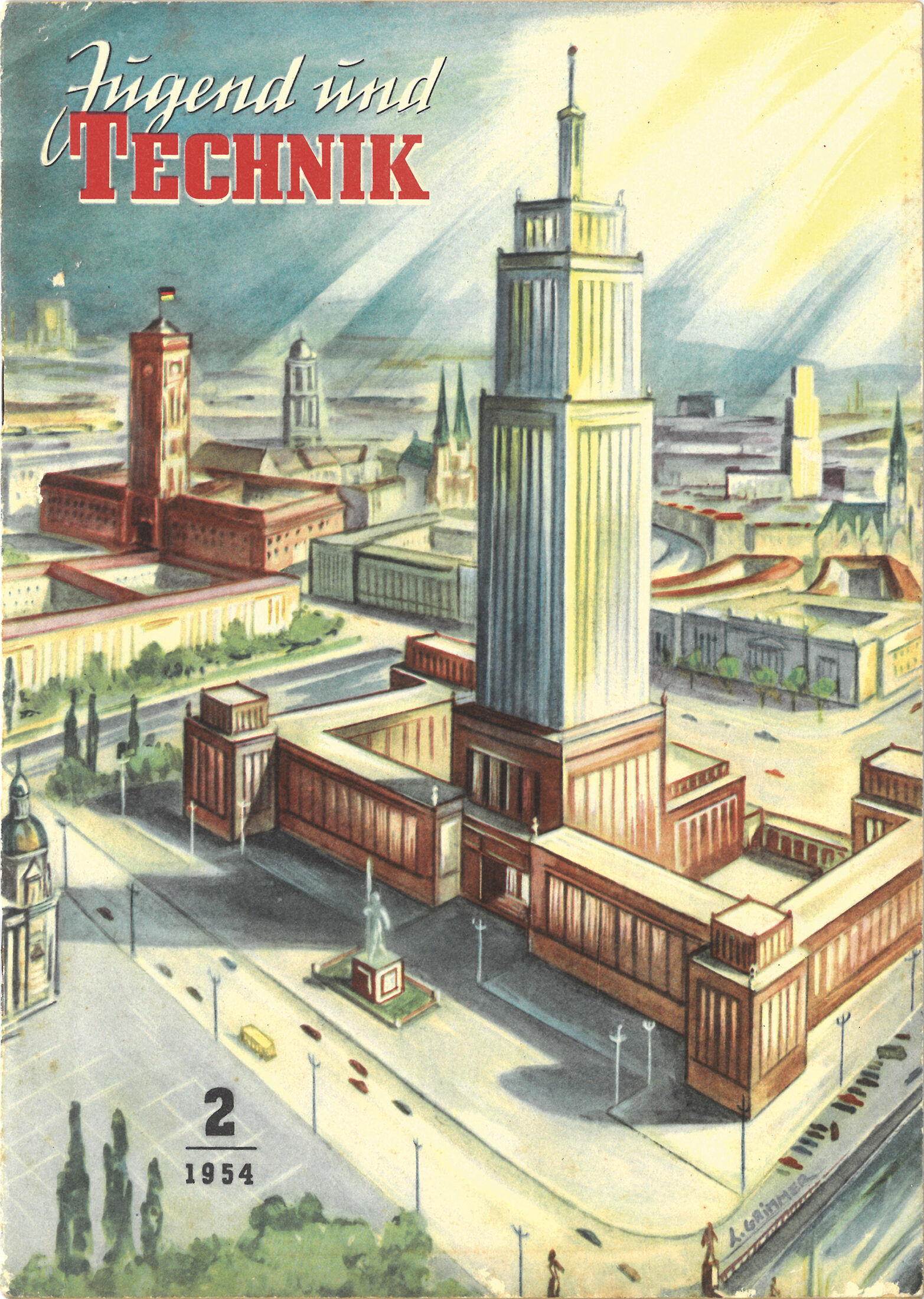
After the division of Berlin, the historic centre moved to the outskirts of the Soviet sector. Nevertheless, it was confirmed as the centre of the socialist city. This was emphasised by a central multi-storey building, similar to one planned in Moscow and built in Warsaw.
Rebuilding the Centre during the Cold War
The division of Berlin after the end of the war was further cemented when the Berlin Wall was built. It led to the formation of two large city centres located in two central areas: Alexanderplatz in the east and Breitscheidplatz in the west. Both offered insights into their sides of the city and their systems. Initially it was not clear how either of the squares would be designed. Only one thing was for sure: they should look radically different to how they did before the war. Both squares are important examples of car-oriented city planning. It’s as if both were working off the same plans.
Alexanderplatz: The Centre of Berlin and Capital of the German Democratic Republic
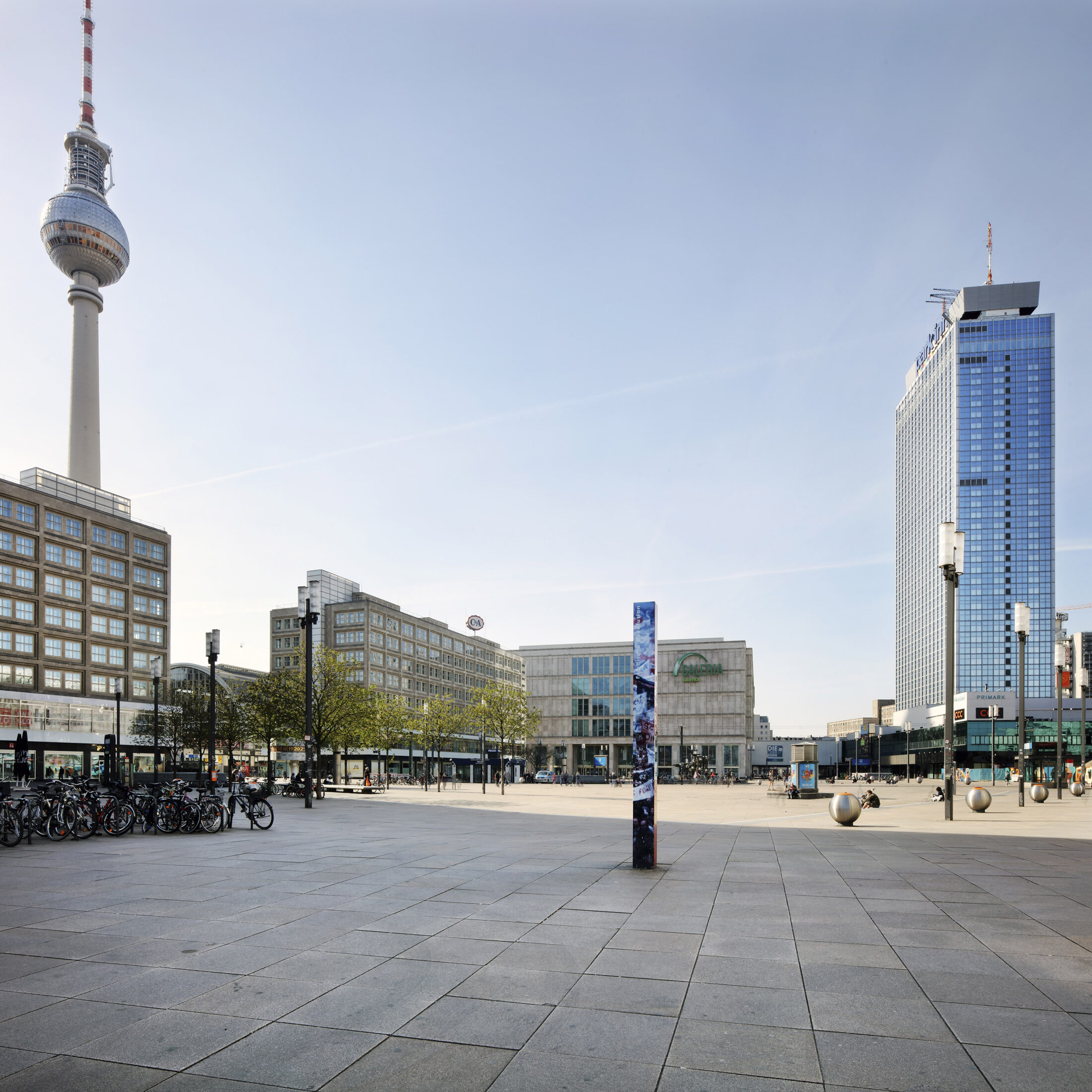
Alexanderplatz had changed significantly as a result of the renovation works carried out during the years of the Weimar Republic. It was redesigned following the destruction of the Second World War and incorporated the Alexander House and Berlonia House buildings designed by Peter Behrens in 1929.
Breitscheidplatz: The Centre of West Berlin
The centre of the New West, which has now risen to become the centre of West Berlin, was also completely redesigned. The Kaisereck building and the ruins of the Kaiser Wilhelm Memorial Church are the only remaining reminders of the old Roman Forum.
Two Central Squares in a Period of Change
Alexanderplatz was drawn into the spotlight immediately after the reunification of East and West Berlin. Breitscheidplatz, on the other hand, disappeared in the shadows. Groups of multi-storey buildings that would tower over the existing buildings were planned for both squares, but the process of building them was slow. Both squares continue to remain relevant thanks to their important train stations, which are surrounded by wide open spaces. Debate over how these spaces are designed has raged since the 1990s.
Alexanderplatz: The Centre of the East
After the reconstruction of Alexanderplatz towards the end of the Weimar Republic and the new construction undertaken in the GDR period, a third, brand-new architectural vision of Alexanderplatz was decided after reunification.
Breitscheidplatz: Centre of the West
Following on from the construction of the Roman Forum in the imperial period and its redevelopment as the centre of West Berlin in the 1950s, City West, as it is now known, is currently taking on a third urban form. Skyscrapers are now being built at Breitscheidplatz, while Alexanderplatz is still waiting for its high-rise buildings.
A Number of Centres Since the Imperial Era
Until 1920, Greater Berlin was not a single city, but rather a collection of many cities and municipalities. Each municipality had its own centre, and some even had several centres. This legacy is invaluable, as it provides for a degree of decentralisation and, as a result, sustainable development. The number of centres continued to grow in the years after 1920, but not all were successful in the long term. Some of these centres have attracted international attention, but have not received the attention they deserve in Berlin.
Lichterfelde West Centre: Archetype of a Suburban Centre
The square in front of Lichterfelde West station is quite possibly the first planned local suburban shopping centre of its kind. It’s older than the much more famous centre in Lake Forest, north of Chicago in the US. The centre in Lichterfelde West is still open and serving the community today. It has proven to be forward thinking, particularly given the current transition away from car-oriented cities.
Frohnau Centre: A Model Centre in the Garden City
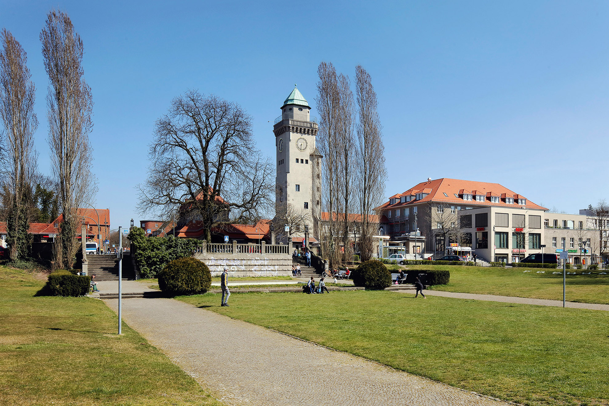
Greater Berlin has some suburban centres at suburban train stations that are of great significance. In addition to the Lichterfelde West station forecourt and Mexikoplatz, this also includes the double square in Frohnau, which is one of the most important suburban centres in terms of urban quality.
The Weißensee Communal Forum: A Small Lake as the Town Centre
The Weißensee Communal Forum was built in around 1910 around the small Kreuzpfuhl pond and is another, lesser-known highlight in the construction of suburban centres in the greater Berlin area. It intended, although ultimately failed, to underline the claim that the suburb would become a town.
Hermannplatz: Centre of the South (Karstadt)
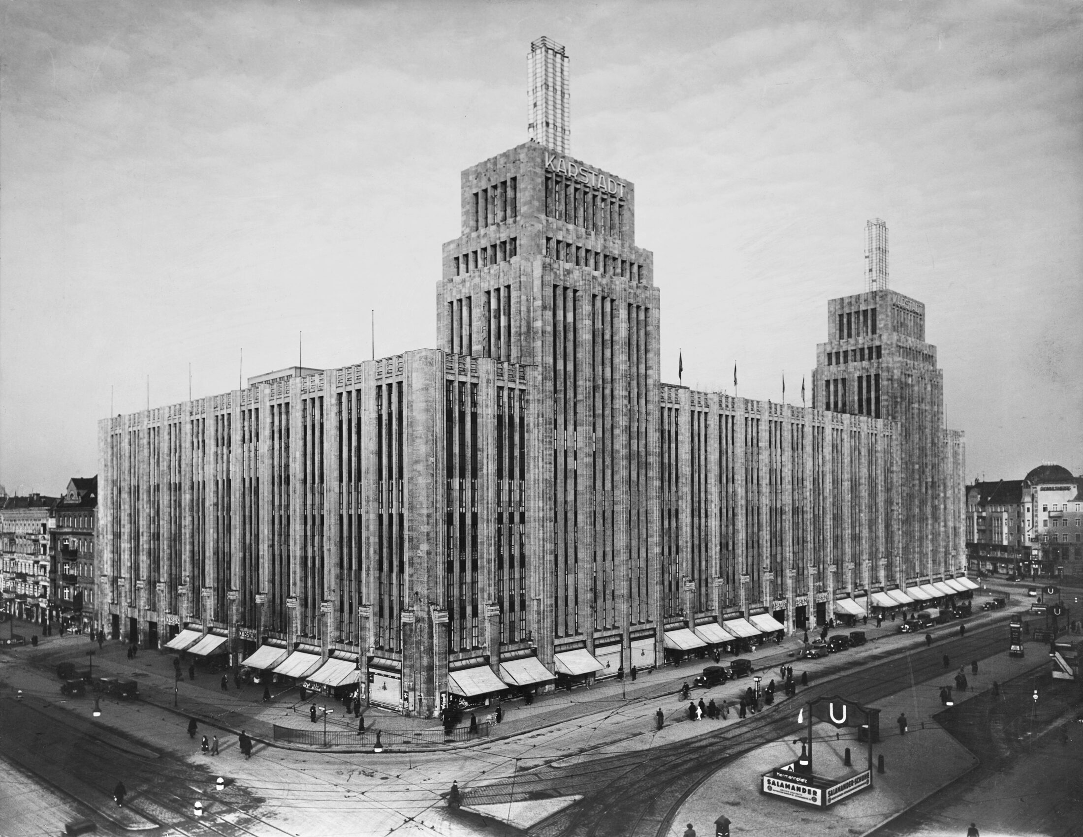
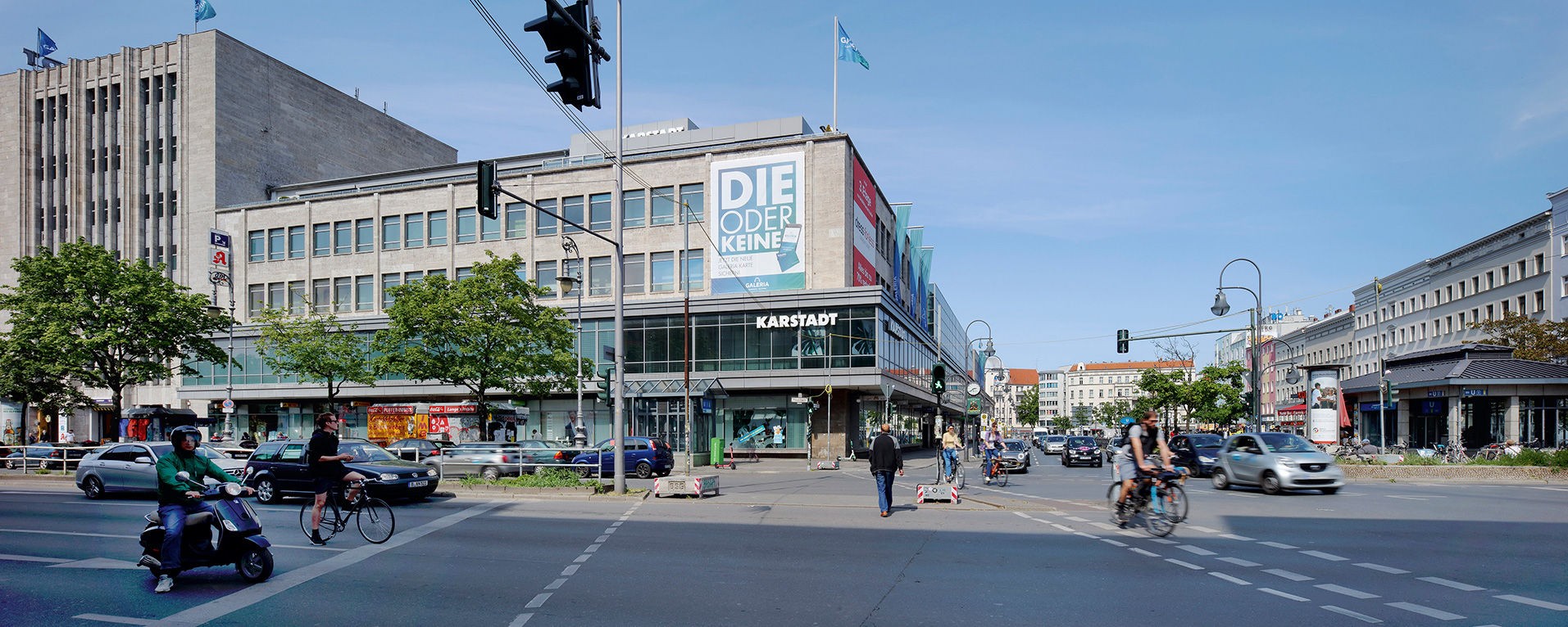
Striking new district centres were also created in the densely built-up city built according to the Hobrecht city. Hermannplatz is a perfect example. Its huge Karstadt department store was designed by Philipp Schaefer and built between 1927 and 1929. It attracted international attention at the time.
Fehrbelliner Platz: Administrative Centre of the Southwest
Due to the one-sided attention given to the new plans conceived for the centre of the Reich capital, real building activity carried out during the National Socialist dictatorship often took place out of sight – for example, the strictly designed Fehrbelliner Platz, the most important new city centre built during the Nazi era.
Marzahner Promenade: Pride of the Far East
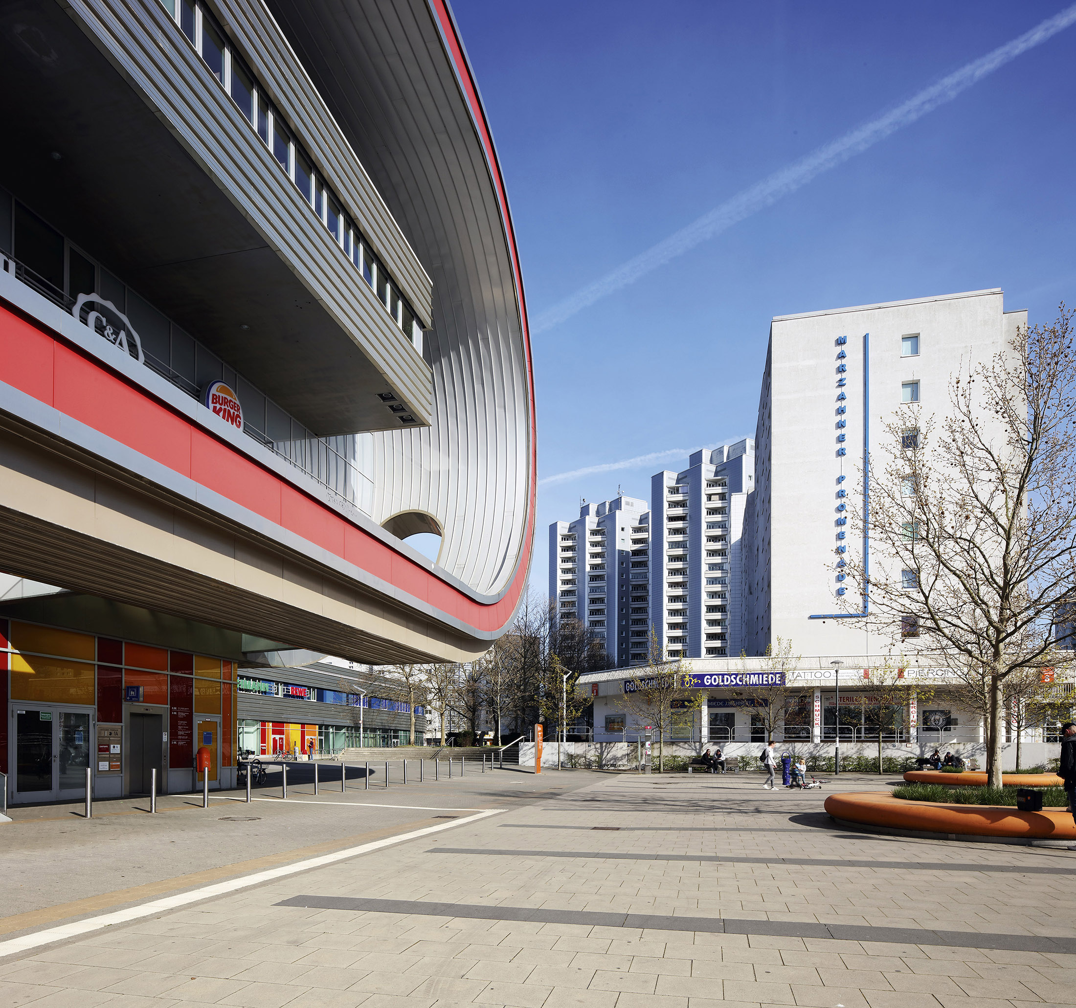
Marzahner Promenade is situated in the far east of Berlin and runs parallel to Landsberger Allee, formerly Leninallee. It’s still not well known to many residents of the western part of the city, but it is perhaps the most ambitious centre of a large-scale housing development from the GDR era.
Greater Berlin has always experimented with different forms of housing and urban development policy. It was centre stage in the struggle against the largest tenement city in the world. Sub-standard housing conditions and housing shortages have also been part of the history of Greater Berlin from the outset. From the 1880s to the 1910s, a stark contrast emerged between the overpopulated working class neighbourhoods and the attractive upper class neighbourhoods within the context of private and municipal competition. In the years after 1920, another layer of housing construction was added to that of Berlin’s imperial period. It was an extremely contradictory social settlement landscape of various forms and sponsors, and came as a result of a long period of publicly regulated housing construction. After the fall of the Berlin Wall, private housing construction returned to the fore for the first time since the imperial period.
Gustav Böß, mayor of Greater Berlin from 1921 to 1929 Berlin Today, Berlin 1929
Down with the Tenement City!
Down with the tenement city! Make room for the new Berlin! City planners, architects and politicians from all sides proposed these solutions for decades. The resulting programme fundamentally changed the housing landscape in Greater Berlin. The goal was to demolish the dense inner-city blocks with rear courtyards, which had been built, according to various regulations, around the old city to plans designed by James Hobrecht in 1862. However, these demolition plans were initially stopped due to extreme housing shortages and a lack of public subsidies. The first openings occurred during the Second World War, but it wasn’t until 1963 that Bonn provided funds to launch the ‘first urban regeneration programme’ in West Berlin. The pilot project focused on the area around Brunnenstrasse in Wedding. It took a little longer on the other side of the Berlin Wall in the Mitte district of East Berlin. The regeneration of the area around Arkonaplatz has been underway since 1970.
The Arkonaplatz Redevelopment Area
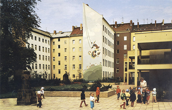
The Arkonaplatz redevelopment area was located right on the other side of the wall in the Mitte district of East Berlin. The shift away from wholesale redevelopment was already in progress when the area was being redeveloped between 1970 and 1984.
Solutions to the Tenement City: Large-scale Developments
Large residential areas made up of social housing are a feature of every city. Berlin is famous for this type of housing construction, as it dominated the city from the creation of Greater Berlin until reunification. However, there were also huge differences in terms of urban and structural design, responsible body, financing, production, location in the urban environment, and occupancy, and this all affected the question of who could move into these homes. Social housing construction does not always mean housing for people on low incomes.
The Weimar Republic: Neu-Tempelhof Development
Neu-Tempelhof was the first new, large-scale development in Berlin during the Weimar Republic. Construction was subsidised with public funds. However, the isolated yet idyllic suburban development was intended for high-income earners rather than low-income workers.
The Weimar Republic: The Residential Area around Laubenheimer Platz
One of the largest development areas in Berlin during the Weimar Republic comprised more than 1,700 apartments. However, today it is one of the least well known. It’s centred around the continuation of the Rheinischen Viertel area on the south side of Südwestkorso Boulevard in Wilmersdorf.
The Weimar Republic: Britz Housing Development
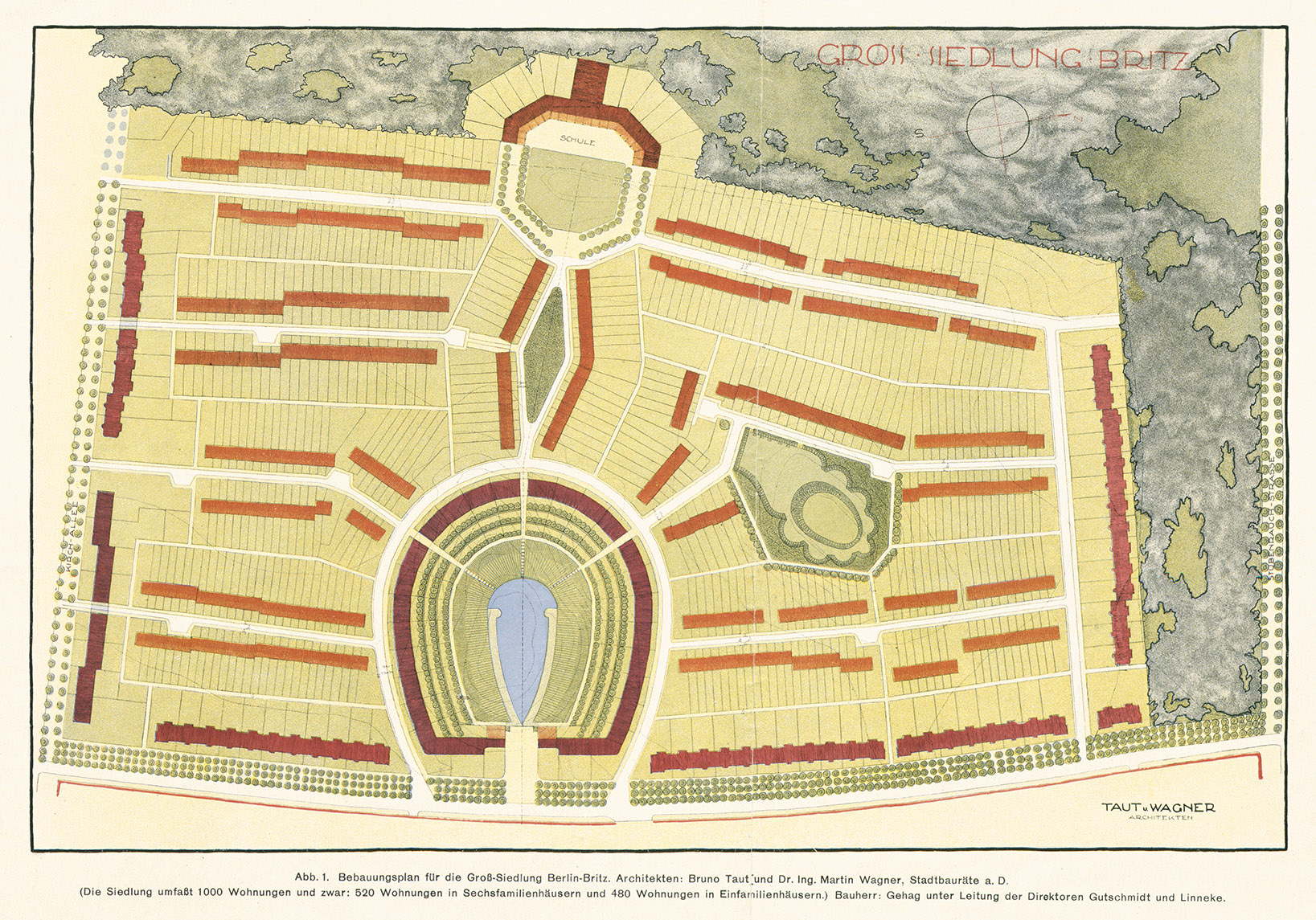
The Britz housing development is the most well known development built during the Weimar Republic. The 2,900 state-subsidised apartments were unaffordable for ordinary unskilled workers and instead provided homes for mainly white-collar workers and other middle-class groups.
The Weimar Republic: Südgelände Housing Development in Schöneberg
The largest new residential development planned during the Weimar Republic was to be built at Südgelände in Schöneberg. The massive private-sector project to construct 15,000 homes launched in 1927, but failed due to widespread resistance, including from the local construction industry.
The Nazi Dictatorship: South City Project
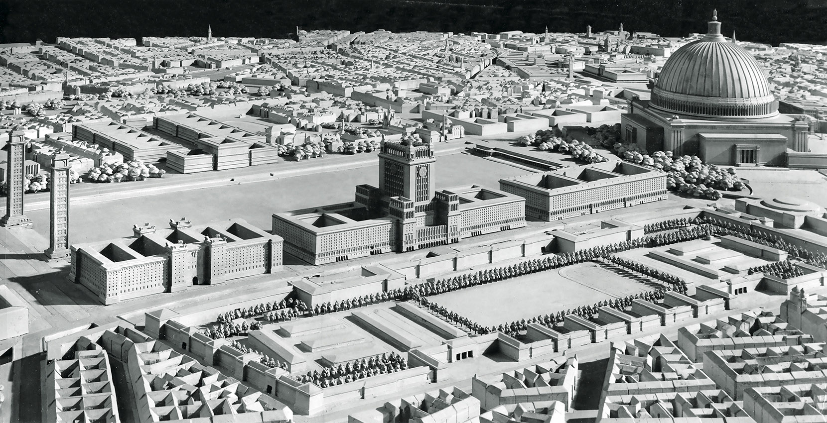
During the National Socialist dictatorship, General Building Inspector Albert Speer planned to massively expand Berlin as far out as the outer orbital motorway, thereby providing sufficient space for around 1.5 million people. The South City was part of this project.
West Berlin: Märkisches Viertel Development
Märkisches Viertel, built between 1963 and 1974, was West Berlin’s most ambitious large-scale housing development. Many residents came from redevelopment areas in the inner city and saw their rents increase two- to three-fold after moving into the more comfortable newly-built apartments.
East Berlin: The Fennpfuhl Development
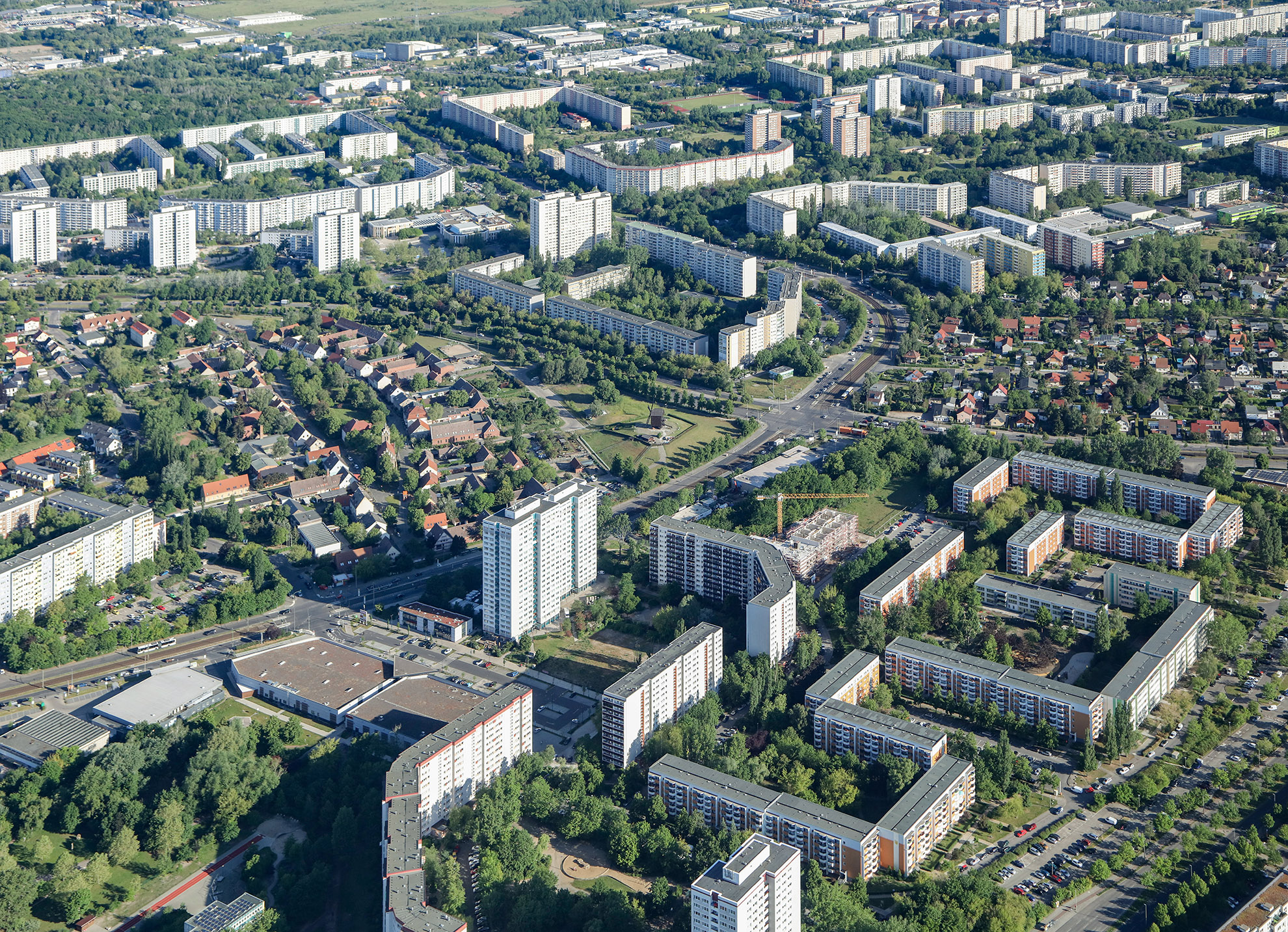
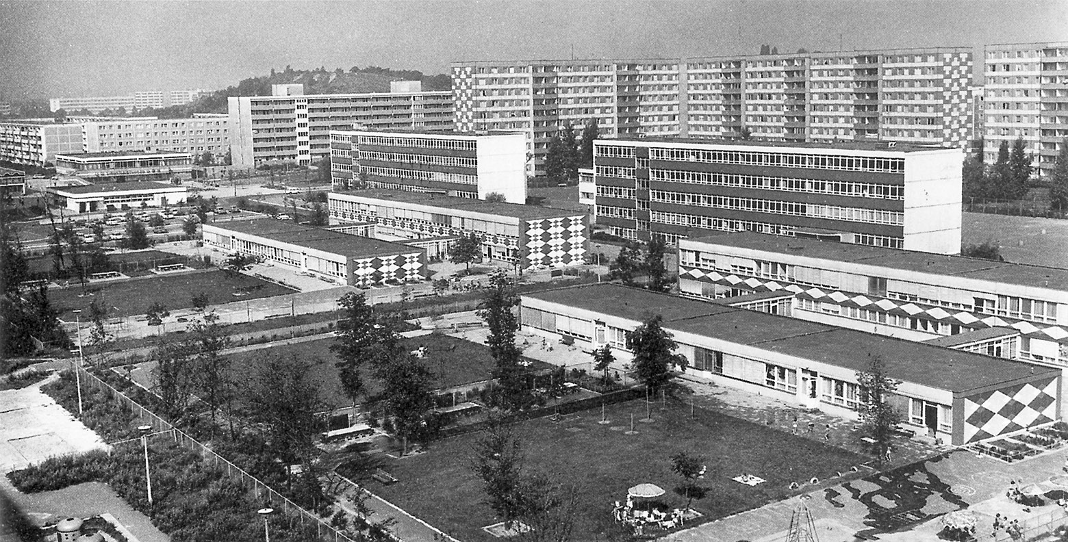
The Fennpfuhl complex, built between 1970 and 1980, was East Berlin’s first large-scale housing development to feature sophisticated furnishings. Allotments were cleared in order to make way for the project. Large housing developments in East Berlin were home to a greater mix of different social groups than in West Berlin.
Housing Construction during the Cold War
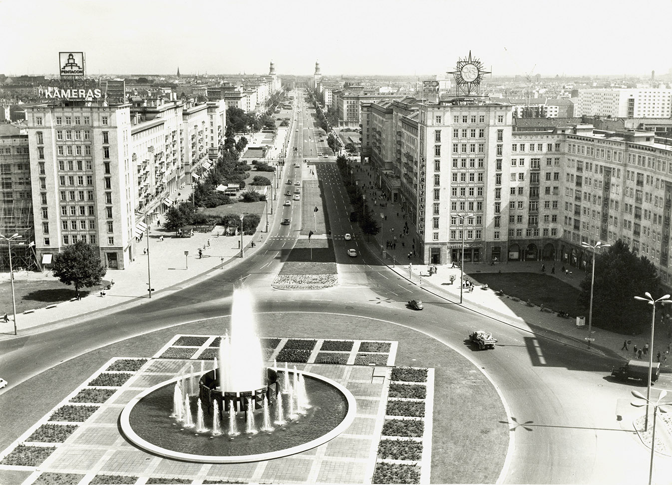
The first Cold War in urban development between East and West Berlin was dominated by housing construction. It was intense, but the reality was somewhat different from how it is generally described. East Berlin was initially a step ahead of West Berlin, but this fact is largely forgotten today. Construction of palatial residences along the new Stalinallee, now Karl-Marx-Allee, began in 1951. They were modelled on Moscow and built in line with the ‘national architectural tradition’. West Berlin was not yet capable of the same level of construction at that time. In response, the modest Ernst Reuter development was built in the Wedding district between 1954 and 1955 and launched with a great deal of publicity. West German President Theodor Heuß even attended the ribbon-cutting ceremony. The Hansaviertel project didn’t come around until 1957, yet it’s often referred to as being a parallel project to Stalinallee. In a further step, East Berlin launched the second construction phase of Karl-Marx-Allee between 1959 and 1965 following a change in building policy in Moscow. It was indeed like a game of urban development ping pong played out over many years.
Stalinallee
Stalinallee, seen here from Strausberger Platz. Work began on the East Berlin prestige project in 1951.
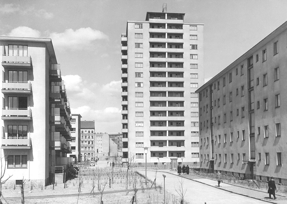
The Ernst Reuter Housing Development
West Berlin’s Ernst Reuter housing development near the border between the eastern and western sectors was built between 1954 and 1955. It was launched as a response to East Berlin’s Stalinallee.
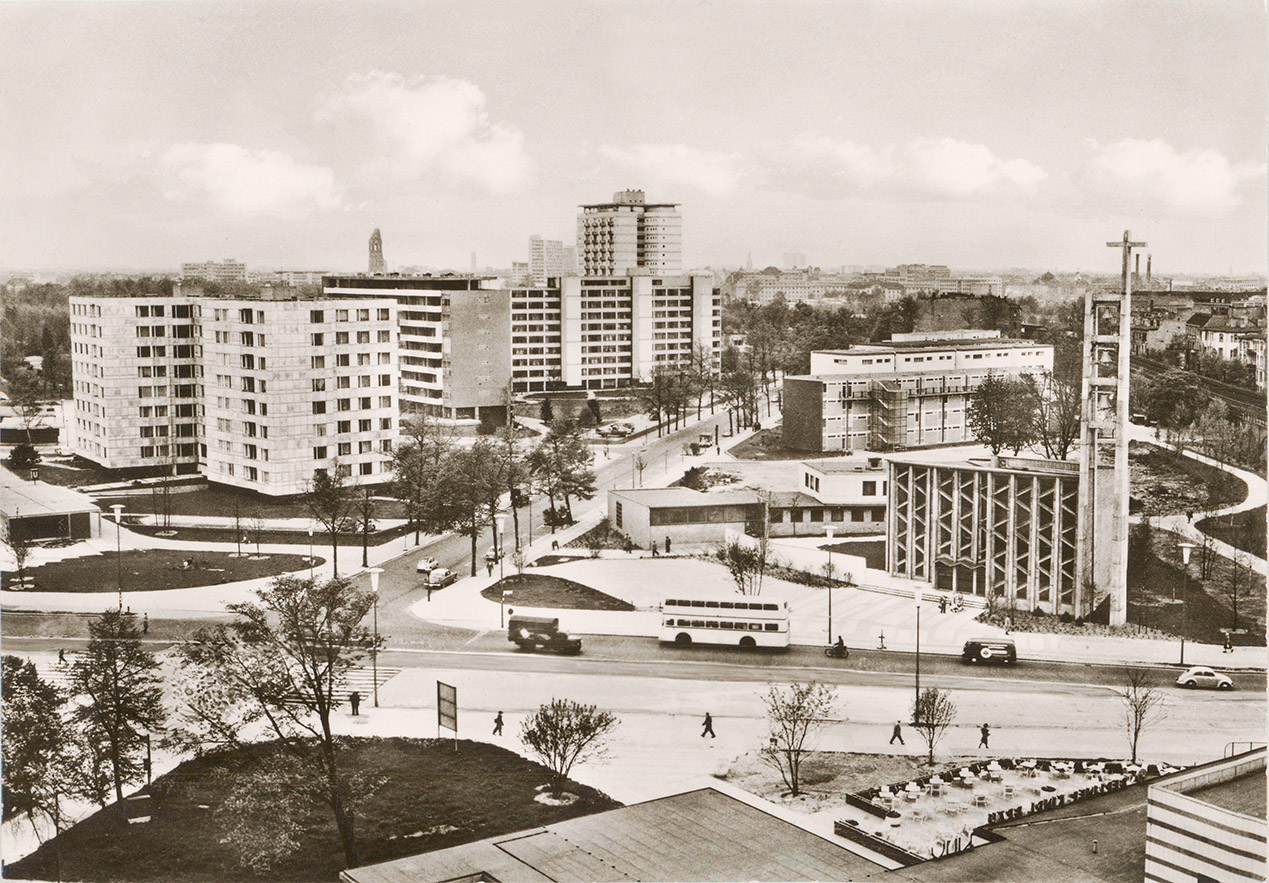
The Hansaviertel
The Hansaviertel housing development project, constructed as part of the 1957 International Building Exhibition, is often regarded as a response to Stalinallee.
Second Construction Phase of Karl-Marx-Allee
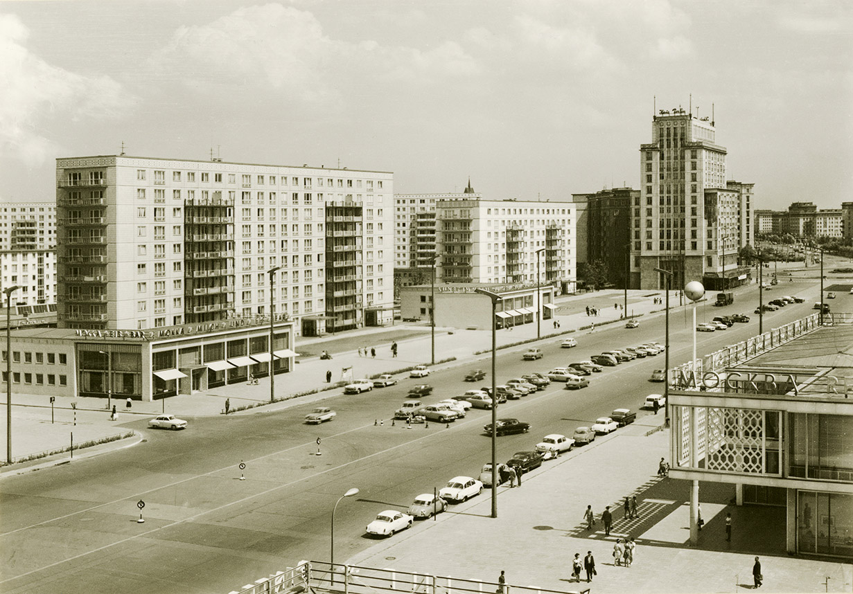
The second construction phase of Karl-Marx-Allee photographed in 1964. The Mokka-Milch-Eisbar ice cream parlour is on the left, while Cafe Moskau is on the right. At that time, eastern and western urban planning design were becoming more similar.
After 1990: From Barracks to Homes
Expectations were high following German reunification. Berlin was expected to experience tremendous growth according to all predictions. It was a near-certainty. As a result, a huge number of apartments were built inside and outside the city. However, it soon became clear that it was too many, as the population did not grow significantly. There were an estimated 120,000 vacant apartments in Berlin in 2002. This is all long forgotten now, as are the major efforts that were undertaken in the early 1990s to restore and upgrade areas that predominantly consist of period buildings and the large housing developments of East Berlin. The city’s population has been on the rise since around 2007, sometimes dramatically so. Apartments have once again become scarce, especially in the city centre. The ‘tenement quarters’ that survived the war and the wholesale redevelopment projects that followed are extremely popular today. Rents and apartment prices of these highly flexible apartments are skyrocketing across the board. Large new neighbourhoods are slow to develop. They’re primarily concentrated in former industrial and railway areas as well as on military sites. Homes are now being built where barracks once stood in the Soviet military compound in Karlshorst and the US military compound in Zehlendorf.
The Garden City of Karlshorst
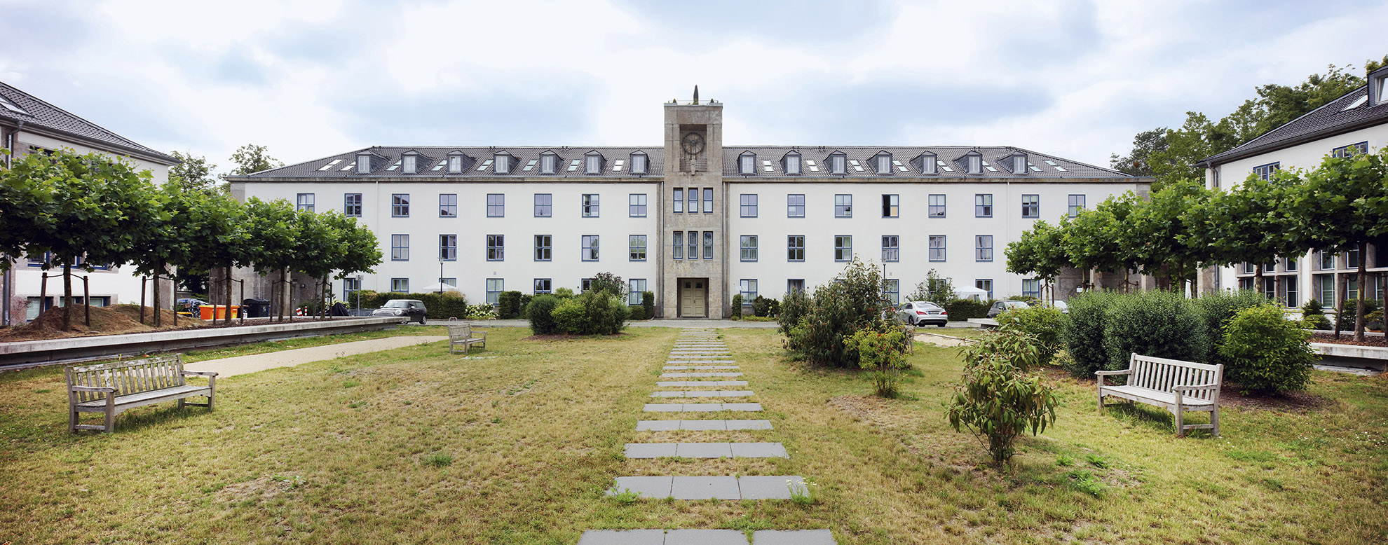
Karlshorst was the Red Army’s most important site in East Berlin. The military area was established during the Nazi period and was a base for Russian troops until their withdrawal from Berlin in 1994. After a long period of uncertainty, the area was transformed into a large, attractive residential area.
The Metropolitan Gardens
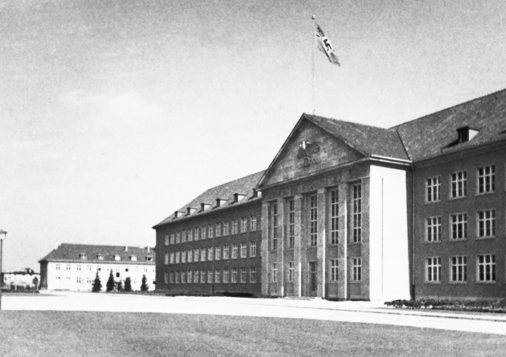
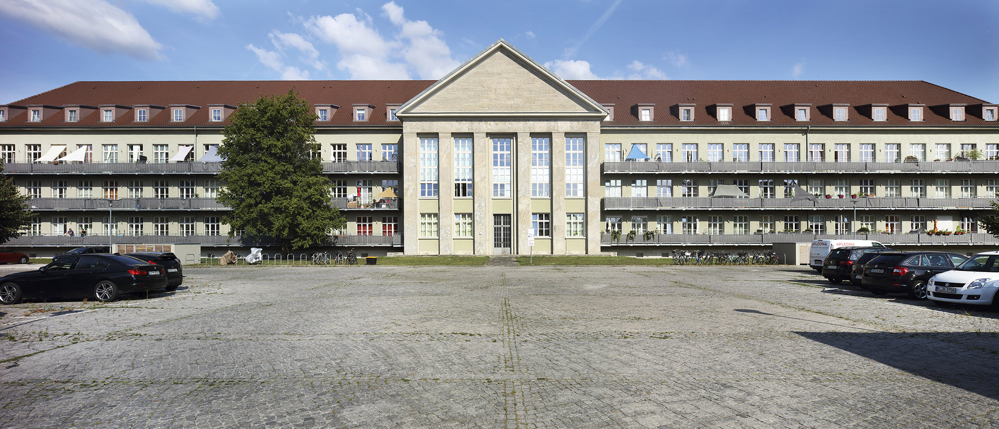
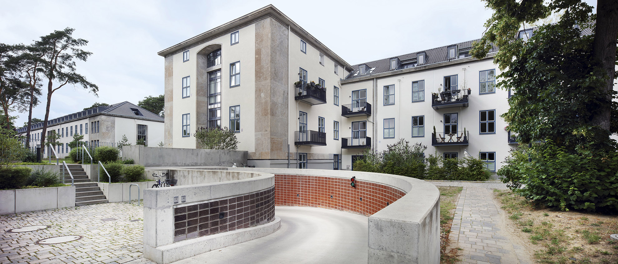
The Nazi Luftgaukommando III in Dahlem, which was built between 1936 and 1938, served as the headquarters of the US Army in Berlin until 1994. Starting in 2010, the barracks area began being transformed into a residential area called the Metropolitan Gardens.
How can a city that is constantly growing remain healthy? The answer is simple: street trees and lots of lots of greenery! The Permanent Forest Agreement of 1915 was the first important step taken in efforts to protect green spaces. It reserved extensive areas of forest for local recreation. The formation of Greater Berlin made it possible to open up additional public parks for recreation, culture and sport. This was often thanks to private financial support. The Strandbad Wannsee lido became well known far beyond the borders of Berlin. The Nazis created the enormous Reich Sports Field sports complex, while later on, other parks were expanded and created during the German Democratic Republic. In the later years of West Berlin, the long tradition of preserving historic gardens and parks reached a new high. After the fall of the Berlin Wall, new large parks were created in Berlin and plans were made for regional parks in the city’s surrounding area. Berlin’s most important historic park landscape has also been carefully restored: the Palaces and Parks of Potsdam and Berlin, which are a UNESCO World Heritage Site.
Gustav Böß, mayor of Greater Berlin from 1921 to 1929 Berlin Today, Berlin 1929
A Ward of the Big City: The Ordinary Street Tree
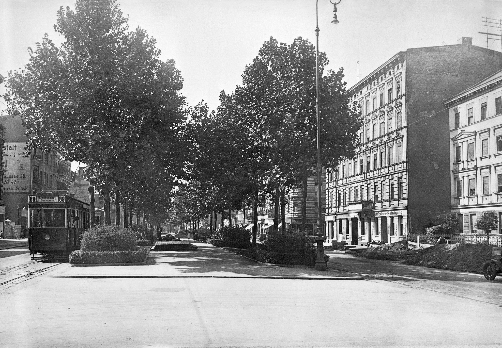
There were rarely any trees in the streets of early towns and villages. It was not until the era of absolutism that some urban avenues were created, such as Unter den Linden. Tree-lined city streets came to the fore in Paris in the nineteenth century and this became a model for other cities and indeed the greater Berlin area. The large radial and ring roads gained their characteristic trees, particularly lindens, maples, oaks, sycamores and chestnuts. The photo below shows street trees along Frankfurter Allee and Ruschestrasse in 1928. Once decimated by car-oriented urban redevelopment, the street tree can once again look ahead to a bright future. The humble street tree is an ambassador for the shift towards sustainable transport, makes a positive contribution to address climate change and brings joy to pedestrians.
All Kinds of Public Parks
Public parks were a feature of Greater Berlin even before 1920. They provide city dwellers with spaces for leisure and recreation and include beautifully designed open spaces, playgrounds, sports fields and even cultural institutions. The idea for public parks like this came from the United States, in particular Chicago, but was also based on Berlin’s own traditions. Large-scale public parks were created in Berlin during the Weimar Republic, some on the direct initiative of Mayor Böß, who managed to use a foundation to collect private funds for this purpose. Berlin’s largest public leisure facility, the Strandbad Wannsee lake-side lido, was structurally a child of Greater Berlin. More parks have been planned, created and further developed in the years since 1933 right up to the present day.
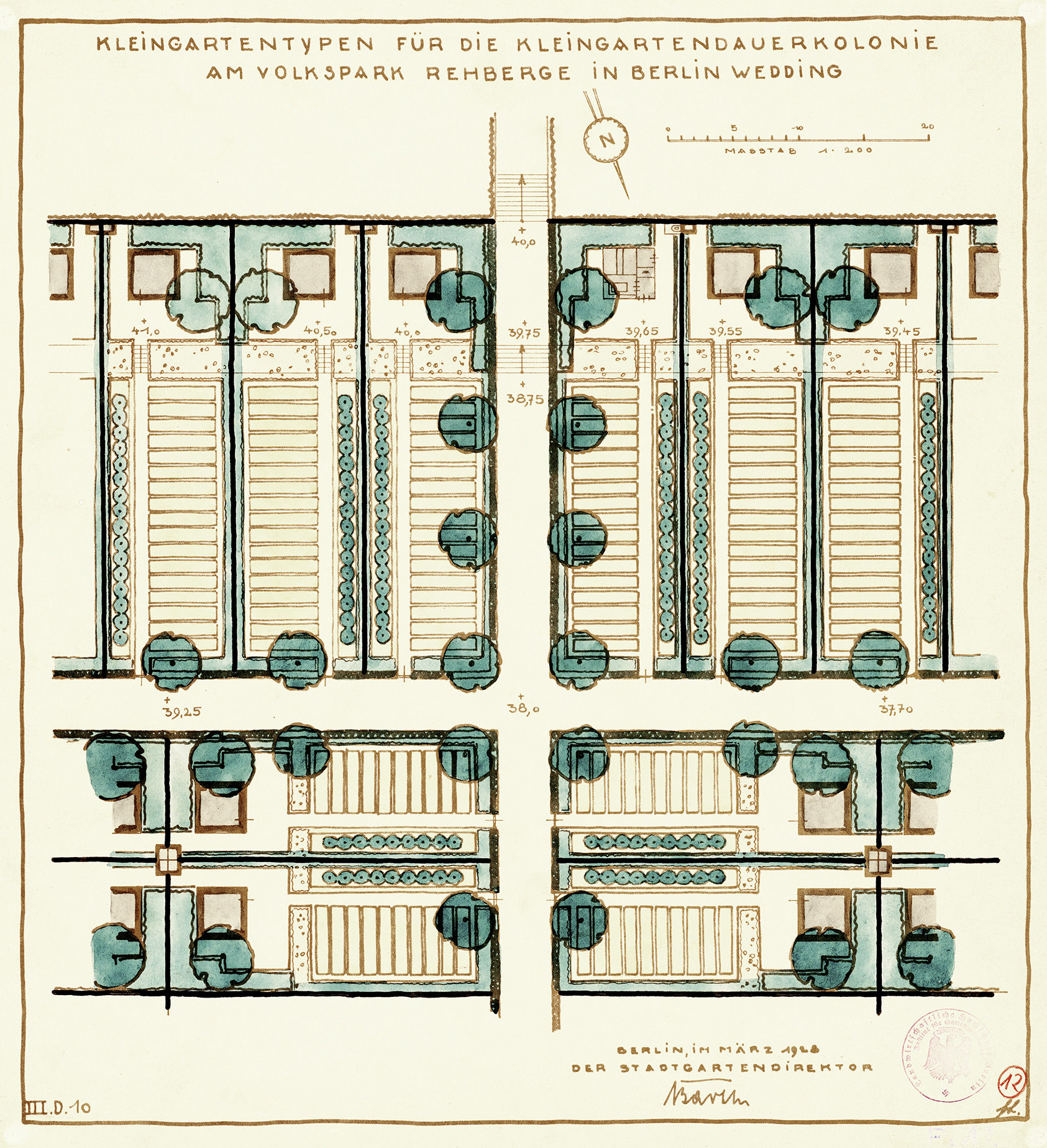
Volkspark Rehberge Public Park
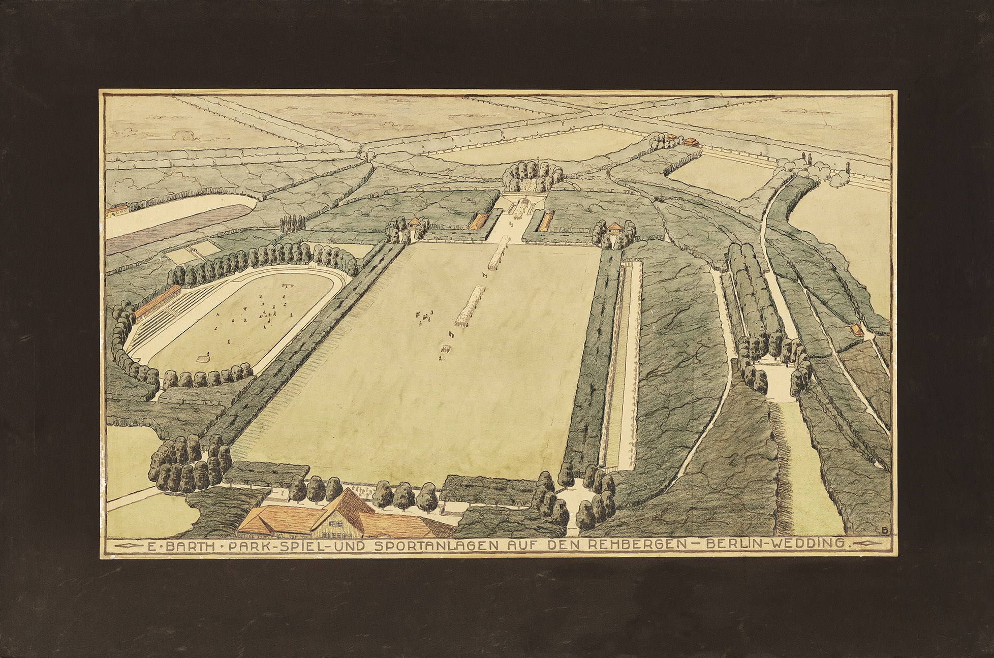
Public parks are a social achievement and should primarily provide residents of densely populated neighbourhoods with space for recreation, play and sport. Volkspark Rehberge public park is a prime example of a public park in the working class district of Wedding.
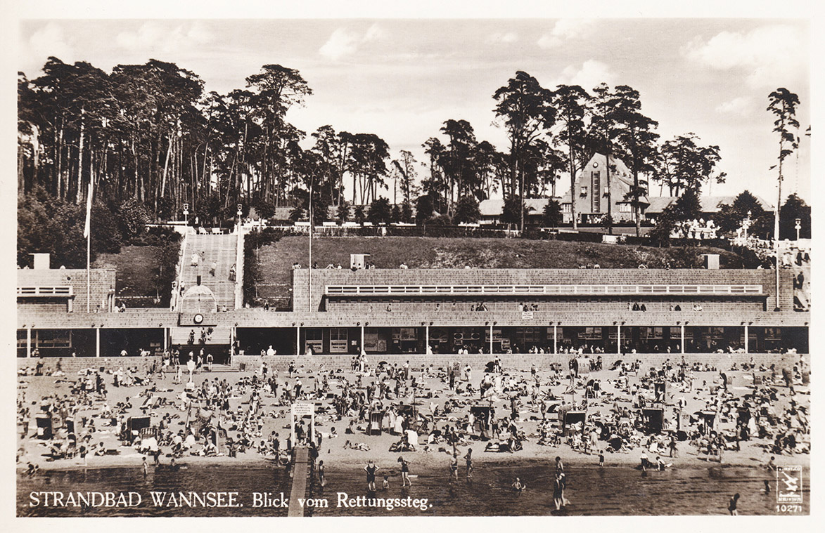
Strandbad Wannsee Lido
The Strandbad Wannsee lido is one of Greater Berlin’s most renowned achievements. The large lido was designed in 1927 by urban development councillor Martin Wagner, who wanted to build a modern, world-class swimming bath.
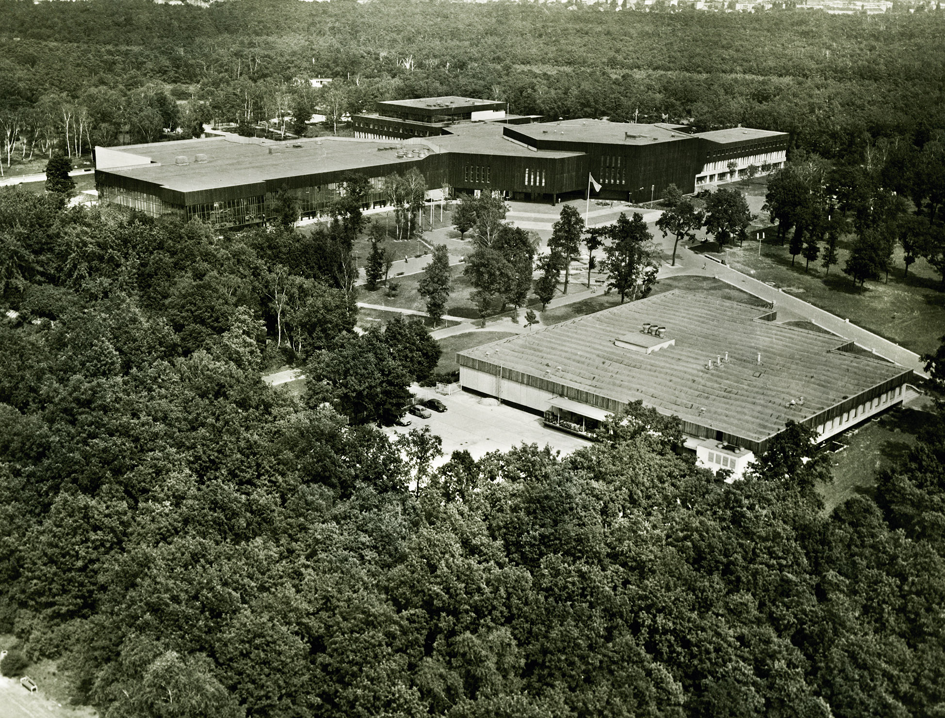
The Reich Sports Field
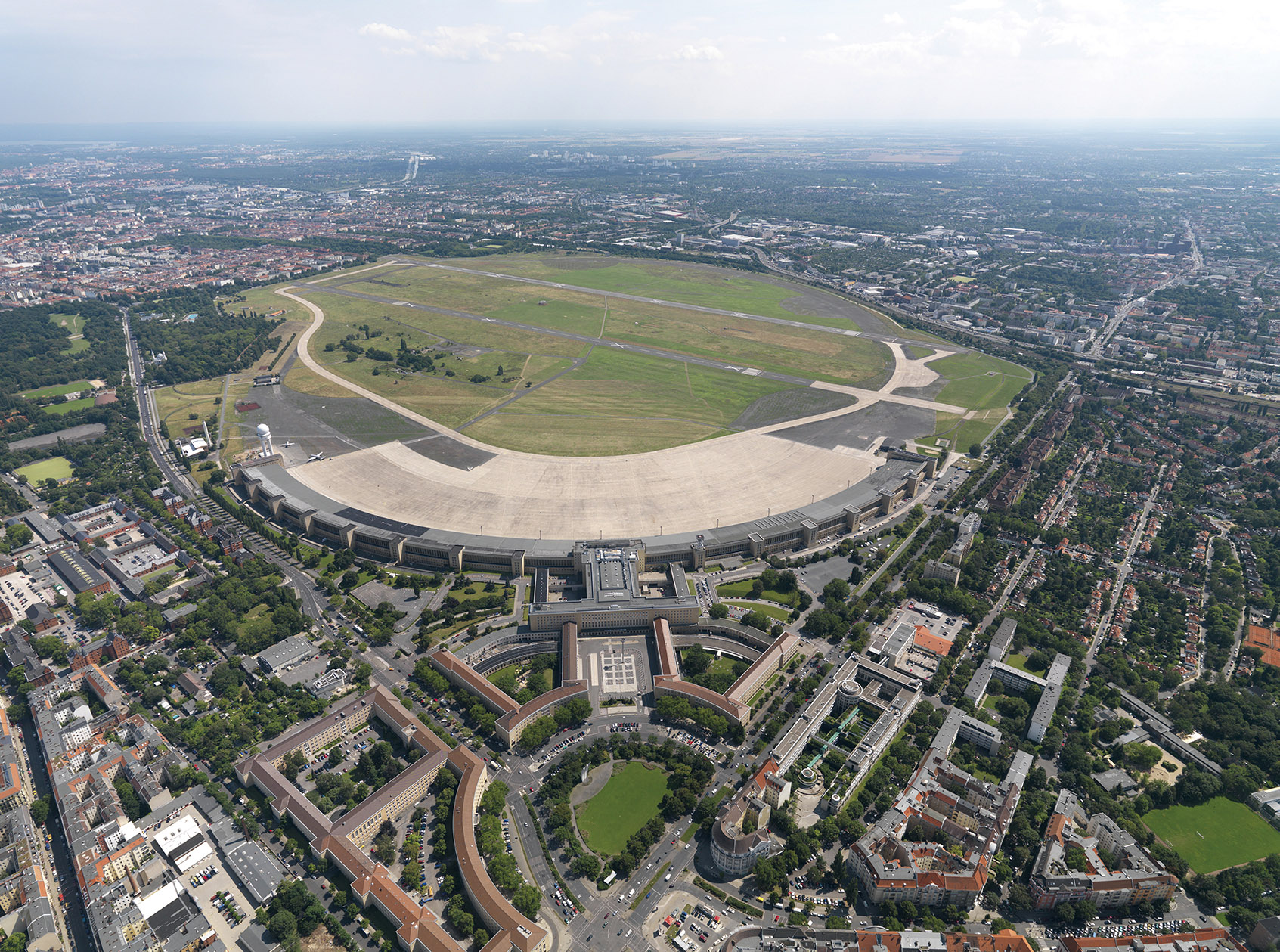
The Nazi-era sports complex presented itself as an enormous public park, with different sports facilities, recreational areas and a cultural centre. However, it was a detailed propaganda manifesto by the state, not the municipality.
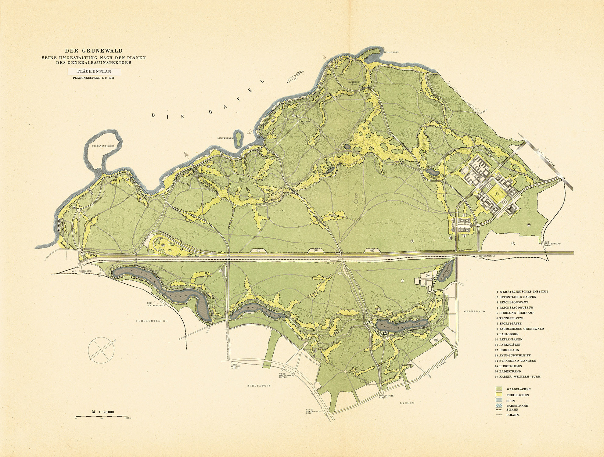
The New Grunewald Forest
Transforming Grunewald Forest was a key part of General Building Inspector Albert Speer’s plans to redesign Berlin. His plans were based on those designed by Willi Schelkes. Work began in 1938.
Wuhlheide Park
Wuhlheide Park has been redesigned several times since 1924 according to plans designed by Treptow public gardens director Ernst Harrich. The popular Ernst Thälmann Pioneer Park was built further to the east in 1950 during the German Democratic Republic, while the Ernst Thälmann Pioneer Palace designed by Günter Stahn opened in 1979.
Allotments for Greater Berlin
The allotment gardener is a common urban species, particularly in Greater Berlin. Berlin’s allotments cover an area of around 2,900 hectares, which amounts to three per cent of the entire city area. About three quarters of this area is the property of the state of Berlin. Allotments can contribute to the urban climate, but more importantly, they have a social function. They also provide gardens and green spaces for those who are less well off. In times of crisis, they can even be used as (unauthorised) permanent living spaces and as sources for food. Nevertheless, property developers are always eyeing them up, especially when there is a housing shortage as is the case at the moment.
There is Another Way: Green Squares
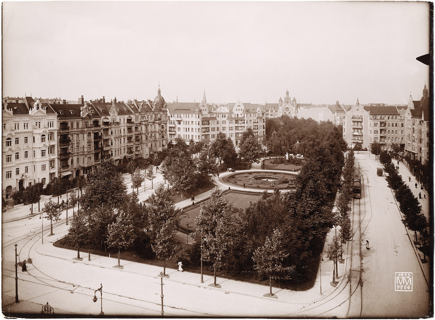
Before its transformation into a car-oriented city, Greater Berlin had beautifully designed streets and squares lined with street trees, plants, park benches and playgrounds. Although it is hard to believe today, flower beds adorned the central reservation of Bismarckstrasse in the imperial era. Before the First World War, landscaping companies in particular created beautiful streets and squares, including Rüdesheimer Platz, Victoria-Luise-Platz, Bayerischer Platz, Mexikoplatz, Ludolfingerplatz and Zeltinger Platz. During the Weimar Republic, squares throughout the city were increasingly made more usable by well-known landscape architects like Erwin Barth, who designed the mini public parks at Oranienplatz and Boxhagener Platz, as well as many other squares. The work of Wilmersdorf landscape architect Richard Thieme, who modernised the streets and squares around Kaiserallee, now Bundesallee, also spanned eras.
Plans for Green Squares by Erwin Barth
During the 1920s, many squares across Greater Berlin were redesigned to meet the needs of residents rather than cars. Playgrounds were added and the spaces were enhanced with decorative adornments. Erwin Barth, city public gardens director of Greater Berlin from 1926 to 1929, along with municipal landscape gardeners, were responsible for the redesigns.
Green Spaces in the Carstenn Figure Designed by Richard Thieme
The almost symmetrical street and square design known as the Carstenn Figure is one of the most striking geometric spatial designs in Greater Berlin. It unfolds over almost four kilometres on both sides of Bundesallee, formerly Kaiserallee, from Schaperstrasse to Stubenrauchstrasse. It is crossed by Volkspark Wilmersdorf public park, and Bundesplatz, formerly Kaiserplatz, sits at the centre.
Exemplary: The Preservation of Historic Gardens and Parks
The preservation and maintenance of historic gardens and parks in Berlin and Brandenburg has been world-renowned since the 1980s. The reconstruction of the large, contiguous park landscape of southwest Berlin and Potsdam in particular is considered exemplary and has now been recognised as a World Heritage Site. As a result the city regained a wonderful recreational landscape and developed a tourist attraction with an international reputation. Other parks such as the Tiergarten park and the Körnerpark were also restored as part of efforts to preserve historic gardens and parks. The former horticultural director Klaus-Henning von Krosigk worked tirelessly on the initiative to preserve historic gardens and parks and the results of these efforts benefited some much-admired town squares in addition to large and small parks.
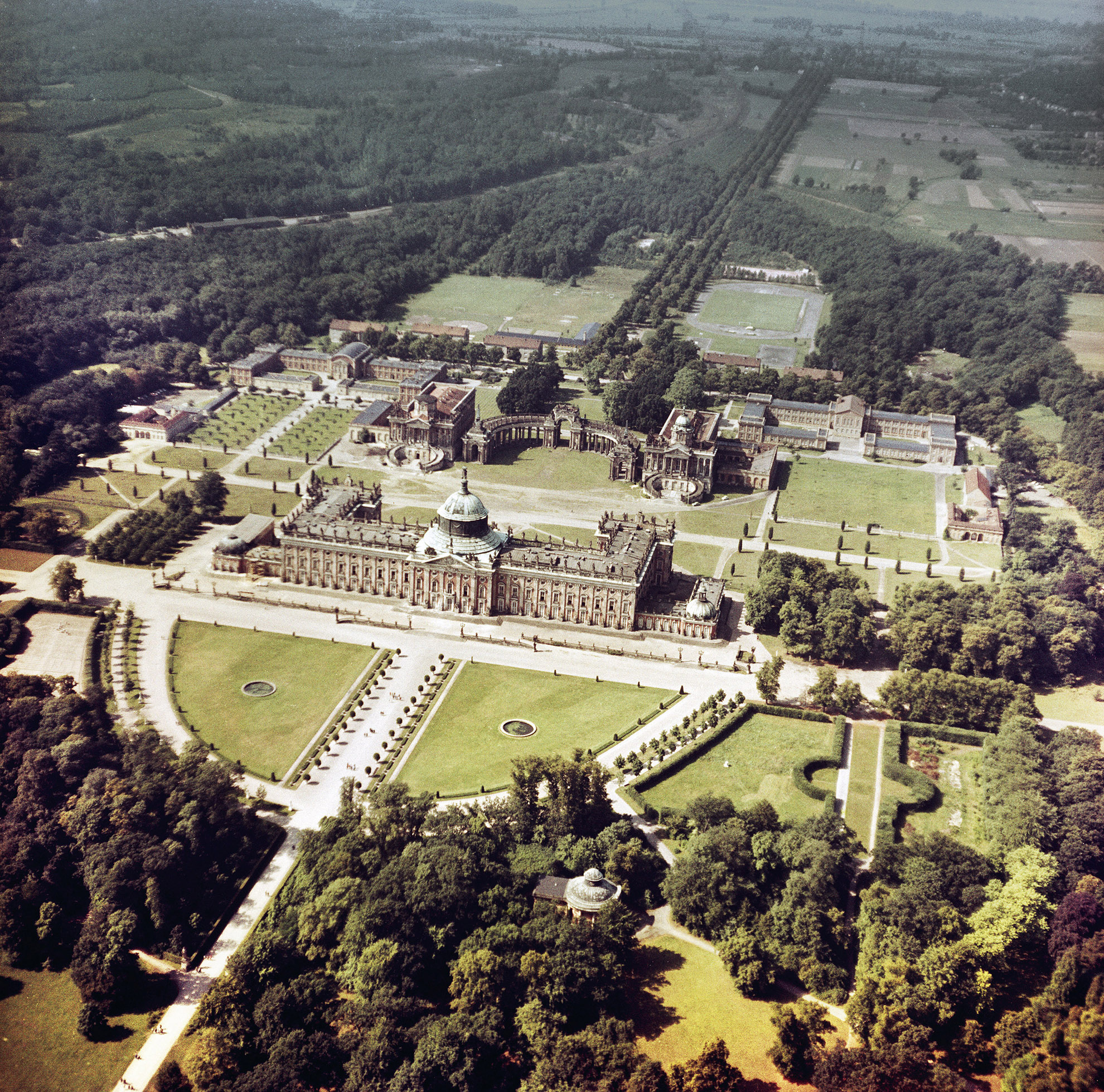
Palaces and Parks of Potsdam and Berlin
The Prussian palaces and gardens of the greater Berlin area – the crown jewels of the region – were awarded UNESCO World Heritage status in 1990. The UNESCO designation also covers palace complexes in Potsdam and Glienicke.
Preservation of Historic Gardens and Parks: Squares
Following on from the car-oriented transformation of the city in the 1950s and 1960s, some squares were restored to become more pedestrian-friendly in the 1980s and 1990s as part of the city’s efforts to preserve historic gardens and parks. There have been no large programmes focused on squares since then.
After 1990: The Desire for New Parks
Many people forget that Berlin was gripped by a fever for new parks in the years after reunification. Historic parks were reconstructed, new parks were created, and additional parks were planned. This included national events such as the International Garden Exhibition (IGA) in Marzahn in 2017 as well as local Greater Berlin projects like Mauerpark and the Green Belt. Plans were also made for spacious regional parks designed to strengthen and enrich the city’s star-shaped settlement pattern.
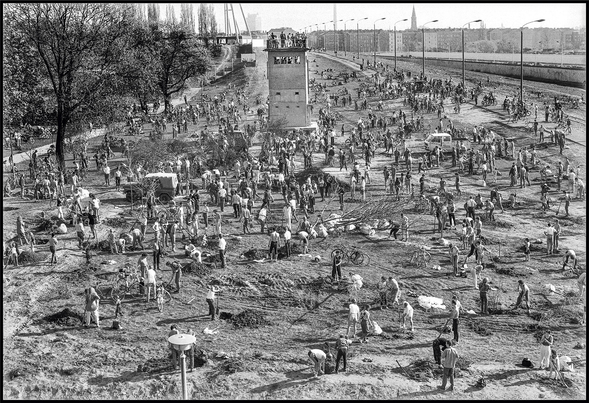
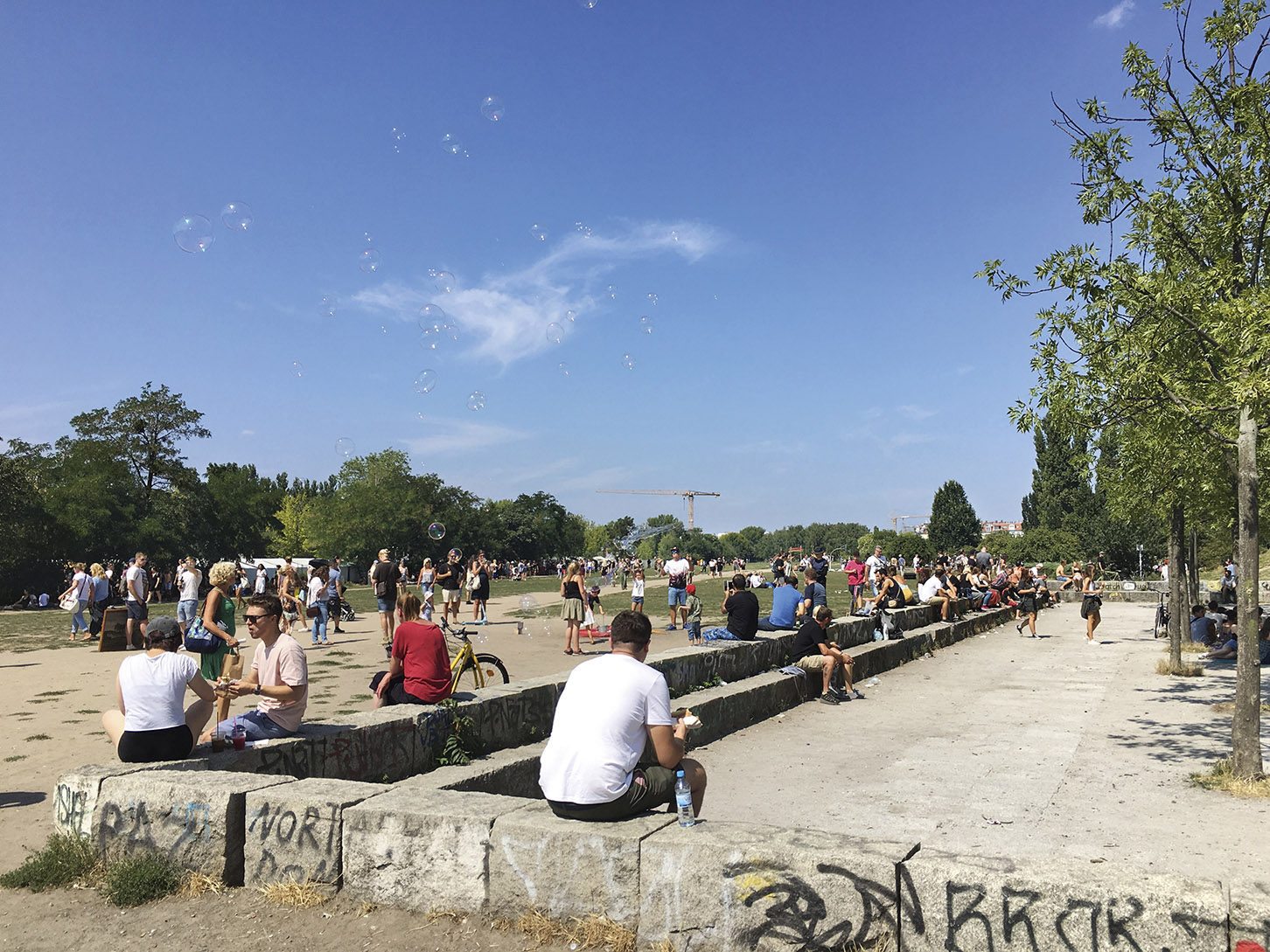
Mauerpark
Mauerpark is a typical example of one of Berlin’s new parks. The idea to designate the area as a green space dates back to the time of the fall of the Berlin Wall. Today the park connects the former districts of Wedding and Prenzlauer Berg and is heavily used by the public.
The IGA Exhibition Site
The large Marzahn Park was created during the German Democratic Republic and further developed and upgraded for the 2017 International Garden Exhibition (IGA). The Gardens of the World site is its most famous attraction.
The Green Belt
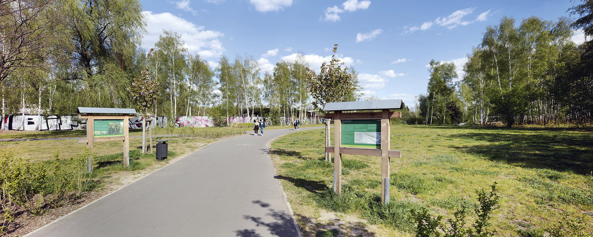
The Green Belt is an impressive new park under development for pedestrians and cyclists. Once completed, it will run over 13 kilometres along the path of the former Berlin Wall from Nordbahnhof train station to the northern outskirts of the city.
Major plans have paved the way of Greater Berlin. It all began with the Greater Berlin Competition of 1908 – 1910. This was followed by efforts to create a general settlement plan for Berlin and a development plan for Brandenburg-Mitte during the Weimar Republic. Work on the general development plan continued under the direction of Albert Speer. Plans developed by the planning collective working with Hans Scharoun came immediately after the war and then came the grand plans for the divided city. Large-scale, trans-regional plans were developed after the fall of the Berlin Wall. The current plan follows the traditional star-shaped settlement model. All of these major plans served very different purposes – to generate interest, to call on authorities to commit to projects and goals, to provide guidance to private investors, but also to demonstrate socio-political objectives. Today, major plans have to meet all of these requirements.
Gustav Böß, mayor of Greater Berlin from 1921 to 1929 Berlin Today, Berlin 1929
The Greater Berlin Competition of 1908 – 1910
Hermann Jansen’s comprehensive plan was awarded first place in 1910. The international Greater Berlin Competition was judged in 1910 and focused for the first time on the planning of a new phenomenon: the constantly growing megacity. The integrated plan contained statements on housing, transport, green spaces and centres. The competition was organised by the Vereinigung Berliner Architekten and the Architekten-Verein zu Berlin (now Architekten- und Ingenieurverein zu Berlin-Brandenburg). It expected to receive proposals ranging from large-scale plans to detailed urban development projects. The competition involved many social stakeholders from politics, business, the arts and professional bodies. It also aimed to draw attention to the fact that this kind of planning makes sense and that the city needed a new political system: Greater Berlin.
The Creation of Greater Berlin in 1920
The general plan according to the Greater Berlin Act passed on 27 April 1920 shows the 20 boroughs and the permanent forest areas. The Act came into effect on 1 October 1920. The Province of Brandenburg was significantly reduced in size and the new municipality was divided into 20 boroughs. This was preceded by years, or even decades, of debate for and against the creation of Greater Berlin. It was also not clear where the borders of Greater Berlin should be drawn. After the Greater Berlin Competition, the Greater Berlin Joint Authority was established in 1912, but its powers were limited and as a result it was not very successful. The Joint Authority covered an area much larger than what would later become Greater Berlin, and the authority was dissolved in 1920. In the years after the creation of Greater Berlin, some districts tried, without success, to leave the Greater Berlin municipality.
Sub-plans of the Weimar Republic
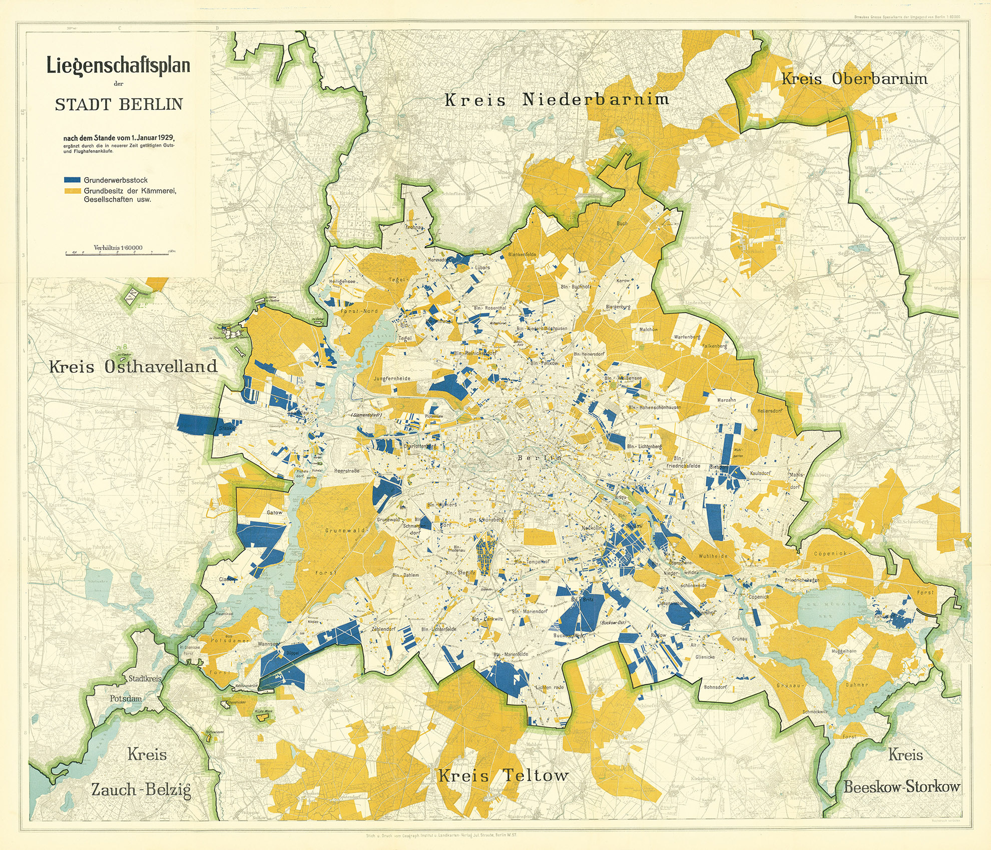
The Berlin property plan as of 1 January 1929. A new era of planning began after Greater Berlin was created in 1920. While private actors had a major influence on urban development before the First World War, the new municipality was now the dominant influence on housing construction, the provision of green spaces, energy supply and the reorganisation of the transport system. This was also made clear in the impressive land assembly policy – a consequence and condition of municipal urban planning. Comprehensive new plans were made. The Zoning Plan came into force in 1925 and the General Land Use Plan was published in 1929. A car-oriented street plan was also presented in 1929. However, despite all of the efforts made, it was not possible to develop a comprehensive general settlement plan.
The State Planning Association of Brandenburg-Mitte in 1935
A map of the Berlin-Brandenburg-Mitte economic plan designed by Gustav Langen in 1935. The creation of Greater Berlin reduced the size of the province of Brandenburg. The province now had fewer residents than Greater Berlin, and Greater Berlin was not part of the Provincial Association. Greater Berlin unsuccessfully attempted to incorporate more of its surrounding area in 1928. In response, the State Planning Association of Brandenburg-Mitte was created in 1929 and existed until 1937. The internationally renowned spatial planner Gustav Langen drew up a differentiated comprehensive plan (general settlement plan) for the association, and his plan has wrongly been ignored to this day. Langen envisaged compensation or supply areas for Berlin’s food supply in the city’s surrounding area. His plan also included a network of motorways and railway lines around Berlin that was later pursued.
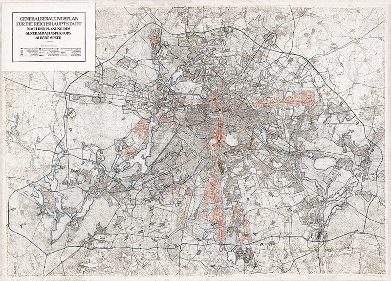
The General Development Plan of Berlin’s General Building inspector (1937 – 1942)
The General Development Plan (comprehensive plan) designed by Albert Speer in 1942. The position of General Building Inspector for the Reich Capital (GBI) was created on 30 January 1937 and tasked with drawing up a comprehensive construction plan for the Reich capital in Berlin. This state authority headed by Albert Speer was now responsible for planning the greater Berlin area. Municipal planning authorities no longer had a role to play and the municipal borders lost their meaning. This marked the beginning of a new urban development system. The formal framework for the expanded capital was to be a system of main roads made up of axes and ring roads. The fact that it would only be possible to partially implement this plan through the persecution of the Jews, the theft of resources and the use of forced labour was long suppressed. The new GBI was based in the palace at Pariser Platz 4 from 1938 onwards. The previous tenant, the Academy of Arts, moved to the Crown Prince’s Palace (Kronprinzenpalais).
The Division of Berlin into Zones of Occupation in 1945
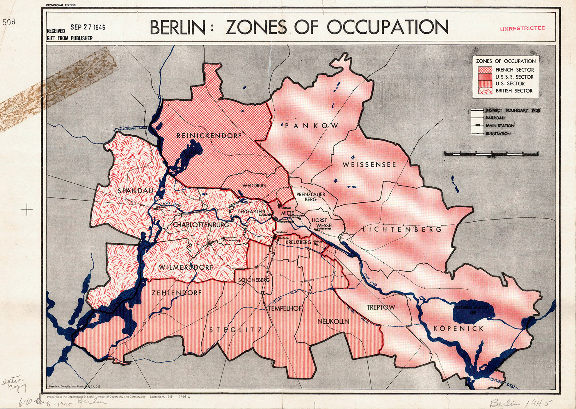
Berlin’s zones of occupation in 1945. Following Germany’s unconditional surrender in May 1945, the Allies controlled Berlin. Initially only the Soviet Union occupied Berlin, but the US, British and French occupying powers soon followed in July. It was decided in 1944 that Greater Berlin would be divided into sectors (initially without a French sector) based on the city and district boundaries determined by the Greater Berlin Act. The Magistrat of Greater Berlin, which was the official term used by the Allies, was still not a self-governing body, but rather an institution under the command of the Allies. The Allies also decided on issues concerning apartment and infrastructure repairs as well as urban development more generally. The Allied Kommandatura was set up as a joint governing body for the city, although it experienced increasing levels of conflict. It was headquartered in Kaiserswerther Strasse 16–18 in Zehlendorf.
The Collective Plan of 1945 /1946
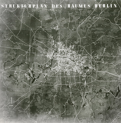
A structural plan of the Berlin area in 1945 / 1946. The collective plan was the first official plan to be drawn up after Germany’s unconditional surrender. After it was approved by the occupying powers, it was presented to the public in the ruins of Berlin Palace from 22 August to 15 October 1946. The plan was developed under the direction of Hans Scharoun, head of the Department for Building and Housing. It ignored tradition and instead embodied the vision of a new, car-oriented city and functionally separated urban landscape, which would extend in a strip-like, east–west-oriented band along the Spree glacial valley. Approaches in line with the traditional radial concept are visible on the outskirts. Scharoun was voted out in the first free elections on 20 October 1946, but the plan still had a major impact. In a time of extreme uncertainty, just thinking about a possible future was an act of hope.
East Berlin: The 1953 Land Use Plan
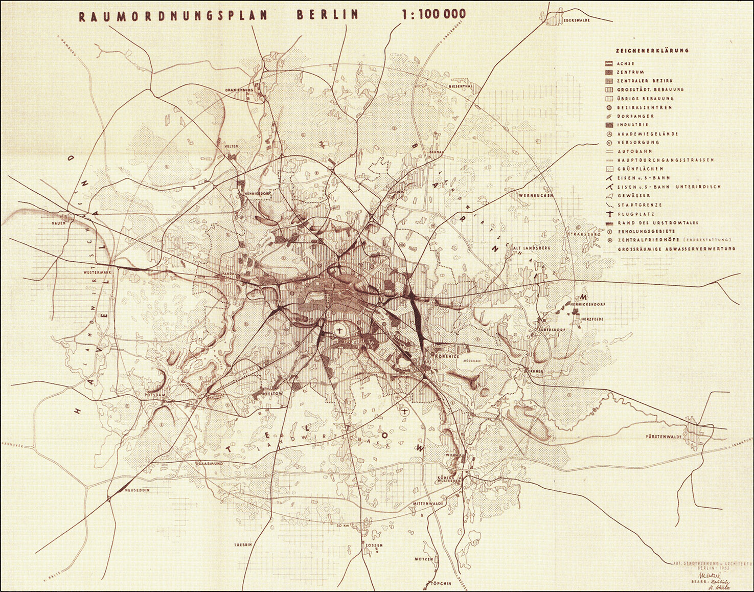
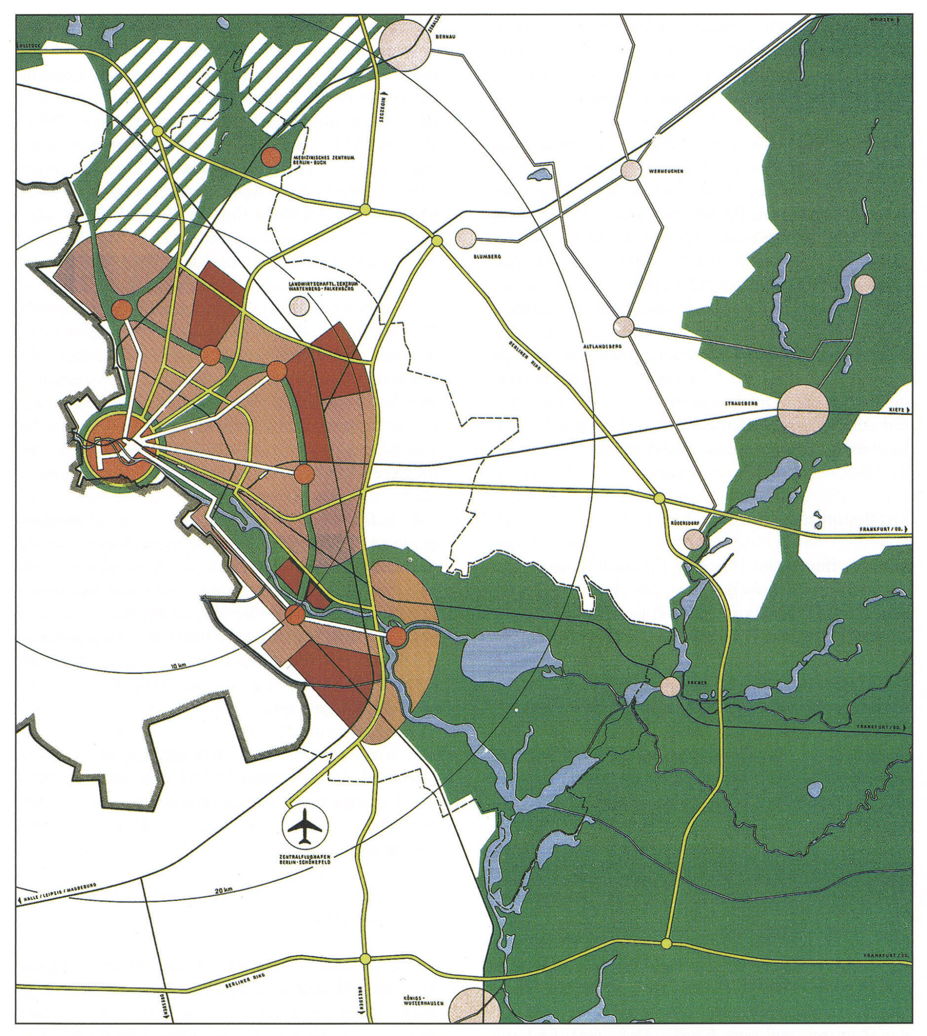
The East Berlin Land Use Plan of 1953. The 1953 Land Use Plan was based on the German Democratic Republic’s 16 principles of urban design and still showed Berlin and its surrounding area without the partition between east and west. The railway lines, including the outer railway ring, were emphasised, yet the outer Berliner Ring orbital motorway is barely noticeable. However, motorway planning played a key role. The plan emphasised the hierarchy of building density and, in particular, the diversity of the centres. Schönefeld Airport is shown, but is visibly smaller than Tempelhof Airport. The map extends in the north to Oranienburg and Eberswalde, in the east to Fürstenwalde, in the south to Zossen and in the west to Nauen. The circle marks a radius of 30 kilometres around the city centre. Compared to the collective plan, the 1953 plan respected the traditional city and avoided radical new visions of the city.
West Berlin: The 1965 Land Use Plan
West Berlin’s 1965 Land Use Plan (adopted in 1970). West Berlin’s Land Use Plan was completed a few years after the Berlin Wall was built in 1965. In the long term, it has affected the city more than any other major plan since 1945. It had a clear concept: to modernise the western section of the city in a public initiative. The plan included the construction of large-scale housing developments, the redevelopment of parts of the inner city, the construction of a city motorway network and the expansion of the U-Bahn underground network. Overall, the plan was relatively effective thanks to the extensive federal funds that were made available to implement it. This, however, provides the background for the broad protest movement, active since the late 1960s, that had questioned some of the plan’s key projects.
East-Berlin: The 1969 General Development Plan
The 1969 General Development Plan: plan of the structure and composition. Shortly after the West Berlin Land Use Plan was released, the Magistrat of Greater Berlin presented the General Development Plan together with the General Transport Plan in East Berlin. This plan also focused on the comprehensive restoration of the city with the aim of ‘creating a typical cityscape of the city of the first Workers’ and Farmers’ state’. The plan envisaged a ‘compact’ city with a clear centre and close integration of work, living and recreational spaces, developed using a local public transport system that included trams and a radial ring road system. Numerous multi-storey residential buildings and blocks were planned in the centre, while any urban sprawl into the outskirts was ruled out. This concept differed significantly from plans in other large western cities.
West Berlin: The 1984 Land Use Plan
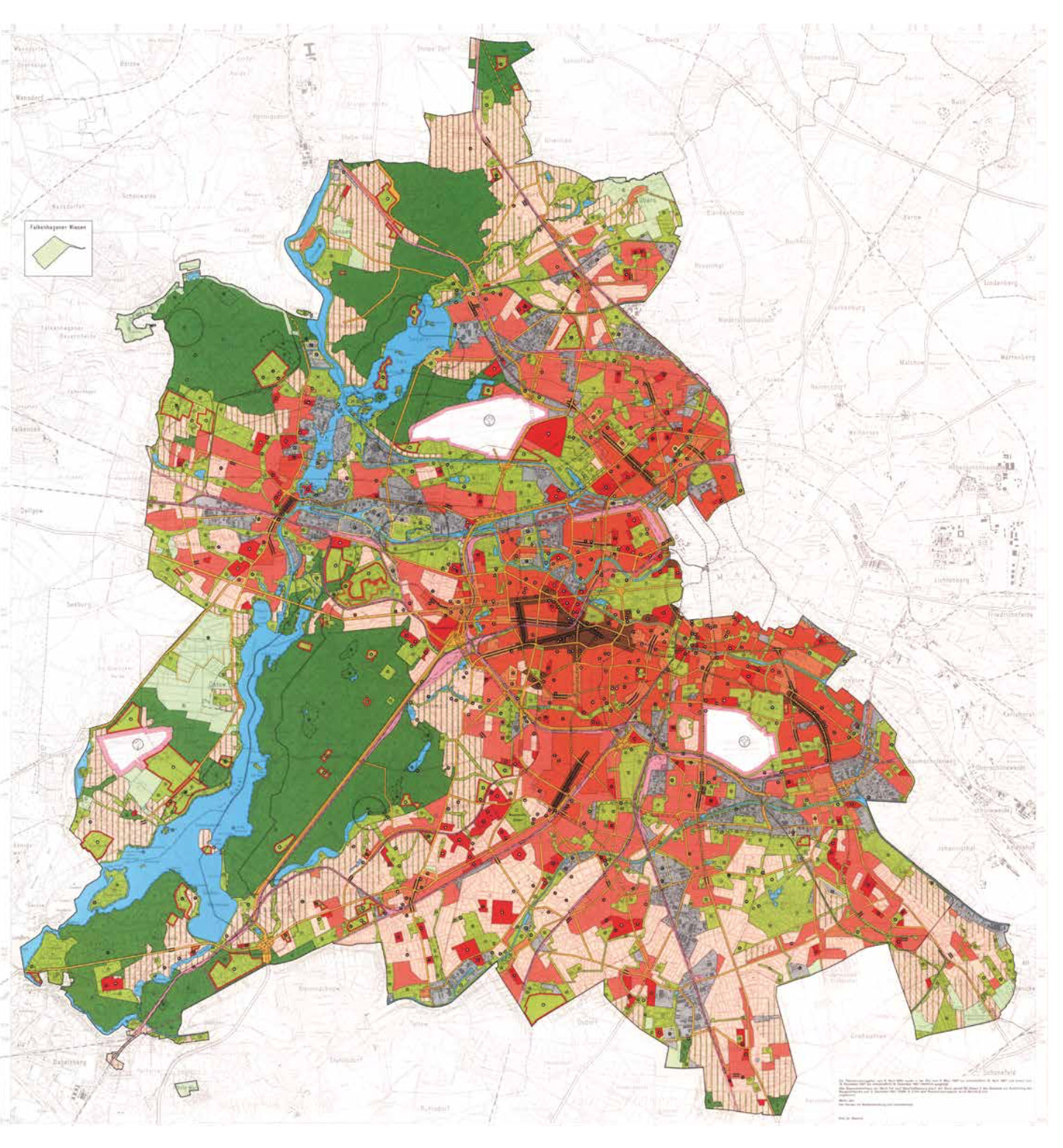
The 1984 Land Use Plan. West Berlin’s 1984 Land Use Plan embodied the fundamental change in perspective in urban development that had taken place within the context of massive social conflict during the 1970s and early 1980s. The expansion of the urban motorway with the tangent system was abandoned, and wholesale redevelopment projects were replaced by careful urban renewal projects and the construction of large housing developments on the outskirts of the city. The plan rediscovered the values of the old city. The International Building Exhibition (IBA 1984) was used to communicate the change. After the signing of the Basic Treaty of 1972, which gave the German Democratic Republic recognition as a sovereign state, the plan was no longer a tool of the Cold War. The plan did not come into effect until 1988 and therefore had very little time to produce results. However, its basic ideas survived the reunification process.
East Berlin: The 1987 General Development Plan
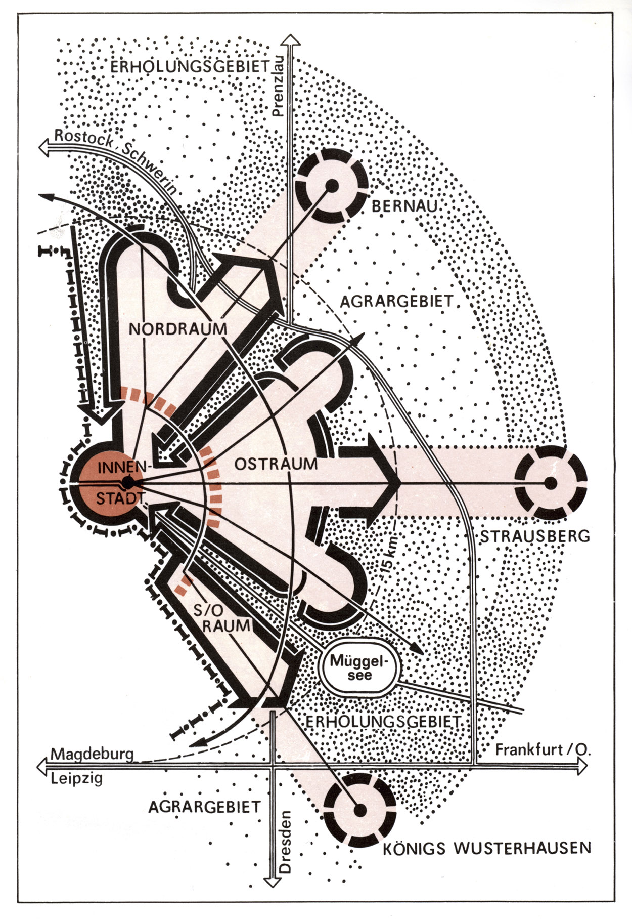
A diagram of the 1987 General Development Plan. The objectives had also fundamentally changed in East Berlin. The old city was given a completely new, positive profile in light of Berlin’s 750th anniversary in 1987. This was reflected in the construction of the Nikolaiviertel quarter and the Friedrichstadt projects. At the same time, construction continued on the large housing developments on the outskirts of the city; this had only begun in the 1970s. The large-scale orientation of the diagram is particularly striking. The General Development Plan shows a star-shaped settlement plan with green wedges, but only for half of the greater Berlin area. Potsdam did not appear on the map and was completely isolated. The East Berlin General Development Plan had even less time to take effect than West Berlin’s 1984 Land Use Plan, as it never entered into force.
The 1990 Plan of the Provisional Regional Committee
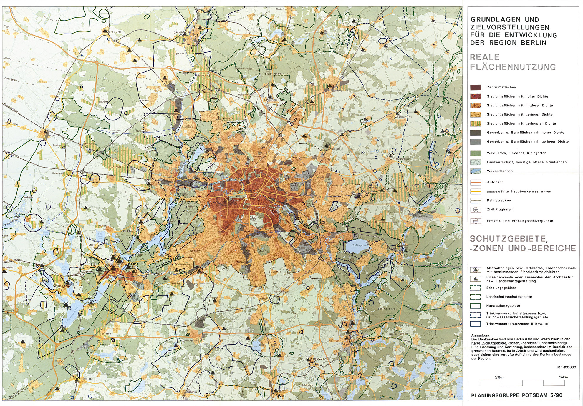
The 1990 plan developed by the Potsdam Planning Group of the Provisional Regional Committee. The situation in Berlin changed dramatically just three years after the General Development Plan was presented. The Berlin Wall fell and spatial perspectives underwent a revolution. Before reunification, a group of East and West German experts from Berlin and its surrounding area met and formed the Potsdam Planning Group of the Provisional Regional Committee. The group recommended preventing urban sprawl, safeguarding open spaces, strengthening the city’s existing centres, preserving the region’s cultural urban development values, striving for equal living conditions and improving public transport, all in an environmentally and socially responsible manner. In terms of spatial development, it was decided to allow the city to develop along the radial settlement structures that had formed over the past 100 years.
The 2019 State Development Plan
The 2019 State Development Plan Capital Region Berlin-Brandenburg (LEP HR). The new state development plan entered into force on 1 July 2019. It is the result of the specialist work carried out by the Joint Spatial Planning Department of Berlin and Brandenburg, which was created in 1996. The star-shaped settlement pattern is an overarching guiding principle, an urban regional model that has developed gradually since the 1880s. The goal is for the city to grow along the lines of the suburban railways and major arterial roads, and this will be reinforced by the expansion of the public transport system. The plan builds on the urban region’s special features and strengths, which is a sustainable concept in principle.
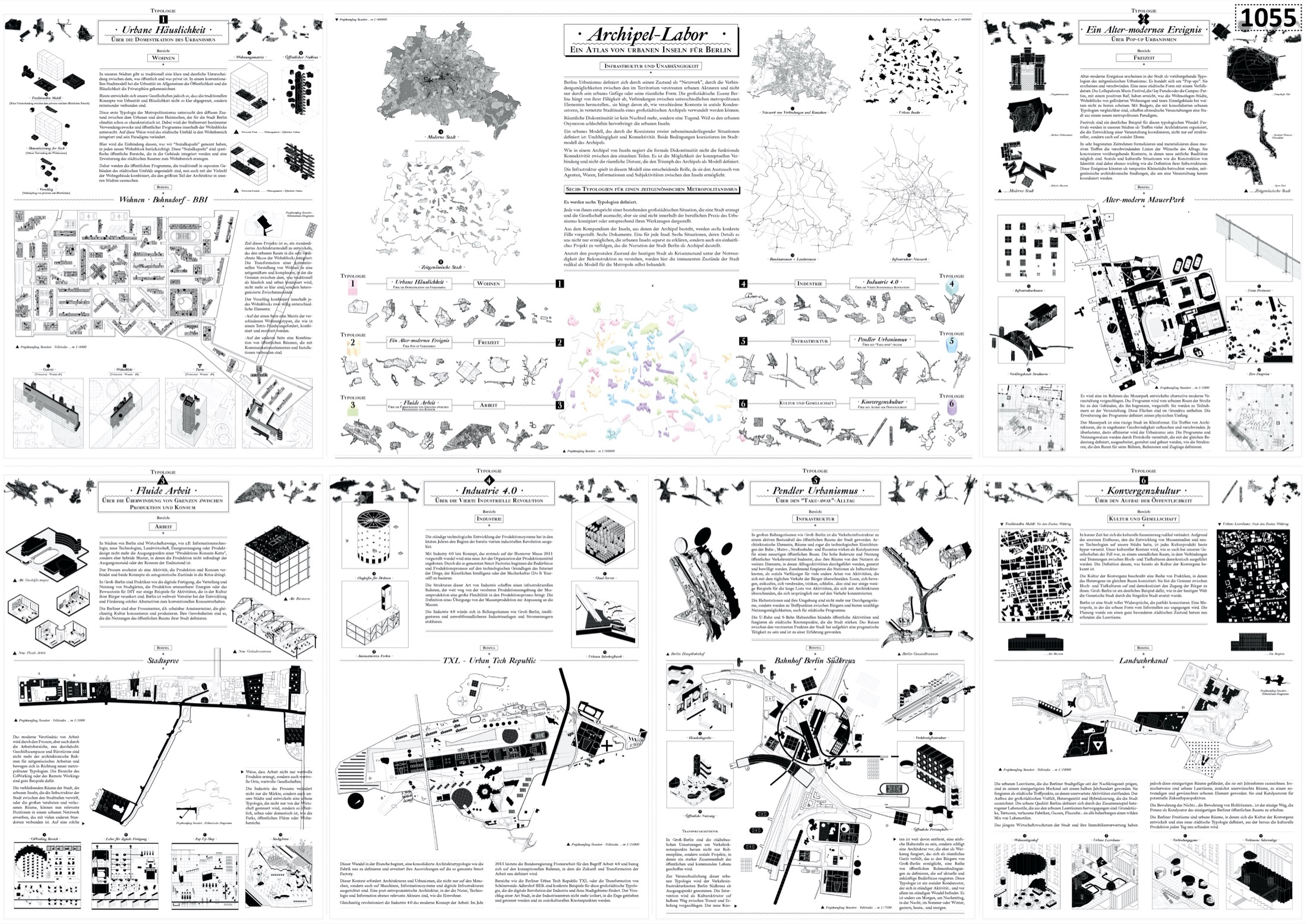
Motto Archipelago Lab: An Atlas of Urban Islands for Berlin Architecture Pedro Pitarch (Madrid) Landscape planning Pedro Pitarch Selected for the second phase
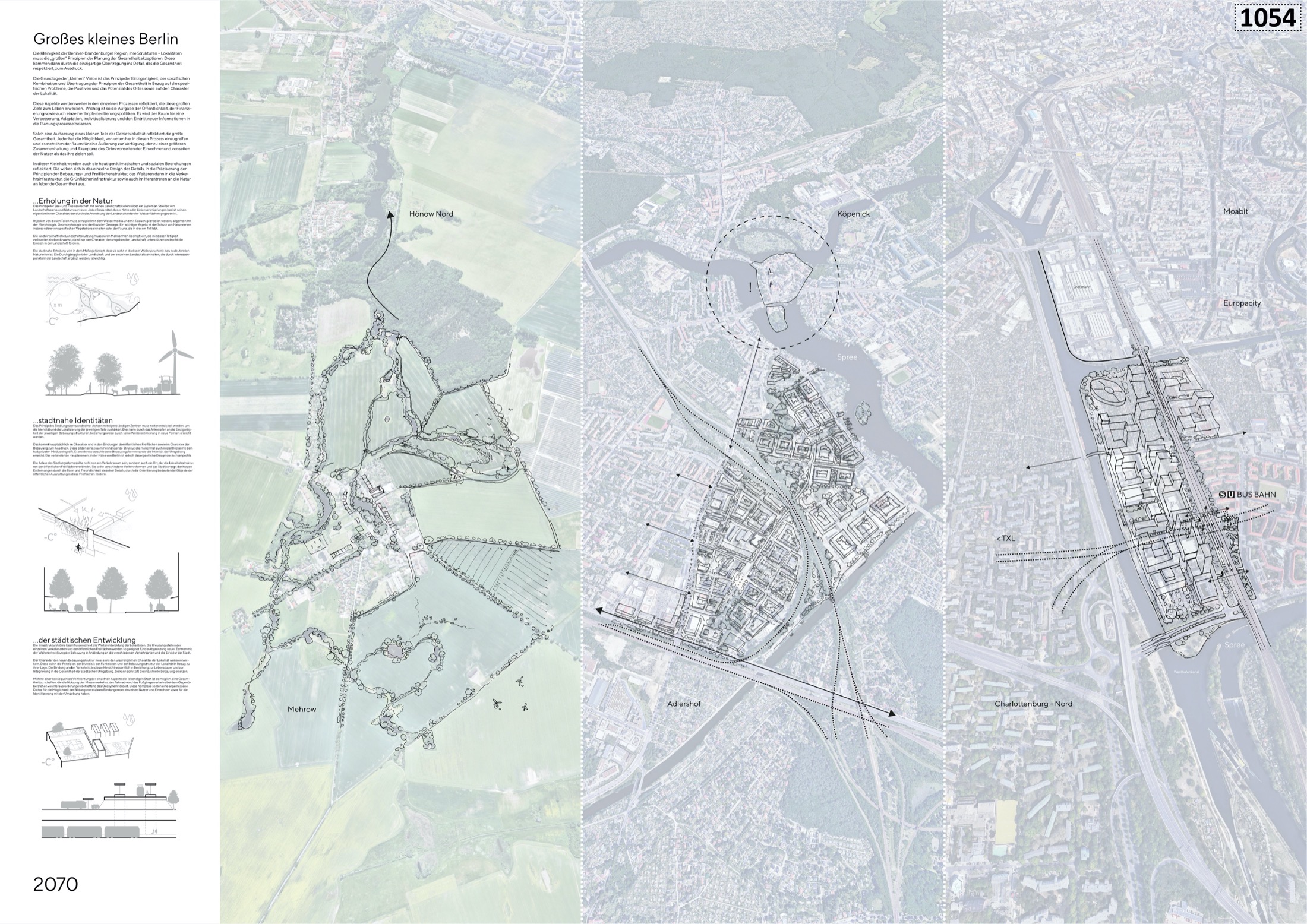
Motto Little Big Berlin Architecture gogolák + grasse, s.r.o. (Prague) Landscape planning gogolák + grasse, KOLMO, Ateliér Koukol Selected for the second phase