Environmental Issues
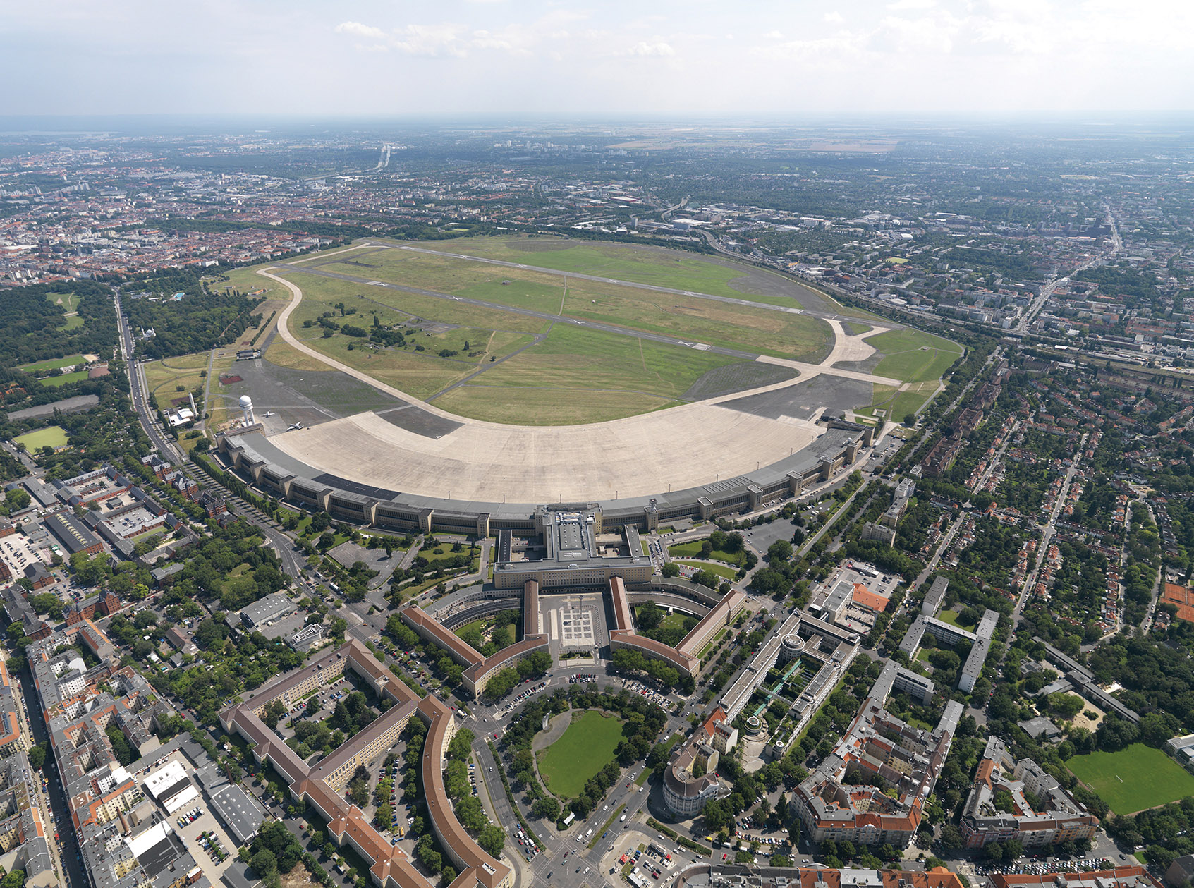
The closure of Tempelhof Airport on 30 October 2008 marked the end of an aviation era that has gone down in the history of Greater Berlin. It was initially unclear what would happen to the massive airfield. Back in 1995, the Senate Department for Urban Development considered developing the periphery of the airport grounds. The airfield was opened as a massive public park in 2010. The ‘100% Tempelhof’ citizens’ initiative began when planners released less than convincing plans to develop the periphery of the site. The city held a referendum on 25 May 2014 and Berliners voted to leave the inner-city airfield as a park. However, given the severe housing shortages, opinions have changed once again and some are calling for the edge of the former airport grounds to be developed.
Photo Philipp Meuser, 2009
How can a city that is constantly growing remain healthy? The answer is simple: street trees and lots of lots of greenery! The Permanent Forest Agreement of 1915 was the first important step taken in efforts to protect green spaces. It reserved extensive areas of forest for local recreation. The formation of Greater Berlin made it possible to open up additional public parks for recreation, culture and sport. This was often thanks to private financial support. The Strandbad Wannsee lido became well known far beyond the borders of Berlin. The Nazis created the enormous Reich Sports Field sports complex, while later on, other parks were expanded and created during the German Democratic Republic. In the later years of West Berlin, the long tradition of preserving historic gardens and parks reached a new high. After the fall of the Berlin Wall, new large parks were created in Berlin and plans were made for regional parks in the city’s surrounding area. Berlin’s most important historic park landscape has also been carefully restored: the Palaces and Parks of Potsdam and Berlin, which are a UNESCO World Heritage Site.
Berlin is the beating heart of German sport. Few cities have access to the kind of high-quality sporting facilities that are available in the imperial capital. Public bodies of water make up 6 per cent of the total area of Berlin, while forests and parks comprise 18 per cent and 1.5 per cent respectively. The call for access to open spaces for the majority of the population was one of the first demands made after the formation of the new city of Berlin. Anyone who visits the imperial capital’s parks, playgrounds and sporting facilities […] would have to agree that the demand for the provision of open spaces was fully satisfied. It is only possible to develop new ways of life in places where people can connect with nature.
A network of green spaces should penetrate the developed areas, and green corridors should radiate from inner city parks out to the forests and outlying areas. […] The open spaces are complemented by playgrounds, sports grounds and allotments. Allotments must be a permanent feature of the city.
Gustav Böß,
mayor of Greater Berlin from 1921 to 1929
Berlin Today, Berlin 1929
A Ward of the Big City:
The Ordinary Street Tree
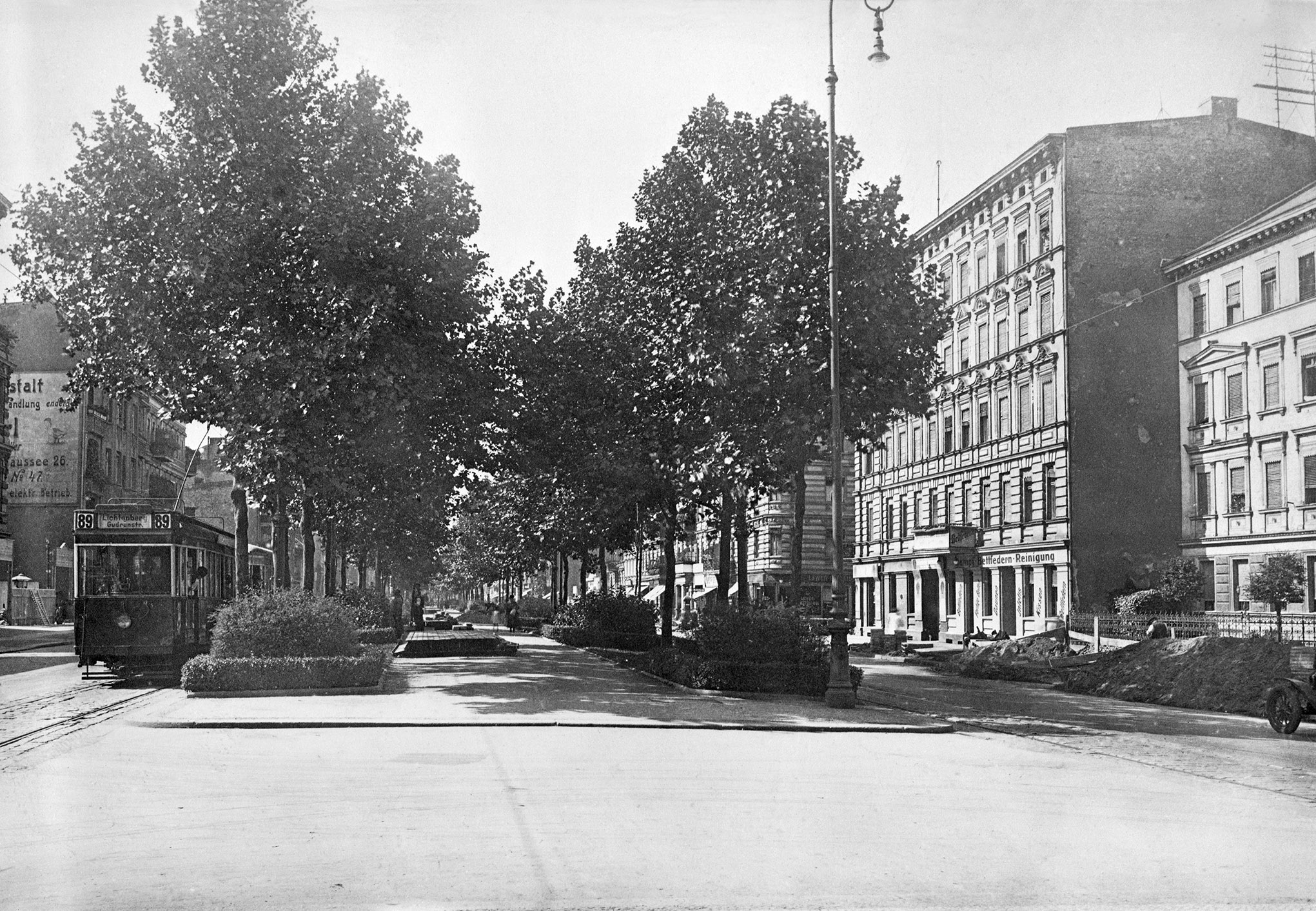
There were rarely any trees in the streets of early towns and villages. It was not until the era of absolutism that some urban avenues were created, such as Unter den Linden. Tree-lined city streets came to the fore in Paris in the nineteenth century and this became a model for other cities and indeed the greater Berlin area. The large radial and ring roads gained their characteristic trees, particularly lindens, maples, oaks, sycamores and chestnuts. The photo below shows street trees along Frankfurter Allee and Ruschestrasse in 1928. Once decimated by car-oriented urban redevelopment, the street tree can once again look ahead to a bright future. The humble street tree is an ambassador for the shift towards sustainable transport, makes a positive contribution to address climate change and brings joy to pedestrians.
All Kinds of Public Parks
Public parks were a feature of Greater Berlin even before 1920. They provide city dwellers with spaces for leisure and recreation and include beautifully designed open spaces, playgrounds, sports fields and even cultural institutions. The idea for public parks like this came from the United States, in particular Chicago, but was also based on Berlin’s own traditions. Large-scale public parks were created in Berlin during the Weimar Republic, some on the direct initiative of Mayor Böß, who managed to use a foundation to collect private funds for this purpose. Berlin’s largest public leisure facility, the Strandbad Wannsee lake-side lido, was structurally a child of Greater Berlin. More parks have been planned, created and further developed in the years since 1933 right up to the present day.
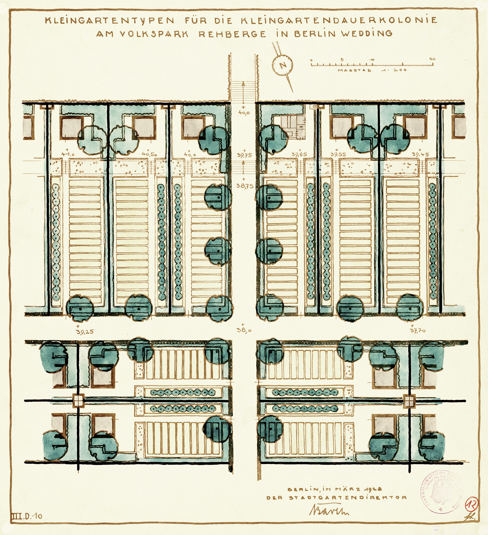
Volkspark Rehberge Public Park
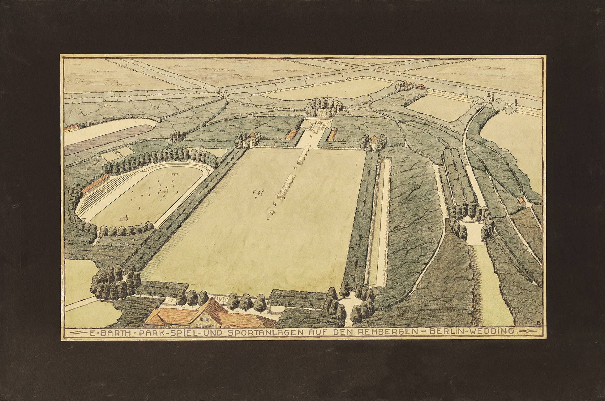
AM TUB, no. 40978
Public parks are a social achievement and should primarily provide residents of densely populated neighbourhoods with space for recreation, play and sport. Volkspark Rehberge public park is a prime example of a public park in the working class district of Wedding.
Strandbad Wannsee Lido
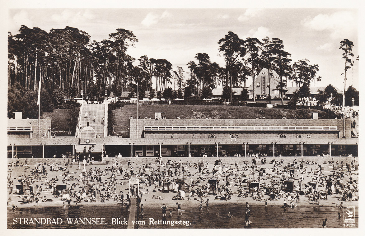
Postcard
The Strandbad Wannsee lido is one of Greater Berlin’s most renowned achievements. The large lido was designed in 1927 by urban development councillor Martin Wagner, who wanted to build a modern, world-class swimming bath.
The Reich Sports Field

Werner March, The Reich Sports Field, images by Charlotte Rohrbach (Berlin, 1936), image 3
The Nazi-era sports complex presented itself as an enormous public park, with different sports facilities, recreational areas and a cultural centre. However, it was a detailed propaganda manifesto by the state, not the municipality.
The New Grunewald Forest
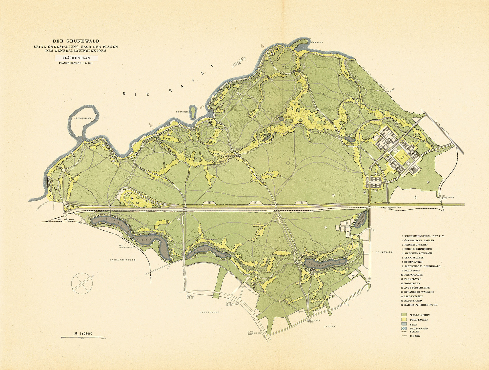
Die Baukunst Heft architecture journal (August / September 1941), p. 151
Transforming Grunewald Forest was a key part of General Building Inspector Albert Speer’s plans to redesign Berlin. His plans were based on those designed by Willi Schelkes. Work began in 1938.
Wuhlheide Park
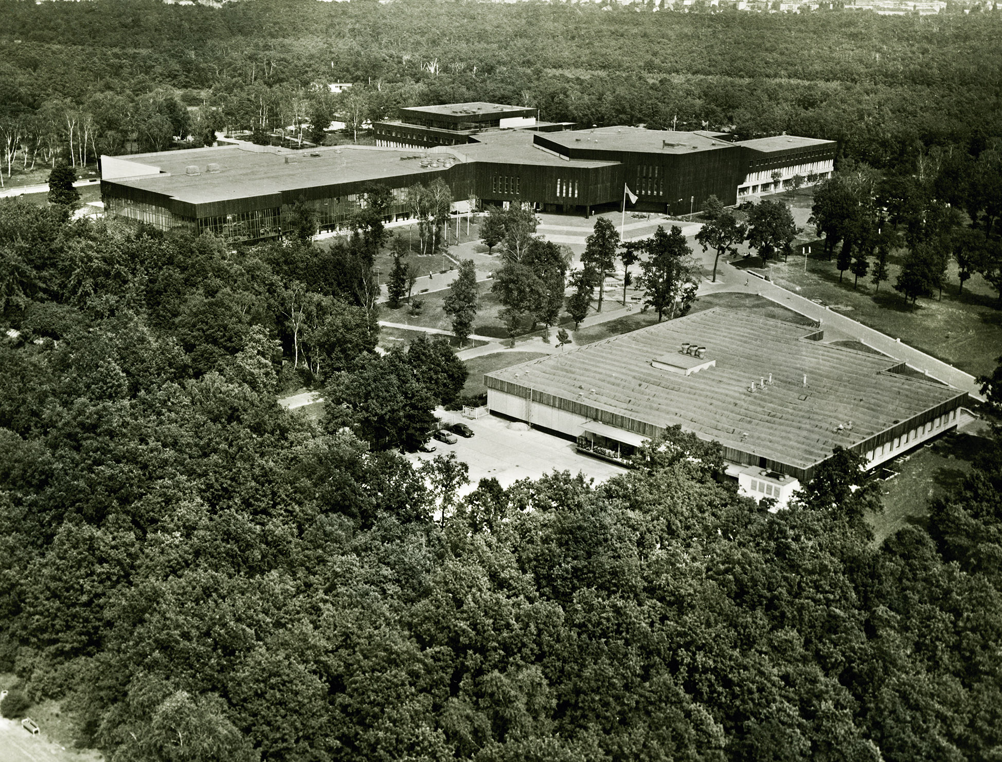
IRS (Erkner) / Scientific Collection, no. 820021-1920
Wuhlheide Park has been redesigned several times since 1924 according to plans designed by Treptow public gardens director Ernst Harrich. The popular Ernst Thälmann Pioneer Park was built further to the east in 1950 during the German Democratic Republic, while the Ernst Thälmann Pioneer Palace designed by Günter Stahn opened in 1979.
Allotments for Greater Berlin
The allotment gardener is a common urban species, particularly in Greater Berlin. Berlin’s allotments cover an area of around 2,900 hectares, which amounts to three per cent of the entire city area. About three quarters of this area is the property of the state of Berlin. Allotments can contribute to the urban climate, but more importantly, they have a social function. They also provide gardens and green spaces for those who are less well off. In times of crisis, they can even be used as (unauthorised) permanent living spaces and as sources for food. Nevertheless, property developers are always eyeing them up, especially when there is a housing shortage as is the case at the moment.
AM TUB, no. 40992
There is Another Way: Green Squares
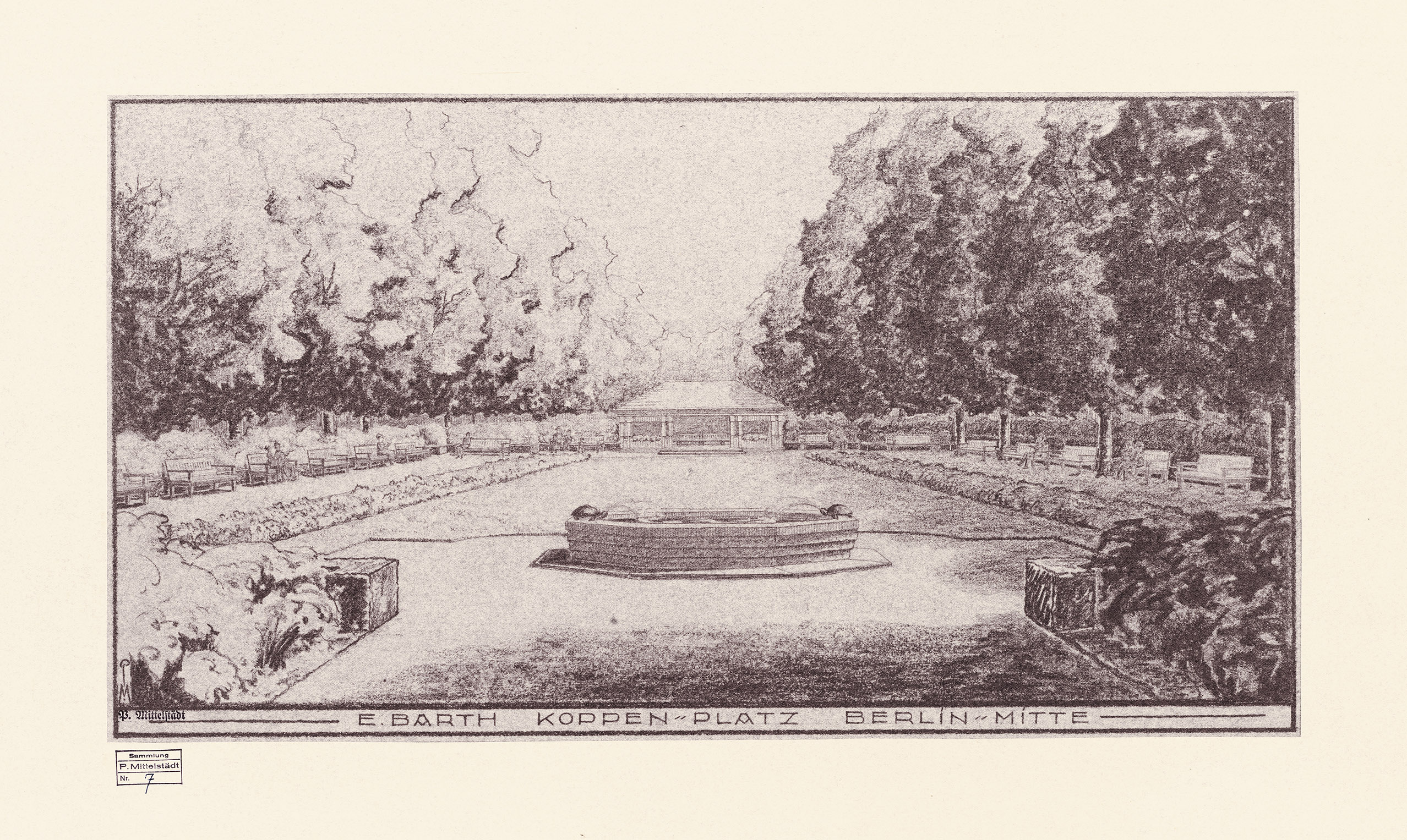
Before its transformation into a car-oriented city, Greater Berlin had beautifully designed streets and squares lined with street trees, plants, park benches and playgrounds. Although it is hard to believe today, flower beds adorned the central reservation of Bismarckstrasse in the imperial era. Before the First World War, landscaping companies in particular created beautiful streets and squares, including Rüdesheimer Platz, Victoria-Luise-Platz, Bayerischer Platz, Mexikoplatz, Ludolfingerplatz and Zeltinger Platz. During the Weimar Republic, squares throughout the city were increasingly made more usable by well-known landscape architects like Erwin Barth, who designed the mini public parks at Oranienplatz and Boxhagener Platz, as well as many other squares. The work of Wilmersdorf landscape architect Richard Thieme, who modernised the streets and squares around Kaiserallee, now Bundesallee, also spanned eras.
AM TUB, no. 41074
Plans for Green Squares by
Erwin Barth
During the 1920s, many squares
across Greater Berlin were redesigned
to meet the needs of residents
rather than cars. Playgrounds were
added and the spaces were enhanced
with decorative adornments. Erwin
Barth, city public gardens director
of Greater Berlin from 1926 to 1929,
along with municipal landscape
gardeners, were responsible for the
redesigns.
Green Spaces in the Carstenn Figure Designed by Richard Thieme
The almost symmetrical street and square design known as the Carstenn Figure is one of the most striking geometric spatial designs in Greater Berlin. It unfolds over almost four kilometres on both sides of Bundesallee, formerly Kaiserallee, from Schaperstrasse to Stubenrauchstrasse. It is crossed by Volkspark Wilmersdorf public park, and Bundesplatz, formerly Kaiserplatz, sits at the centre.
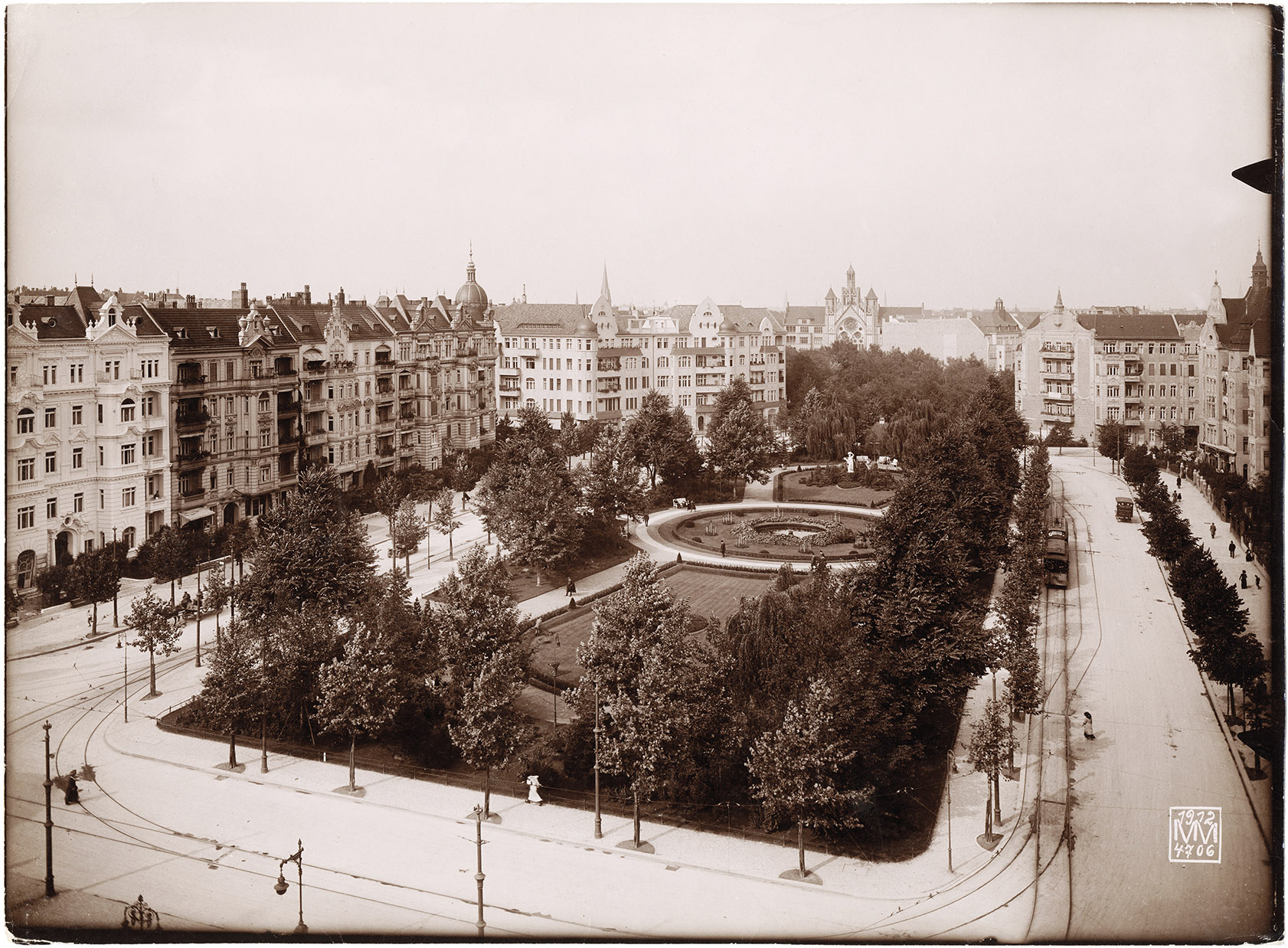
Photo Max Missmann; Stadtmuseum Berlin Foundation, no. IV 65 / 839
Exemplary: The Preservation of Historic Gardens and Parks
The preservation and maintenance of historic gardens and parks in Berlin and Brandenburg has been world-renowned since the 1980s. The reconstruction of the large, contiguous park landscape of southwest Berlin and Potsdam in particular is considered exemplary and has now been recognised as a World Heritage Site. As a result the city regained a wonderful recreational landscape and developed a tourist attraction with an international reputation. Other parks such as the Tiergarten park and the Körnerpark were also restored as part of efforts to preserve historic gardens and parks. The former horticultural director Klaus-Henning von Krosigk worked tirelessly on the initiative to preserve historic gardens and parks and the results of these efforts benefited some much-admired town squares in addition to large and small parks.
Palaces and Parks of Potsdam and Berlin
The Prussian palaces and gardens of the greater Berlin area – the crown jewels of the region – were awarded UNESCO World Heritage status in 1990. The UNESCO designation also covers palace complexes in Potsdam and Glienicke.
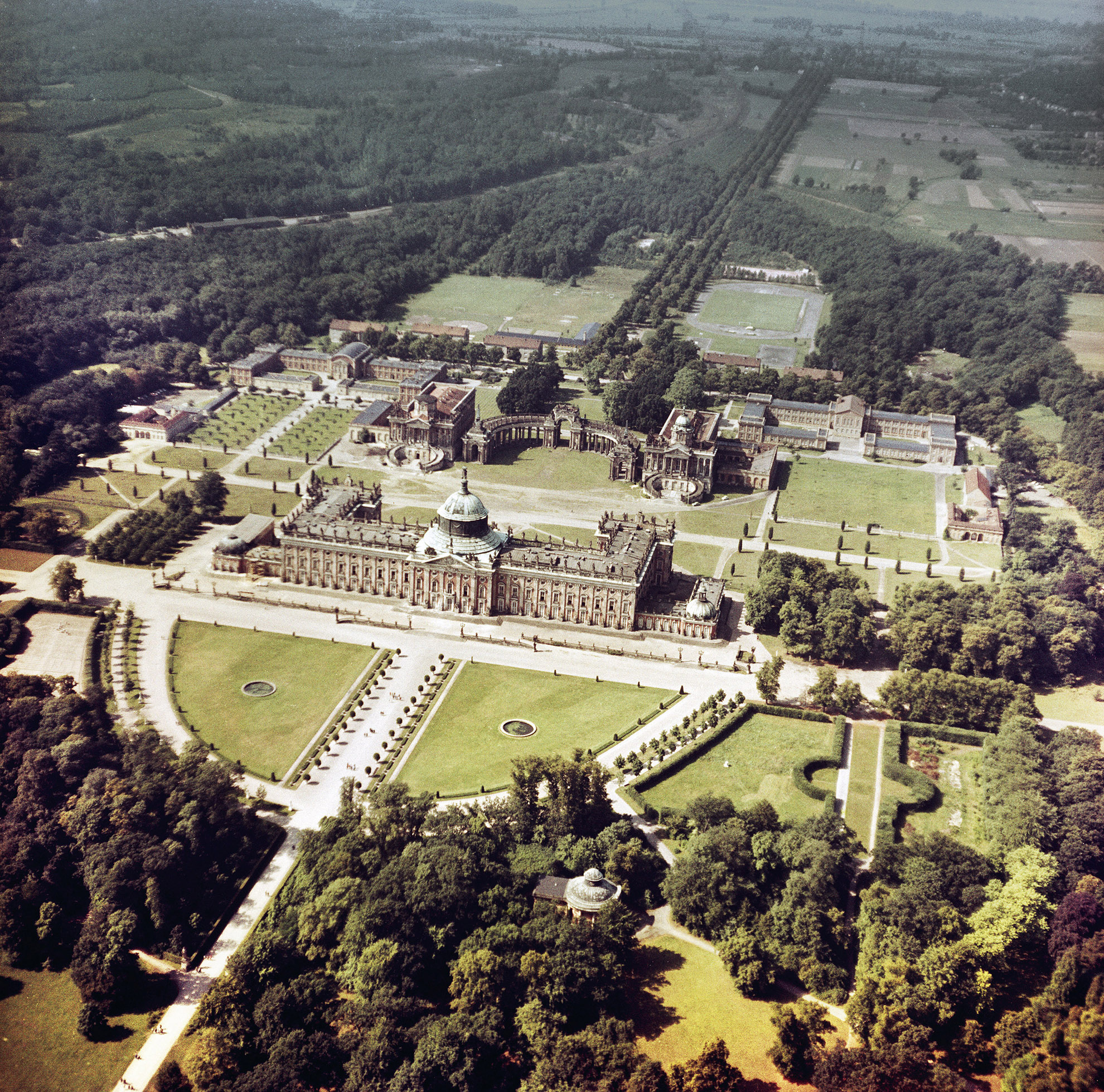
Photo Lothar Willmann; State Archive of the German Democratic Republic, no. 52228

It is pictured here in 2012.
Photo Katrin Lesser
Preservation of Historic Gardens and Parks: Squares
Following on from the car-oriented transformation of the city in the 1950s and 1960s, some squares were restored to become more pedestrian-friendly in the 1980s and 1990s as part of the city’s efforts to preserve historic gardens and parks. There have been no large programmes focused on squares since then.
After 1990: The Desire for New Parks
Many people forget that Berlin was gripped by a fever for new parks in the years after reunification. Historic parks were reconstructed, new parks were created, and additional parks were planned. This included national events such as the International Garden Exhibition (IGA) in Marzahn in 2017 as well as local Greater Berlin projects like Mauerpark and the Green Belt. Plans were also made for spacious regional parks designed to strengthen and enrich the city’s star-shaped settlement pattern.
Mauerpark
Mauerpark is a typical example of one of Berlin’s new parks. The idea to designate the area as a green space dates back to the time of the fall of the Berlin Wall. Today the park connects the former districts of Wedding and Prenzlauer Berg and is heavily used by the public.
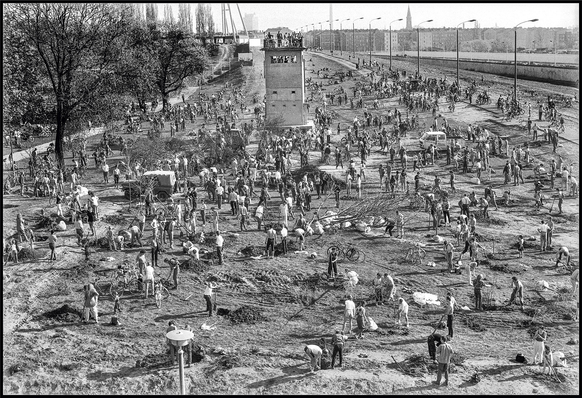
Photo Gerd Danigel

Photo Philipp Meuser
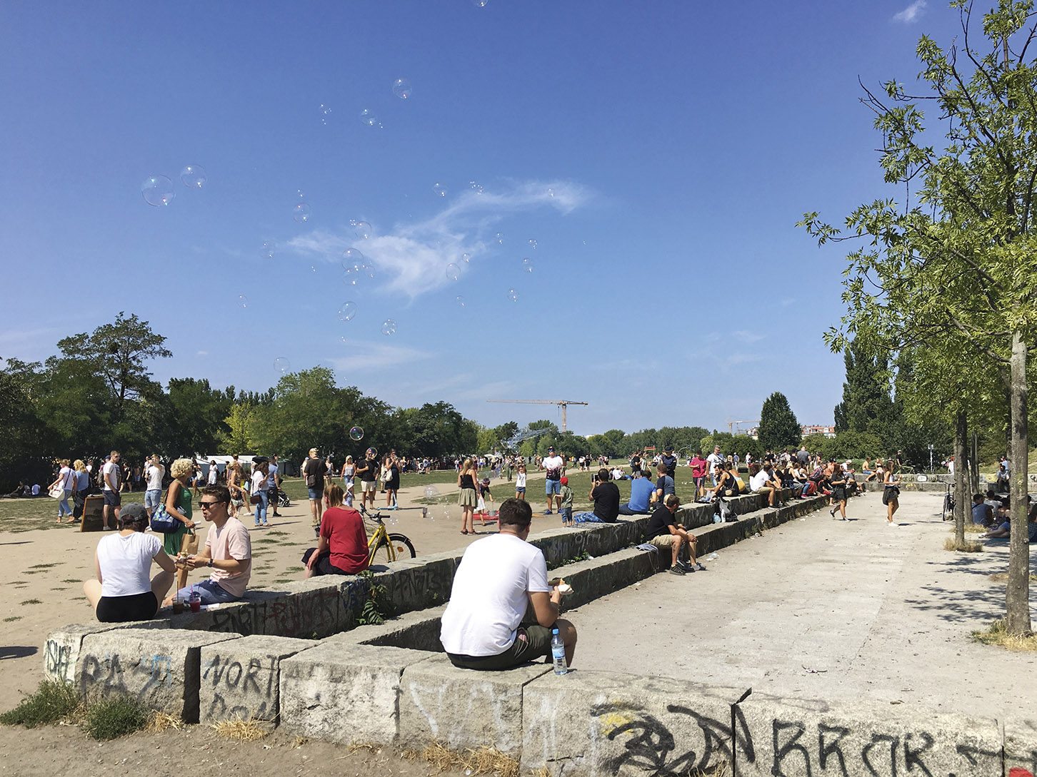
Photo Celina Miriam Schlichting
The IGA Exhibition Site
The large Marzahn Park was created during the German Democratic Republic and further developed and upgraded for the 2017 International Garden Exhibition (IGA). The Gardens of the World site is its most famous attraction.

Photo Harald Bodenschatz

Photo Harald Bodenschatz

Photo Harald Bodenschatz
The Green Belt
The Green Belt is an impressive new park under development for pedestrians and cyclists. Once completed, it will run over 13 kilometres along the path of the former Berlin Wall from Nordbahnhof train station to the northern outskirts of the city.
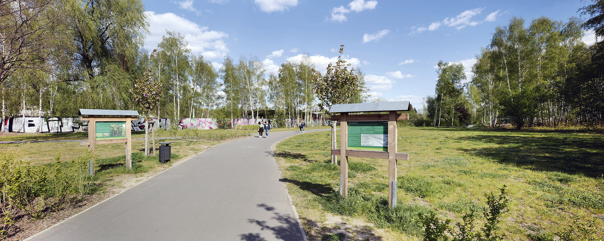
Photo Thomas Spier, apollovision